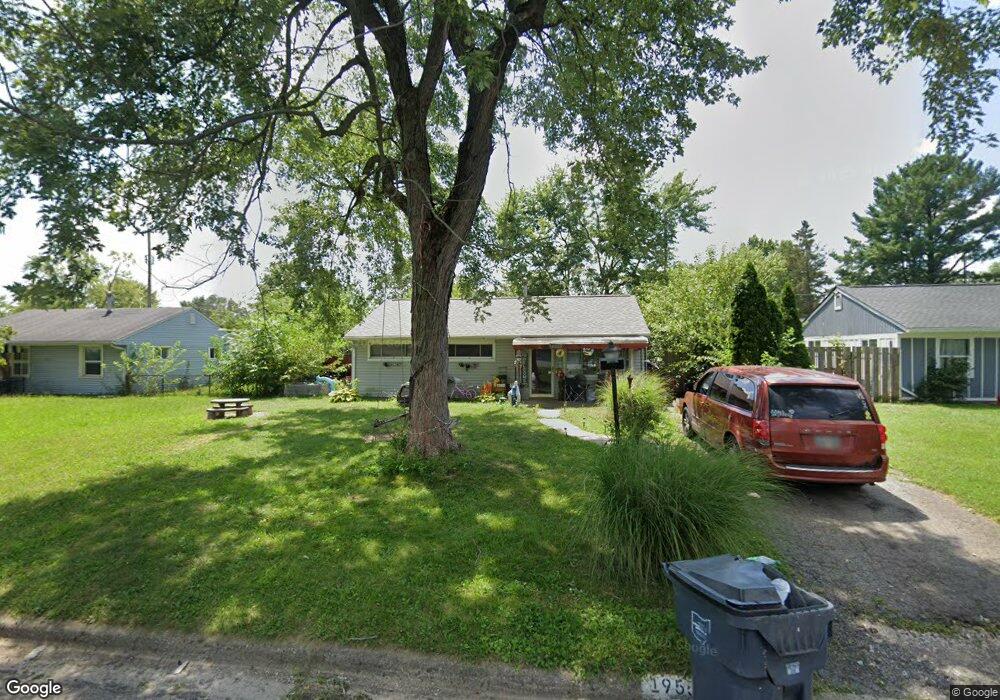
1955 Westfield Dr N Columbus, OH 43223
Estimated Value: $146,092 - $189,000
2
Beds
1
Bath
925
Sq Ft
$191/Sq Ft
Est. Value
About This Home
This home is located at 1955 Westfield Dr N, Columbus, OH 43223 and is currently estimated at $176,773, approximately $191 per square foot. 1955 Westfield Dr N is a home located in Franklin County with nearby schools including Finland Elementary School, Franklin Woods Intermediate School, and Finland Middle School.
Ownership History
Date
Name
Owned For
Owner Type
Purchase Details
Closed on
Oct 11, 2016
Sold by
Hobbs David L
Bought by
Ammar Abdul J
Current Estimated Value
Purchase Details
Closed on
Mar 5, 2010
Sold by
Wells Fargo Financial Ohio 1 Inc
Bought by
Hobbs David L
Purchase Details
Closed on
Feb 19, 2010
Sold by
Baumgartner Sandra K and Case #09Cve 03 3255
Bought by
Wells Fargo Financial Ohio 1 Inc
Purchase Details
Closed on
Oct 11, 1995
Sold by
Beebe David K
Bought by
Sandra K Baumgartner
Home Financials for this Owner
Home Financials are based on the most recent Mortgage that was taken out on this home.
Original Mortgage
$51,534
Interest Rate
7.8%
Mortgage Type
FHA
Purchase Details
Closed on
Jan 8, 1988
Create a Home Valuation Report for This Property
The Home Valuation Report is an in-depth analysis detailing your home's value as well as a comparison with similar homes in the area
Home Values in the Area
Average Home Value in this Area
Purchase History
| Date | Buyer | Sale Price | Title Company |
|---|---|---|---|
| Ammar Abdul J | $14,574 | None Available | |
| Hobbs David L | $29,000 | Rels Title | |
| Wells Fargo Financial Ohio 1 Inc | $44,000 | None Available | |
| Sandra K Baumgartner | $52,000 | -- | |
| -- | -- | -- |
Source: Public Records
Mortgage History
| Date | Status | Borrower | Loan Amount |
|---|---|---|---|
| Previous Owner | Sandra K Baumgartner | $51,534 |
Source: Public Records
Tax History Compared to Growth
Tax History
| Year | Tax Paid | Tax Assessment Tax Assessment Total Assessment is a certain percentage of the fair market value that is determined by local assessors to be the total taxable value of land and additions on the property. | Land | Improvement |
|---|---|---|---|---|
| 2024 | $3,269 | $41,860 | $7,560 | $34,300 |
| 2023 | $2,172 | $41,860 | $7,560 | $34,300 |
| 2022 | $1,600 | $21,210 | $8,750 | $12,460 |
| 2021 | $1,522 | $21,210 | $8,750 | $12,460 |
| 2020 | $1,958 | $21,210 | $8,750 | $12,460 |
| 2019 | $1,611 | $17,330 | $7,280 | $10,050 |
| 2018 | $1,271 | $17,330 | $7,280 | $10,050 |
| 2017 | $1,373 | $17,330 | $7,280 | $10,050 |
| 2016 | $1,196 | $14,140 | $3,290 | $10,850 |
| 2015 | $1,163 | $14,140 | $3,290 | $10,850 |
| 2014 | $1,114 | $14,140 | $3,290 | $10,850 |
| 2013 | $693 | $16,625 | $3,850 | $12,775 |
Source: Public Records
Map
Nearby Homes
- 1607 Red Leaf Ln
- 1543 Red Leaf Ln
- 2210 October Ridge Dr
- 0 S Central Ave
- 1417 Fahy Dr
- 1948 Big Run Bluffs Blvd
- 1949 Big Run Bluffs Blvd
- 1390 Gray Meadow Dr
- 4745 Big Run Rd E
- 1723 Farberdale Dr
- 2336 Woodbrook Cir N Unit 92 B
- 1994 Little Ave
- 2362 Woodbrook Cir N Unit 81
- 2180 Eakin Rd
- 1119 Hardesty Place E Unit 1
- 2382 Hardesty Dr S Unit Q-5
- 1085 Hardesty Place E Unit 4
- 2337 Hardesty Ct Unit 1
- 2436 Hardesty Dr S Unit 4
- 2436 Onyx Ct
- 1949 Westfield Dr N
- 1965 Westfield Dr N
- 1964 Marsdale Ave
- 1956 Marsdale Ave
- 1970 Marsdale Ave
- 1971 Westfield Dr N
- 1941 Westfield Dr N
- 1950 Marsdale Ave
- 1956 Westfield Dr N
- 1964 Westfield Dr N
- 1948 Westfield Dr N
- 1976 Marsdale Ave
- 1970 Westfield Dr N
- 1942 Marsdale Ave
- 1940 Westfield Dr N
- 1935 Westfield Dr N
- 1986 Marsdale Ave
- 1985 Westfield Dr N
- 1963 Marsdale Ave
- 1978 Westfield Dr N