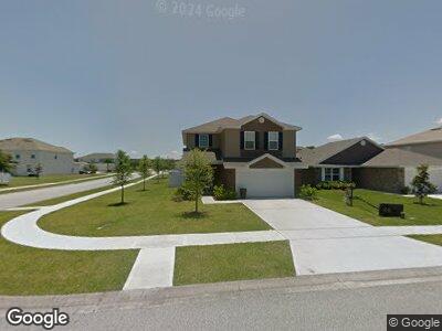
1956 Cove Point Rd Port Orange, FL 32128
Coraci NeighborhoodEstimated Value: $374,000 - $477,000
4
Beds
3
Baths
2,500
Sq Ft
$170/Sq Ft
Est. Value
About This Home
This home is located at 1956 Cove Point Rd, Port Orange, FL 32128 and is currently estimated at $424,064, approximately $169 per square foot. 1956 Cove Point Rd is a home with nearby schools including Spruce Creek Elementary School, Atlantic High School, and Silver Sands Middle School.
Ownership History
Date
Name
Owned For
Owner Type
Purchase Details
Closed on
Oct 30, 2013
Sold by
Russell Doris A
Bought by
Russell Thomas J and Russell Gonzalez Irrevocable Trust
Current Estimated Value
Purchase Details
Closed on
May 30, 2013
Sold by
Adams Homes Of Northwest Florida Inc
Bought by
Russell Dorisa
Home Financials for this Owner
Home Financials are based on the most recent Mortgage that was taken out on this home.
Original Mortgage
$197,260
Outstanding Balance
$142,723
Interest Rate
3.42%
Mortgage Type
FHA
Estimated Equity
$283,934
Create a Home Valuation Report for This Property
The Home Valuation Report is an in-depth analysis detailing your home's value as well as a comparison with similar homes in the area
Home Values in the Area
Average Home Value in this Area
Purchase History
| Date | Buyer | Sale Price | Title Company |
|---|---|---|---|
| Russell Thomas J | -- | Attorney | |
| Russell Dorisa | $200,900 | Trident Title Llc |
Source: Public Records
Mortgage History
| Date | Status | Borrower | Loan Amount |
|---|---|---|---|
| Open | Russell Dorisa | $197,260 |
Source: Public Records
Tax History Compared to Growth
Tax History
| Year | Tax Paid | Tax Assessment Tax Assessment Total Assessment is a certain percentage of the fair market value that is determined by local assessors to be the total taxable value of land and additions on the property. | Land | Improvement |
|---|---|---|---|---|
| 2025 | $5,572 | $362,506 | $56,500 | $306,006 |
| 2024 | $5,572 | $357,963 | $56,500 | $301,463 |
| 2023 | $5,572 | $345,592 | $55,000 | $290,592 |
| 2022 | $5,129 | $320,929 | $36,500 | $284,429 |
| 2021 | $4,678 | $243,988 | $35,000 | $208,988 |
| 2020 | $4,420 | $232,866 | $27,000 | $205,866 |
| 2019 | $4,277 | $227,069 | $25,500 | $201,569 |
| 2018 | $4,099 | $212,203 | $20,500 | $191,703 |
| 2017 | $4,051 | $203,516 | $20,000 | $183,516 |
| 2016 | $4,123 | $200,613 | $0 | $0 |
| 2015 | $4,236 | $201,915 | $0 | $0 |
| 2014 | $3,877 | $178,534 | $0 | $0 |
Source: Public Records
Map
Nearby Homes
- 1959 Yellowfin Dr
- 1950 Yellowfin Dr
- 1932 Cove Point Rd
- 1929 Cove Point Rd
- 5416 Cordgrass Bend Ln
- 5513 Estero Loop
- 1922 Cove Point Rd
- 2305 Santa Rosa Ct
- 1928 Yellowfin Dr
- 5427 Estero Loop
- 1909 Cove Point Rd
- 5433 Estero Loop
- 5304 Cordgrass Bend Ln
- 5321 Cordgrass Bend Ln
- 5635 Estero Loop
- 5429 Hutchinson St
- 5627 Estero Loop
- 1500 Town Blvd W
- 1827 Palmetto Scrub Cir
- 5567 Estero Loop
- 1956 Cove Point Rd
- 1960 Cove Point Rd
- 1975 Yellowfin Dr
- 1977 Yellowfin Dr
- 1979 Yellowfin Dr
- 1950 Cove Point Rd
- 1981 Yellowfin Dr
- 1962 Cove Point Rd
- 1955 Cove Point Rd
- 1953 Cove Point Rd
- 1971 Yellowfin Dr
- 1957 Cove Point Rd
- 1951 Cove Point Rd
- 1983 Yellowfin Dr
- 1948 Cove Point Rd
- 1985 Yellowfin Dr
- 1969 Yellowfin Dr
- 1964 Cove Point Rd