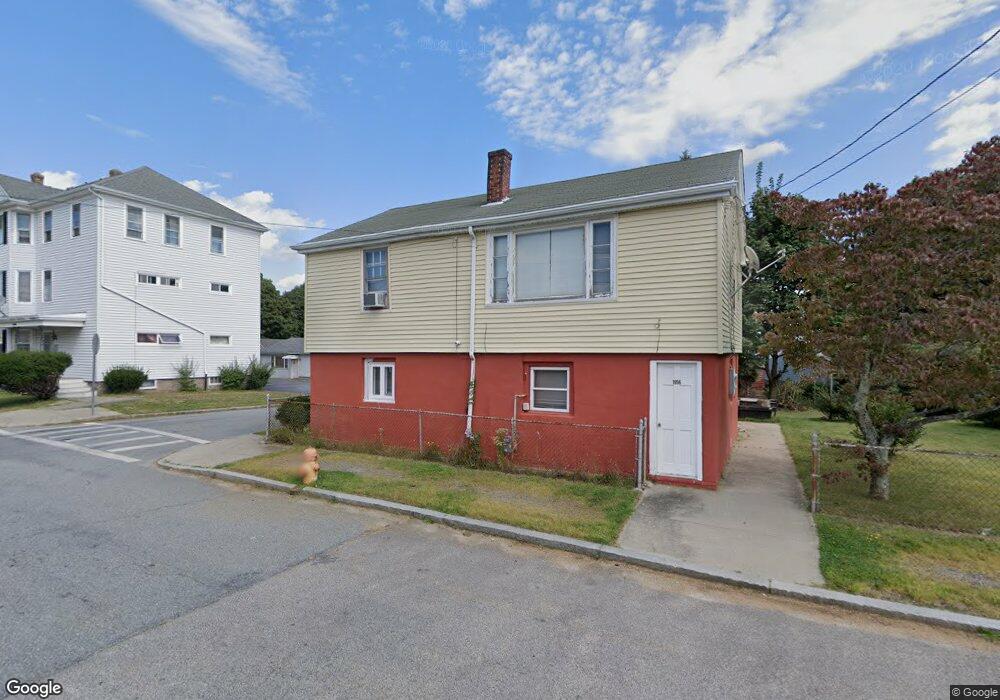
1956 Rodman St Fall River, MA 02721
Maplewood NeighborhoodEstimated Value: $375,000 - $422,000
3
Beds
2
Baths
1,440
Sq Ft
$276/Sq Ft
Est. Value
About This Home
This home is located at 1956 Rodman St, Fall River, MA 02721 and is currently estimated at $398,065, approximately $276 per square foot. 1956 Rodman St is a home located in Bristol County with nearby schools including Letourneau Elementary School, Talbot Innovation School, and B M C Durfee High School.
Ownership History
Date
Name
Owned For
Owner Type
Purchase Details
Closed on
Apr 29, 2002
Sold by
Drewniak Gary Wayne and Drewniak Myron Gerald
Bought by
Lekom Jonathan B and Lekom Anita J
Current Estimated Value
Home Financials for this Owner
Home Financials are based on the most recent Mortgage that was taken out on this home.
Original Mortgage
$106,250
Interest Rate
7.05%
Mortgage Type
Purchase Money Mortgage
Create a Home Valuation Report for This Property
The Home Valuation Report is an in-depth analysis detailing your home's value as well as a comparison with similar homes in the area
Home Values in the Area
Average Home Value in this Area
Purchase History
| Date | Buyer | Sale Price | Title Company |
|---|---|---|---|
| Lekom Jonathan B | $125,000 | -- |
Source: Public Records
Mortgage History
| Date | Status | Borrower | Loan Amount |
|---|---|---|---|
| Open | Lekom Jonathan B | $120,000 | |
| Closed | Lekom Jonathan B | $106,250 |
Source: Public Records
Tax History Compared to Growth
Tax History
| Year | Tax Paid | Tax Assessment Tax Assessment Total Assessment is a certain percentage of the fair market value that is determined by local assessors to be the total taxable value of land and additions on the property. | Land | Improvement |
|---|---|---|---|---|
| 2025 | $3,193 | $278,900 | $127,300 | $151,600 |
| 2024 | $3,018 | $262,700 | $122,500 | $140,200 |
| 2023 | $2,925 | $238,400 | $105,000 | $133,400 |
| 2022 | $2,615 | $207,200 | $95,500 | $111,700 |
| 2021 | $2,547 | $184,200 | $88,400 | $95,800 |
| 2020 | $2,519 | $174,300 | $84,600 | $89,700 |
| 2019 | $2,430 | $166,700 | $80,500 | $86,200 |
| 2018 | $2,342 | $160,200 | $79,000 | $81,200 |
| 2017 | $2,247 | $160,500 | $80,600 | $79,900 |
| 2016 | $2,171 | $159,300 | $84,000 | $75,300 |
| 2015 | $2,043 | $156,200 | $80,900 | $75,300 |
| 2014 | $2,018 | $160,400 | $85,100 | $75,300 |
Source: Public Records
Map
Nearby Homes
- 55 Kennedy St
- 415 Anthony St
- 475 Ludlow St
- 59 Denver St
- 495 Chicago St
- 478 Tucker St
- 191 Glasgow St Unit 2
- 539 Aetna St
- 125 Carl St
- 59 Wayne St
- 1441 Stafford Rd
- 311 S Oxford St
- 186 Spencer St
- 248 Jefferson St
- 256 Rhode Island Ave
- 883 Grinnell St
- 889 Grinnell St Unit 2
- 889 Grinnell St Unit 8
- 889 Grinnell St Unit 7
- 250 Laurel St
- 1966 Rodman St
- 175 Grattan St
- 1926 Rodman St Unit 2N
- 1926 Rodman St Unit 1S
- 1926 Rodman St Unit 2S
- 1926 Rodman St
- 1934 Rodman St
- 1986 Rodman St
- 1967 Rodman St
- 176 Grattan St
- 1920 Rodman St
- 138 Frost St
- 185 Grattan St
- 124 Grattan St
- 1906 Rodman St
- 86 Frost St
- 105 Grattan St
- 119 Frost St
- 203 Kennedy St
- 168 Frost St