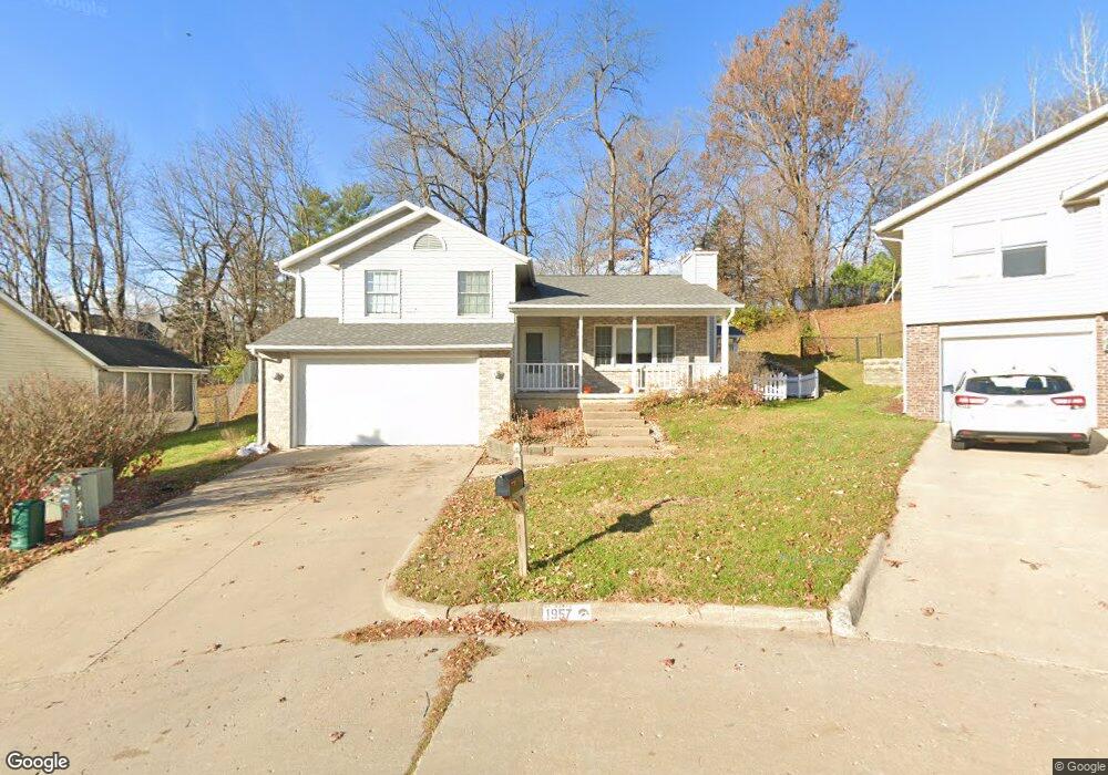
1957 Meadow Ridge Ln Iowa City, IA 52245
Shimek NeighborhoodEstimated Value: $310,330 - $357,000
4
Beds
1
Bath
1,524
Sq Ft
$222/Sq Ft
Est. Value
About This Home
This home is located at 1957 Meadow Ridge Ln, Iowa City, IA 52245 and is currently estimated at $338,833, approximately $222 per square foot. 1957 Meadow Ridge Ln is a home located in Johnson County with nearby schools including Horace Mann Elementary School, Southeast Junior High School, and City High School.
Ownership History
Date
Name
Owned For
Owner Type
Purchase Details
Closed on
Jun 21, 2012
Sold by
Beideman Brandon P
Bought by
1957 Meadow Ridge Llc
Current Estimated Value
Purchase Details
Closed on
Jul 10, 2006
Sold by
Elrod Donald M and Elrod Mary Lou B
Bought by
Beideman Brandon P
Home Financials for this Owner
Home Financials are based on the most recent Mortgage that was taken out on this home.
Original Mortgage
$168,000
Interest Rate
6.72%
Mortgage Type
New Conventional
Create a Home Valuation Report for This Property
The Home Valuation Report is an in-depth analysis detailing your home's value as well as a comparison with similar homes in the area
Home Values in the Area
Average Home Value in this Area
Purchase History
| Date | Buyer | Sale Price | Title Company |
|---|---|---|---|
| 1957 Meadow Ridge Llc | -- | None Available | |
| Beideman Brandon P | $210,000 | None Available |
Source: Public Records
Mortgage History
| Date | Status | Borrower | Loan Amount |
|---|---|---|---|
| Previous Owner | Beideman Brandon P | $168,000 |
Source: Public Records
Tax History Compared to Growth
Tax History
| Year | Tax Paid | Tax Assessment Tax Assessment Total Assessment is a certain percentage of the fair market value that is determined by local assessors to be the total taxable value of land and additions on the property. | Land | Improvement |
|---|---|---|---|---|
| 2024 | $5,394 | $286,710 | $49,130 | $237,580 |
| 2023 | $5,168 | $286,710 | $49,130 | $237,580 |
| 2022 | $4,938 | $238,430 | $46,240 | $192,190 |
| 2021 | $5,176 | $238,430 | $46,240 | $192,190 |
| 2020 | $5,176 | $239,420 | $43,350 | $196,070 |
| 2019 | $4,872 | $239,420 | $43,350 | $196,070 |
| 2018 | $4,872 | $221,720 | $40,460 | $181,260 |
| 2017 | $4,826 | $221,720 | $40,460 | $181,260 |
| 2016 | $4,732 | $219,540 | $40,460 | $179,080 |
| 2015 | $4,732 | $219,540 | $40,460 | $179,080 |
| 2014 | $4,676 | $216,210 | $40,460 | $175,750 |
Source: Public Records
Map
Nearby Homes
- 1818 N Dubuque St
- 56 Pentire Cir
- 15 Camborne Cir
- 1639 Ridge Rd
- 13 Pentire Cir
- 47 Colwyn Ct Unit 18
- 41 Colwyn Ct
- 135 Pentire Cir
- 3350 Kenruth Cir NE
- 1753 Louis Place
- 1745 Louis Place
- 24 Samuel Dr
- Lot Whiting Ave
- 1722 Algonquin Rd
- 751 Mission Point Rd
- 741 Arch Rock Rd
- 1806 Prairie Du Chien Rd
- 2091 Mackinaw Dr
- 1113 Manitou Trail
- 12 W Park Rd
- 1949 Meadow Ridge Ln
- 1965 Meadow Ridge Ln
- 1941 Meadow Ridge Ln
- 1973 Meadow Ridge Ln
- 1968 Meadow Ridge Ln
- 2000 N Dubuque St
- 1950 Meadow Ridge Ln
- 1958 Meadow Ridge Ln
- 1933 Meadow Ridge Ln
- 1900 N Dubuque St
- 1942 Meadow Ridge Ln
- 1934 Meadow Ridge Ln
- 1925 Meadow Ridge Ln
- 1926 Meadow Ridge Ln
- 1850 N Dubuque St
- 1913 Meadow Ridge Ln
- 1918 Meadow Ridge Ln
- 2039 Tanglewood St
- 1910 Meadow Ridge Ln
- 2040 Tanglewood St