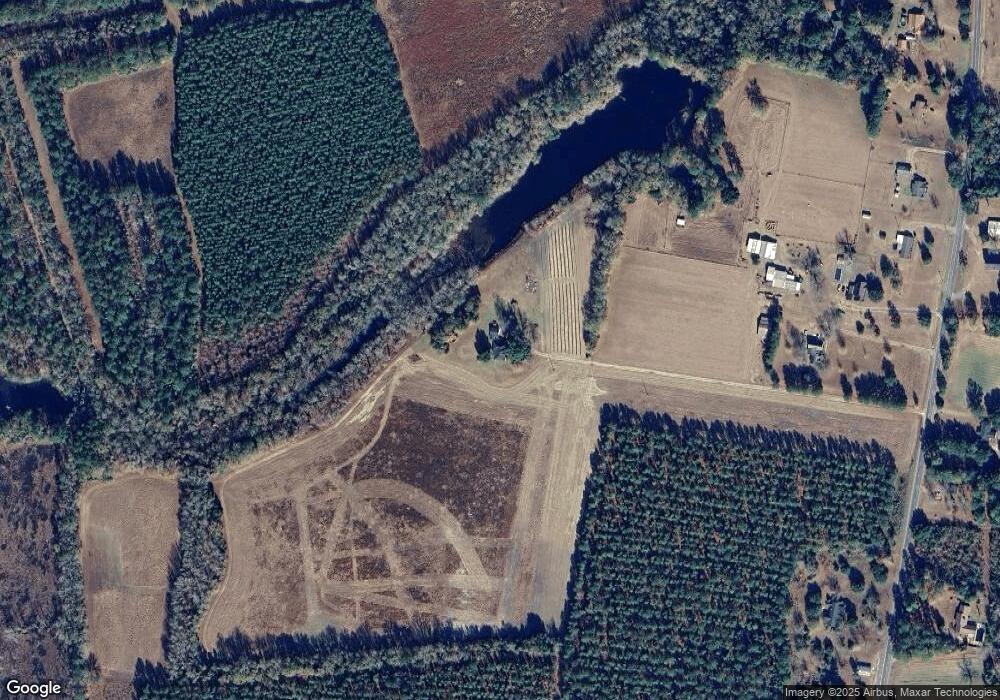
1957 N Brewington Rd Manning, SC 29102
Estimated Value: $253,000
--
Bed
--
Bath
1,916
Sq Ft
$132/Sq Ft
Est. Value
About This Home
This home is located at 1957 N Brewington Rd, Manning, SC 29102 and is currently estimated at $253,000, approximately $132 per square foot. 1957 N Brewington Rd is a home with nearby schools including Manning Early Childhood Center, Manning Primary School, and Manning Elementary School.
Ownership History
Date
Name
Owned For
Owner Type
Purchase Details
Closed on
Mar 26, 2019
Sold by
Lowder W A and Simons Daphne
Bought by
Lowder William A
Current Estimated Value
Purchase Details
Closed on
Feb 16, 2018
Sold by
Huntsinger Sharon
Bought by
Lowder W A and Simons Daphne
Purchase Details
Closed on
Jan 16, 2018
Sold by
Floyd Sharon L
Bought by
Lowder W A and Simmons Daphne
Purchase Details
Closed on
Jun 12, 2014
Sold by
Estate Of Johnny Oneal Lowder
Bought by
Lowder Kathryn L
Create a Home Valuation Report for This Property
The Home Valuation Report is an in-depth analysis detailing your home's value as well as a comparison with similar homes in the area
Home Values in the Area
Average Home Value in this Area
Purchase History
| Date | Buyer | Sale Price | Title Company |
|---|---|---|---|
| Lowder William A | $70,000 | -- | |
| Lowder W A | -- | -- | |
| Lowder W A | -- | -- | |
| Lowder Kathryn L | -- | None Available |
Source: Public Records
Tax History Compared to Growth
Tax History
| Year | Tax Paid | Tax Assessment Tax Assessment Total Assessment is a certain percentage of the fair market value that is determined by local assessors to be the total taxable value of land and additions on the property. | Land | Improvement |
|---|---|---|---|---|
| 2024 | $2,172 | $10,584 | $522 | $10,062 |
| 2023 | $2,129 | $10,584 | $522 | $10,062 |
| 2022 | $2,104 | $10,584 | $522 | $10,062 |
| 2021 | $213 | $13,744 | $622 | $13,122 |
| 2020 | $213 | $622 | $0 | $0 |
| 2019 | $2,790 | $8,404 | $0 | $0 |
| 2018 | $1,472 | $4,622 | $0 | $0 |
| 2017 | $1,443 | $4,545 | $0 | $0 |
| 2016 | $1,419 | $9,090 | $0 | $0 |
| 2015 | $1,459 | $4,738 | $562 | $4,176 |
| 2014 | $1,052 | $3,478 | $562 | $2,916 |
| 2013 | -- | $3,478 | $562 | $2,916 |
Source: Public Records
Map
Nearby Homes
- 1664 N Brewington Rd
- 0000 N Brewington Rd Unit 10
- 0 N Brewington Rd Unit 24570399
- 0000 N Brewington Rd Unit 9
- 5120 N Brewington Rd Unit 5
- 0000 N Brewington Rd
- 0 N Brewington Rd Unit 3
- 0000 N Brewington Rd Unit 3
- 5120 N Brewington Rd
- N Brewington Rd
- N Brewington Rd
- Tbd Sparkman Dr
- N Brewington Rd
- 1190 Whistle Top Ln
- 1349 Patton Rd
- Tbd Old Cc Camp Rd
- 527 Tbd Hwy 527
- 1252 Hoffman Dr Unit Lot D
- 1252 Hoffman Dr Unit Lot C
- 1252 Hoffman Dr
- 1981 N Brewington Rd
- 2033 N Brewington Rd
- 2063 N Brewington Rd
- 1829 N Brewington Rd
- 2199 N Brewington Rd
- 1904 N Brewington Rd
- 2115 N Brewington Rd
- 1950 N Brewington Rd
- 2205 N Brewington Rd
- 1834 N Brewington Rd
- 2172 N Brewington Rd
- 2397 N Brewington Rd
- 2362 N Brewington Rd
- 2396 N Brewington Rd
- 1466 N Brewington Rd
- 1425 N Brewington Rd
- 1331 N Brewington Rd
- 1285 N Brewington Rd
- 1274 N Brewington Rd
- 1201 N Brewington Rd
