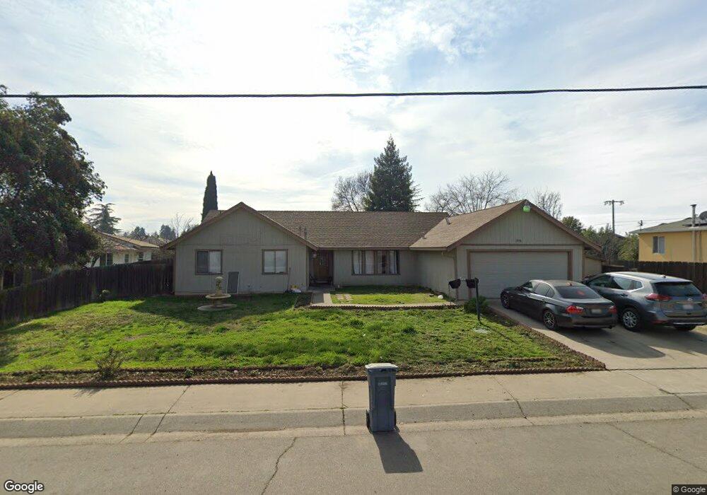
1958 Franklin Rd Yuba City, CA 95993
Estimated Value: $367,000 - $440,000
3
Beds
2
Baths
1,604
Sq Ft
$246/Sq Ft
Est. Value
About This Home
This home is located at 1958 Franklin Rd, Yuba City, CA 95993 and is currently estimated at $394,084, approximately $245 per square foot. 1958 Franklin Rd is a home located in Sutter County with nearby schools including Andros Karperos, River Valley High School, and Adventist Christian School.
Ownership History
Date
Name
Owned For
Owner Type
Purchase Details
Closed on
Mar 26, 2004
Sold by
Bhandal Gurnam S and Bains Harkirat S
Bought by
Bhandal Gurnam S
Current Estimated Value
Home Financials for this Owner
Home Financials are based on the most recent Mortgage that was taken out on this home.
Original Mortgage
$138,750
Outstanding Balance
$64,884
Interest Rate
5.57%
Mortgage Type
New Conventional
Estimated Equity
$329,200
Purchase Details
Closed on
Apr 15, 2002
Sold by
Thiara Joga S and Thiara Surinderpall K
Bought by
Bhandal Gurnam S and Bains Harkirat S
Home Financials for this Owner
Home Financials are based on the most recent Mortgage that was taken out on this home.
Original Mortgage
$101,500
Interest Rate
7.08%
Mortgage Type
FHA
Purchase Details
Closed on
Oct 8, 2001
Sold by
Dosanjh Parmjit S
Bought by
Thiara Joga S and Thiara Surinderpall K
Create a Home Valuation Report for This Property
The Home Valuation Report is an in-depth analysis detailing your home's value as well as a comparison with similar homes in the area
Home Values in the Area
Average Home Value in this Area
Purchase History
| Date | Buyer | Sale Price | Title Company |
|---|---|---|---|
| Bhandal Gurnam S | -- | -- | |
| Bhandal Gurnam S | $120,000 | Placer Title Company | |
| Thiara Joga S | -- | Placer Title Company |
Source: Public Records
Mortgage History
| Date | Status | Borrower | Loan Amount |
|---|---|---|---|
| Open | Bhandal Gurnam S | $138,750 | |
| Closed | Bhandal Gurnam S | $101,500 |
Source: Public Records
Tax History Compared to Growth
Tax History
| Year | Tax Paid | Tax Assessment Tax Assessment Total Assessment is a certain percentage of the fair market value that is determined by local assessors to be the total taxable value of land and additions on the property. | Land | Improvement |
|---|---|---|---|---|
| 2025 | $2,479 | $177,247 | $47,259 | $129,988 |
| 2024 | $2,479 | $173,773 | $46,333 | $127,440 |
| 2023 | $2,479 | $170,367 | $45,425 | $124,942 |
| 2022 | $2,086 | $167,028 | $44,535 | $122,493 |
| 2021 | $2,331 | $163,777 | $43,674 | $120,103 |
| 2020 | $1,927 | $162,098 | $43,226 | $118,872 |
| 2019 | $2,263 | $158,920 | $42,379 | $116,541 |
| 2018 | $2,219 | $155,804 | $41,548 | $114,256 |
| 2017 | $1,912 | $152,748 | $40,733 | $112,015 |
| 2016 | $1,782 | $149,753 | $39,934 | $109,819 |
| 2015 | $1,754 | $147,503 | $39,334 | $108,169 |
| 2014 | $1,733 | $144,614 | $38,564 | $106,050 |
Source: Public Records
Map
Nearby Homes
- 1955 Jason Ct
- 156 Bristol Way
- 152 College Hill Way
- 238 Anita Way
- 1781 Franklin Rd Unit 36
- 1781 Franklin Rd Unit 59
- 138 Nantucket Way
- 170 Nantucket Way
- 1665 Michelle Dr
- 683 Mark Thomas Dr
- 1571 Holly Tree Dr
- 430 Neil Dr
- 2624 Azalea Way
- 1545 Camino Del Oro
- 955 Carson Dr
- 2690 Red Bud Ln
- 2661 Imperial Way
- 0 Lassen Blvd
- 1344 Kean Ave
- 1330 Kean Ave
- 1946 Franklin Rd
- 1957 Lambert Ct
- 1972 Franklin Rd
- 1949 Lambert Ct
- 124 Harding Rd
- 1962 Lambert Ct
- 1932 Franklin Rd
- 306 Gurdas Ct
- 136 Harding Rd
- 305 Gurdas Ct
- 1941 Lambert Ct
- 316 Gurdas Ct
- 374 N Oliver Dr
- 315 Gurdas Ct
- 148 Harding Rd
- 1956 Lambert Ct
- 370 N Oliver Dr
- 1950 Lambert Ct
- 366 N Oliver Dr
- 326 Gurdas Ct