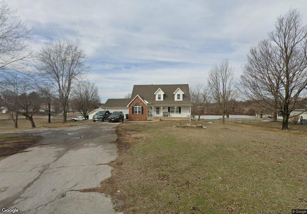
1958 S Black Cat Rd Unit 1 Joplin, MO 64801
Estimated Value: $349,000 - $468,000
4
Beds
4
Baths
3,200
Sq Ft
$125/Sq Ft
Est. Value
About This Home
This home is located at 1958 S Black Cat Rd Unit 1, Joplin, MO 64801 and is currently estimated at $401,537, approximately $125 per square foot. 1958 S Black Cat Rd Unit 1 is a home located in Jasper County with nearby schools including Carl Junction Primary School (K-1), Carl Junction Intermediate School, and Carl Junction Primary School (2-3).
Ownership History
Date
Name
Owned For
Owner Type
Purchase Details
Closed on
Oct 29, 2021
Sold by
Fogel Joseph W and Fogel Deborah A
Bought by
Luczak Patrick M and Luczak Courtney
Current Estimated Value
Home Financials for this Owner
Home Financials are based on the most recent Mortgage that was taken out on this home.
Original Mortgage
$328,412
Outstanding Balance
$301,016
Interest Rate
3.01%
Mortgage Type
Stand Alone Refi Refinance Of Original Loan
Estimated Equity
$100,521
Purchase Details
Closed on
Mar 31, 2014
Sold by
Mitchell Bobby and Mitchell Deborah
Bought by
Fogel Ii Joseph W and Fogel Deborah A
Home Financials for this Owner
Home Financials are based on the most recent Mortgage that was taken out on this home.
Original Mortgage
$178,400
Interest Rate
4.32%
Mortgage Type
New Conventional
Purchase Details
Closed on
Sep 29, 2010
Sold by
Mitchell Dennis O and Mitchell Susan D
Bought by
Mitchell Bobby and Mitchell Deborah
Create a Home Valuation Report for This Property
The Home Valuation Report is an in-depth analysis detailing your home's value as well as a comparison with similar homes in the area
Home Values in the Area
Average Home Value in this Area
Purchase History
| Date | Buyer | Sale Price | Title Company |
|---|---|---|---|
| Luczak Patrick M | -- | None Available | |
| Fogel Ii Joseph W | -- | None Available | |
| Mitchell Bobby | -- | Fatco |
Source: Public Records
Mortgage History
| Date | Status | Borrower | Loan Amount |
|---|---|---|---|
| Open | Luczak Patrick M | $328,412 | |
| Previous Owner | Fogel Ii Joseph W | $178,400 |
Source: Public Records
Tax History Compared to Growth
Tax History
| Year | Tax Paid | Tax Assessment Tax Assessment Total Assessment is a certain percentage of the fair market value that is determined by local assessors to be the total taxable value of land and additions on the property. | Land | Improvement |
|---|---|---|---|---|
| 2024 | $1,924 | $38,550 | $4,640 | $33,910 |
| 2023 | $1,924 | $38,550 | $4,640 | $33,910 |
| 2022 | $1,961 | $39,030 | $4,640 | $34,390 |
| 2021 | $1,950 | $39,030 | $4,640 | $34,390 |
| 2020 | $1,836 | $36,170 | $4,640 | $31,530 |
| 2019 | $1,742 | $36,170 | $4,640 | $31,530 |
| 2018 | $1,574 | $32,790 | $0 | $0 |
| 2017 | $1,578 | $32,790 | $0 | $0 |
| 2016 | $1,729 | $36,250 | $0 | $0 |
| 2015 | $1,729 | $36,250 | $0 | $0 |
| 2014 | $1,729 | $34,850 | $0 | $0 |
Source: Public Records
Map
Nearby Homes
- 1958 S Black Cat Rd
- 4308 Par Ln
- 4402 Par Ln
- TBD S Black Cat Rd
- 1366 S Twin Oaks Ln
- 2304 Iron Gates Rd
- 000 Golf Links Rd Unit Lot E
- TBD-E Golf Links Rd Unit E
- 4.43 acres NW 27th & Iron Gates Rd
- 1817 S Cleveland Terrace
- 3224 W Junge Blvd
- 4709 W 28th Place
- 4431 W 29th St
- 3019 W 17th St
- 2930 Heartland Ave
- 2520 S Cleveland Ave
- 3007 W 15th St
- .21+/- Mina Ave
- 3415 Sunset Dr
- 3017 Jessica St
- 1936 S Black Cat Rd
- 1929 S Black Cat Rd Unit A&B
- 1929 S Black Cat Rd
- 1929 S Black Cat Rd
- 1920 S Black Cat Rd
- 1923/1929 S Black Cat Rd
- 1923 S Black Cat Rd
- 2032 Country
- 2001 Twin Hills Dr
- 1900 S Black Cat Rd
- 2005 Twin Hills Dr
- TBD W 20th St
- 2030 S Country Club Dr
- 2004 Twin Hills Dr
- 2025 Twin Hills Dr
- 2020 Twin Hills Dr
- 2026 Fairway Dr
- 2010 S Country Club Dr
- 2110 S Country Club Dr