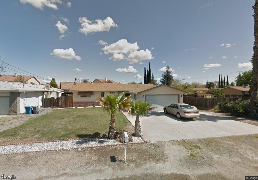
1958 Sanborn Rd Yuba City, CA 95993
Estimated Value: $285,000 - $374,000
3
Beds
2
Baths
1,200
Sq Ft
$288/Sq Ft
Est. Value
About This Home
This home is located at 1958 Sanborn Rd, Yuba City, CA 95993 and is currently estimated at $346,150, approximately $288 per square foot. 1958 Sanborn Rd is a home located in Sutter County with nearby schools including Barry Elementary School, Yuba City High School, and Adventist Christian School.
Ownership History
Date
Name
Owned For
Owner Type
Purchase Details
Closed on
Apr 25, 2018
Sold by
Randhawa Piara S and Randhawa Jaswir K
Bought by
Randhawa Piara S and Randhawa Jaswir K
Current Estimated Value
Purchase Details
Closed on
Dec 29, 2009
Sold by
Randhawa Sukhpal and Randhawa Surjit
Bought by
Randhawa Jaswir K and Randhawa Piara S
Purchase Details
Closed on
Aug 3, 2009
Sold by
Brad Parmjit
Bought by
Randhawa Surjit
Purchase Details
Closed on
Dec 30, 2008
Sold by
Randhawa Piara and Randhawa Jaswir
Bought by
Randhawa Sukhpal and Randhawa Surjit
Create a Home Valuation Report for This Property
The Home Valuation Report is an in-depth analysis detailing your home's value as well as a comparison with similar homes in the area
Home Values in the Area
Average Home Value in this Area
Purchase History
| Date | Buyer | Sale Price | Title Company |
|---|---|---|---|
| Randhawa Piara S | -- | None Available | |
| Randhawa Jaswir K | -- | None Available | |
| Randhawa Surjit | -- | None Available | |
| Randhawa Sukhpal | -- | None Available |
Source: Public Records
Tax History Compared to Growth
Tax History
| Year | Tax Paid | Tax Assessment Tax Assessment Total Assessment is a certain percentage of the fair market value that is determined by local assessors to be the total taxable value of land and additions on the property. | Land | Improvement |
|---|---|---|---|---|
| 2025 | $1,385 | $124,020 | $36,949 | $87,071 |
| 2024 | $1,385 | $121,589 | $36,225 | $85,364 |
| 2023 | $1,385 | $119,206 | $35,515 | $83,691 |
| 2022 | $1,327 | $116,869 | $34,819 | $82,050 |
| 2021 | $1,312 | $114,634 | $34,166 | $80,468 |
| 2020 | $1,290 | $113,460 | $33,817 | $79,643 |
| 2019 | $1,261 | $111,234 | $33,153 | $78,081 |
| 2018 | $1,242 | $109,055 | $32,504 | $76,551 |
| 2017 | $1,212 | $106,916 | $31,866 | $75,050 |
| 2016 | $1,187 | $104,818 | $31,240 | $73,578 |
| 2015 | $1,167 | $103,245 | $30,772 | $72,473 |
| 2014 | $1,153 | $101,222 | $30,169 | $71,053 |
Source: Public Records
Map
Nearby Homes
- Plan 2311 at Montego
- Plan 1924 at Montego
- Plan 1894 at Montego
- 2021 Nand Dr
- 1981 Ash Ct
- 1811 Alyssa Dr
- 1515 Jodi Dr
- 1524 Spyglass Dr
- 2399 Holcomb Ave
- 1372 Johnathan Dr
- 1180 Sanborn Rd
- 1525 Bogue Rd
- 2038 Nicholas Dr
- 1474 Smith Rd
- 1105 Johnathan Dr
- 1150 Pico Ct
- 2185 Lincoln Rd
- 1181 Robert Dr
- 0 Victoria Ct
- 1710 Edwards Ln
- 1944 Sanborn Rd
- 1986 Sanborn Rd
- 2101 Bogue Rd
- 1887 Burgandy Dr
- 1930 Sanborn Rd
- 2093 Bogue Rd
- 1895 Burgandy Dr
- 1879 Burgandy Dr
- 2085 Bogue Rd
- 1924 Sanborn Rd
- 1871 Burgandy Dr
- 1863 Burgandy Dr
- 1902 Tuscany Dr
- 1876 Burgandy Dr
- 1916 Sanborn Rd
- 2108 Bogue Rd
- 2100 Bogue Rd
- 2069 Bogue Rd
- 1868 Burgandy Dr
- 2090 Bogue Rd