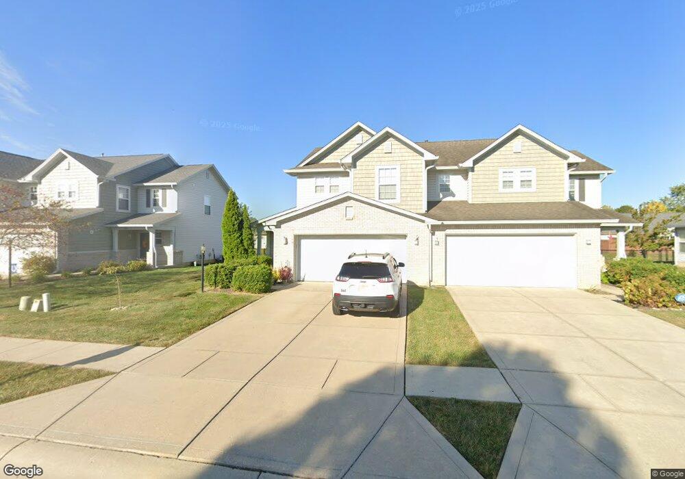
196 Clear Branch Dr Brownsburg, IN 46112
Estimated Value: $237,000 - $253,000
3
Beds
3
Baths
1,548
Sq Ft
$158/Sq Ft
Est. Value
About This Home
This home is located at 196 Clear Branch Dr, Brownsburg, IN 46112 and is currently estimated at $244,506, approximately $157 per square foot. 196 Clear Branch Dr is a home located in Hendricks County with nearby schools including Brownsburg East Middle School and Brownsburg High School.
Ownership History
Date
Name
Owned For
Owner Type
Purchase Details
Closed on
Mar 27, 2014
Sold by
Mowl Nicholas
Bought by
Osborn Randall S
Current Estimated Value
Home Financials for this Owner
Home Financials are based on the most recent Mortgage that was taken out on this home.
Original Mortgage
$97,650
Outstanding Balance
$74,428
Interest Rate
4.41%
Mortgage Type
New Conventional
Estimated Equity
$170,078
Purchase Details
Closed on
Jun 8, 2010
Sold by
Brace Michael F and Brace Heather L
Bought by
Mowl Nicholas
Home Financials for this Owner
Home Financials are based on the most recent Mortgage that was taken out on this home.
Original Mortgage
$108,439
Interest Rate
4.87%
Mortgage Type
FHA
Purchase Details
Closed on
May 11, 2007
Sold by
Dura Builders Inc
Bought by
Brace Michael F and Brace Heather L
Home Financials for this Owner
Home Financials are based on the most recent Mortgage that was taken out on this home.
Original Mortgage
$76,000
Interest Rate
6.21%
Mortgage Type
New Conventional
Create a Home Valuation Report for This Property
The Home Valuation Report is an in-depth analysis detailing your home's value as well as a comparison with similar homes in the area
Home Values in the Area
Average Home Value in this Area
Purchase History
| Date | Buyer | Sale Price | Title Company |
|---|---|---|---|
| Osborn Randall S | -- | Chicago Title | |
| Mowl Nicholas | -- | Chicago Title Insurance Co | |
| Brace Michael F | -- | None Available |
Source: Public Records
Mortgage History
| Date | Status | Borrower | Loan Amount |
|---|---|---|---|
| Open | Osborn Randall S | $97,650 | |
| Previous Owner | Mowl Nicholas | $108,439 | |
| Previous Owner | Brace Michael F | $76,000 |
Source: Public Records
Tax History Compared to Growth
Tax History
| Year | Tax Paid | Tax Assessment Tax Assessment Total Assessment is a certain percentage of the fair market value that is determined by local assessors to be the total taxable value of land and additions on the property. | Land | Improvement |
|---|---|---|---|---|
| 2024 | $1,724 | $172,400 | $40,000 | $132,400 |
| 2023 | $1,582 | $158,200 | $36,400 | $121,800 |
| 2022 | $1,505 | $150,500 | $34,700 | $115,800 |
| 2021 | $1,350 | $135,000 | $31,500 | $103,500 |
| 2020 | $1,225 | $122,500 | $31,500 | $91,000 |
| 2019 | $1,128 | $116,800 | $31,500 | $85,300 |
| 2018 | $1,093 | $114,500 | $31,500 | $83,000 |
| 2017 | $1,059 | $111,900 | $31,500 | $80,400 |
| 2016 | $1,035 | $110,600 | $31,500 | $79,100 |
| 2014 | $1,032 | $108,700 | $30,600 | $78,100 |
Source: Public Records
Map
Nearby Homes
- 1560 Cold Spring Dr
- 8903 Motorsports Way
- 1844 Creekside Dr
- 35 Robinwood Dr
- 29 Robinwood Dr
- 1686 Cape Hatteras Trail
- 8542 Goldfinch Rd
- 6289 Lewis St
- 6275 Lewis St
- 6291 Lewis St
- 1010 Lakewood North Dr
- 3924 Castle Hill Dr
- 3883 Wren Dr
- Bria Plan at Talon Woods - Townhomes
- T-1415 Adler Plan at Talon Woods - Townhomes
- T-1356 Piper Plan at Talon Woods - Townhomes
- T-1647 Wren Plan at Talon Woods - Townhomes
- 8562 Goldfinch Rd
- 8524 Goldfinch Rd
- 8516 Goldfinch Rd
- 204 Clear Branch Dr
- 192 Clear Branch Dr
- 208 Clear Branch Dr
- 186 Clear Branch Dr
- 191 Rapid Rill Ln
- 214 Clear Branch Dr
- 185 Rapid Rill Ln
- 195 Rapid Rill Ln
- 181 Rapid Rill Ln
- 182 Clear Branch Dr
- 203 Rapid Rill Ln
- 203 Rapid Rill Ln Unit B
- 201 Clear Branch Dr
- 175 Rapid Rill Ln
- 176 Clear Branch Dr
- 207 Rapid Rill Ln
- 172 Clear Branch Dr
- 171 Rapid Rill Ln
- 213 Rapid Rill Ln
- 224 Clear Branch Dr