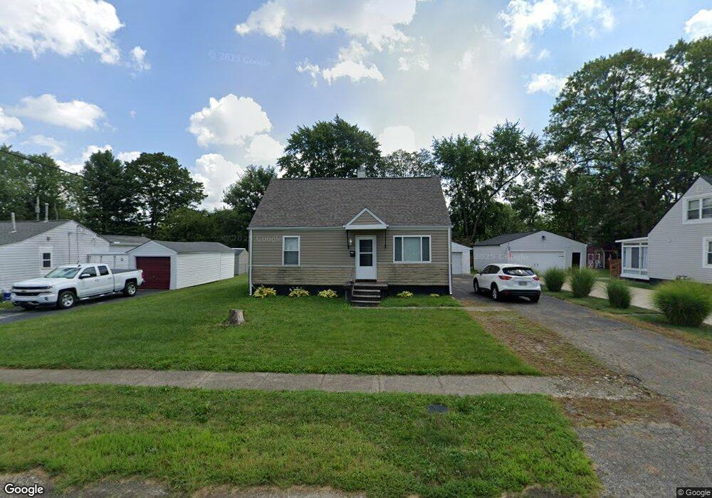
196 Maple Dr Columbus, OH 43228
Estimated Value: $184,000 - $211,000
2
Beds
2
Baths
1,044
Sq Ft
$186/Sq Ft
Est. Value
About This Home
This home is located at 196 Maple Dr, Columbus, OH 43228 and is currently estimated at $194,399, approximately $186 per square foot. 196 Maple Dr is a home located in Franklin County with nearby schools including Prairie Lincoln Elementary School, Galloway Ridge Intermediate School, and Norton Middle School.
Ownership History
Date
Name
Owned For
Owner Type
Purchase Details
Closed on
Jul 6, 2018
Sold by
Collins Amy B
Bought by
Thompson Gail D
Current Estimated Value
Home Financials for this Owner
Home Financials are based on the most recent Mortgage that was taken out on this home.
Original Mortgage
$89,100
Outstanding Balance
$76,567
Interest Rate
4.5%
Mortgage Type
New Conventional
Estimated Equity
$117,832
Purchase Details
Closed on
Jun 4, 1980
Bought by
Norman Julian D
Create a Home Valuation Report for This Property
The Home Valuation Report is an in-depth analysis detailing your home's value as well as a comparison with similar homes in the area
Home Values in the Area
Average Home Value in this Area
Purchase History
| Date | Buyer | Sale Price | Title Company |
|---|---|---|---|
| Thompson Gail D | $90,000 | Chase Title & Escrwo Svcs Ll | |
| Norman Julian D | -- | -- |
Source: Public Records
Mortgage History
| Date | Status | Borrower | Loan Amount |
|---|---|---|---|
| Open | Thompson Gail D | $89,100 |
Source: Public Records
Tax History
| Year | Tax Paid | Tax Assessment Tax Assessment Total Assessment is a certain percentage of the fair market value that is determined by local assessors to be the total taxable value of land and additions on the property. | Land | Improvement |
|---|---|---|---|---|
| 2025 | $2,481 | $54,750 | $16,350 | $38,400 |
| 2024 | $2,481 | $54,750 | $16,350 | $38,400 |
| 2023 | $2,375 | $54,740 | $16,345 | $38,395 |
| 2022 | $1,948 | $31,470 | $4,480 | $26,990 |
| 2021 | $1,979 | $31,470 | $4,480 | $26,990 |
| 2020 | $1,960 | $31,470 | $4,480 | $26,990 |
| 2019 | $1,873 | $26,260 | $3,750 | $22,510 |
| 2018 | $1,773 | $26,260 | $3,750 | $22,510 |
| 2017 | $1,561 | $21,290 | $3,750 | $17,540 |
| 2016 | $1,638 | $21,490 | $5,600 | $15,890 |
| 2015 | $1,638 | $21,490 | $5,600 | $15,890 |
| 2014 | $1,616 | $21,490 | $5,600 | $15,890 |
| 2013 | $620 | $25,270 | $6,580 | $18,690 |
Source: Public Records
Map
Nearby Homes
- 154 Maple Dr
- 185 Sturbridge Rd
- 381 Pasadena Ave
- 396 Pasadena Ave
- 69 Lawrence Ave
- 443 Lawrence Ave
- 5409 Longworth Dr
- 110 Inah Ave
- 89 Postle Blvd
- 463 Darbyhurst Rd
- 97 Tarryton Ct W Unit 19-H
- 87 Tarryton Ct W Unit 18D
- 417 Revere Ct
- 102 Redmond Rd
- 129 Beacon Run W Unit 21C
- 4723 Tarryton Ct S Unit 14-E
- 5713 Larksdale Dr
- 399 Carilla Ln
- 376 Galloway Ridge Dr
- 218 Darbyhurst Rd
- 204 Maple Dr
- 186 Maple Dr
- 210 Maple Dr
- 178 Maple Dr
- 193 Buena Vista Ave
- 175 Buena Vista Ave
- 201 Buena Vista Ave
- 167 Buena Vista Ave
- 191 Maple Dr
- 220 Maple Dr
- 170 Maple Dr
- 205 Maple Dr
- 223 Maple Dr
- 179 Maple Dr
- 209 Buena Vista Ave
- 159 Buena Vista Ave
- 228 Maple Dr
- 162 Maple Dr
- 171 Maple Dr
- 221 Maple Dr
Your Personal Tour Guide
Ask me questions while you tour the home.