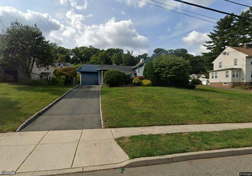
196 Mccosh Rd Upper Montclair, NJ 07043
Montclair Heights NeighborhoodEstimated Value: $720,000 - $782,000
4
Beds
3
Baths
1,615
Sq Ft
$464/Sq Ft
Est. Value
About This Home
This home is located at 196 Mccosh Rd, Upper Montclair, NJ 07043 and is currently estimated at $748,588, approximately $463 per square foot. 196 Mccosh Rd is a home located in Passaic County with nearby schools including Clifton High School, Saint Philip the Apostle Preparatory School, and The Magical Palace of Knowledge.
Ownership History
Date
Name
Owned For
Owner Type
Purchase Details
Closed on
Aug 6, 2021
Sold by
Tevolini Michael Anthony and Tevolini Hannah
Bought by
Pogue Jeffrey T and Pogue Katherine M
Current Estimated Value
Home Financials for this Owner
Home Financials are based on the most recent Mortgage that was taken out on this home.
Original Mortgage
$508,500
Outstanding Balance
$457,364
Interest Rate
2.9%
Mortgage Type
New Conventional
Estimated Equity
$291,224
Purchase Details
Closed on
Sep 29, 2017
Sold by
Turchi Clara
Bought by
Tevolini Michael Anthony and Tevolini Hannah
Home Financials for this Owner
Home Financials are based on the most recent Mortgage that was taken out on this home.
Original Mortgage
$379,200
Interest Rate
3.82%
Mortgage Type
New Conventional
Create a Home Valuation Report for This Property
The Home Valuation Report is an in-depth analysis detailing your home's value as well as a comparison with similar homes in the area
Home Values in the Area
Average Home Value in this Area
Purchase History
| Date | Buyer | Sale Price | Title Company |
|---|---|---|---|
| Pogue Jeffrey T | $565,000 | Acres Land Title | |
| Pogue Jeffrey T | $565,000 | Acres Land Title | |
| Tevolini Michael Anthony | $474,000 | None Available |
Source: Public Records
Mortgage History
| Date | Status | Borrower | Loan Amount |
|---|---|---|---|
| Open | Pogue Jeffrey T | $508,500 | |
| Closed | Pogue Jeffrey T | $508,500 | |
| Previous Owner | Tevolini Michael Anthony | $379,200 |
Source: Public Records
Tax History
| Year | Tax Paid | Tax Assessment Tax Assessment Total Assessment is a certain percentage of the fair market value that is determined by local assessors to be the total taxable value of land and additions on the property. | Land | Improvement |
|---|---|---|---|---|
| 2025 | $12,739 | $214,600 | $118,600 | $96,000 |
| 2024 | $12,434 | $214,600 | $118,600 | $96,000 |
| 2022 | $12,254 | $214,600 | $118,600 | $96,000 |
| 2021 | $11,749 | $214,600 | $118,600 | $96,000 |
| 2020 | $11,788 | $214,600 | $118,600 | $96,000 |
| 2019 | $11,704 | $214,600 | $118,600 | $96,000 |
| 2018 | $11,491 | $211,900 | $118,600 | $93,300 |
| 2017 | $11,366 | $211,900 | $118,600 | $93,300 |
| 2016 | $11,146 | $211,900 | $118,600 | $93,300 |
| 2015 | $11,038 | $211,900 | $118,600 | $93,300 |
| 2014 | $10,811 | $211,900 | $118,600 | $93,300 |
Source: Public Records
Map
Nearby Homes
- 1283 Valley Rd Unit 7
- 31 Nassau Rd
- 620 Highland Ave
- 41 Pino Ct
- 8 MacOpin Ave
- 16 Lenape Trail
- 77 Macarthur Dr
- 138 Alexander Ave
- 28 Overlook Rd
- 605 Grove St Unit 11
- 605 Grove St Unit 8
- 15 Garfield Place
- 18 Adams Terrace Unit 2
- 34 Carline Dr
- 565 Grove St Unit B12
- 70 Anderson Dr
- 11 Kenneth Rd
- 117 Yantacaw Brook Rd
- 43 Graydon Terrace
- 605 F8 Grove St Unit F8
- 192 Mccosh Rd
- 204 Mccosh Rd
- 199 Mccosh Rd
- 184 Mccosh Rd
- 189 Mccosh Rd
- 136 Woodlawn Ave
- 200 Mccosh Rd
- 181 Mccosh Rd
- 211 Mccosh Rd
- 140 Woodlawn Ave
- 182 Mccosh Rd
- 125 Woodlawn Ave
- 144 Woodlawn Ave
- 125 Woodlawn Ave
- 176 Mccosh Rd
- 117 Woodlawn Ave
- 146 Woodlawn Ave
- 110 Woodlawn Ave
- 114 Woodlawn Ave
- 177 Mccosh Rd
Your Personal Tour Guide
Ask me questions while you tour the home.