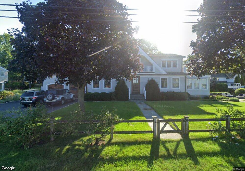
196 Nearwater Ln Darien, CT 06820
Estimated Value: $4,035,451 - $5,273,000
5
Beds
5
Baths
4,508
Sq Ft
$1,065/Sq Ft
Est. Value
About This Home
This home is located at 196 Nearwater Ln, Darien, CT 06820 and is currently estimated at $4,799,484, approximately $1,064 per square foot. 196 Nearwater Ln is a home located in Fairfield County with nearby schools including Hindley Elementary School, Middlesex Middle School, and Darien High School.
Ownership History
Date
Name
Owned For
Owner Type
Purchase Details
Closed on
Sep 13, 2007
Sold by
Klopp John and Klopp Karen K
Bought by
Schrenker Karen A
Current Estimated Value
Purchase Details
Closed on
Feb 8, 1994
Sold by
Nixon Robert
Bought by
Klopp John and Klopp Karen
Create a Home Valuation Report for This Property
The Home Valuation Report is an in-depth analysis detailing your home's value as well as a comparison with similar homes in the area
Home Values in the Area
Average Home Value in this Area
Purchase History
| Date | Buyer | Sale Price | Title Company |
|---|---|---|---|
| Schrenker Karen A | $4,500,000 | -- | |
| Klopp John | $550,000 | -- |
Source: Public Records
Mortgage History
| Date | Status | Borrower | Loan Amount |
|---|---|---|---|
| Open | Klopp John | $2,450,000 | |
| Closed | Klopp John | $2,511,000 |
Source: Public Records
Tax History Compared to Growth
Tax History
| Year | Tax Paid | Tax Assessment Tax Assessment Total Assessment is a certain percentage of the fair market value that is determined by local assessors to be the total taxable value of land and additions on the property. | Land | Improvement |
|---|---|---|---|---|
| 2025 | $47,381 | $3,060,820 | $2,064,160 | $996,660 |
| 2024 | $44,963 | $3,060,820 | $2,064,160 | $996,660 |
| 2023 | $42,442 | $2,410,100 | $1,474,410 | $935,690 |
| 2022 | $41,526 | $2,410,100 | $1,474,410 | $935,690 |
| 2021 | $40,586 | $2,410,100 | $1,474,410 | $935,690 |
| 2020 | $39,429 | $2,410,100 | $1,474,410 | $935,690 |
| 2019 | $39,694 | $2,410,100 | $1,474,410 | $935,690 |
| 2018 | $39,079 | $2,430,260 | $1,474,410 | $955,850 |
| 2017 | $39,273 | $2,430,260 | $1,474,410 | $955,850 |
| 2016 | $38,325 | $2,430,260 | $1,474,410 | $955,850 |
| 2015 | $37,304 | $2,430,260 | $1,474,410 | $955,850 |
| 2014 | $36,478 | $2,430,260 | $1,474,410 | $955,850 |
Source: Public Records
Map
Nearby Homes
- 5 Mayflower Rd
- 5 Shipway Rd
- 74 Long Neck Point Rd
- 92 Pear Tree Point Rd
- 88 Pear Tree Point Rd
- 101 Long Neck Point Rd
- 20 Seagate Rd
- 0 Hay Island Unit 24078034
- 157 Long Neck Point Rd
- 86 Wallacks Dr
- 55 Avery St
- 80 Horton St
- 36 Middlebury St
- 16 Neponsit St
- 101 Palmer Ave
- 15 Robin St
- 120 Webb Ave
- 209 Seaside Ave Unit 2
- 737 Cove Rd Unit D2
- 175 Seaside Ave Unit 1