Estimated Value: $399,402 - $473,000
3
Beds
2
Baths
2,600
Sq Ft
$170/Sq Ft
Est. Value
About This Home
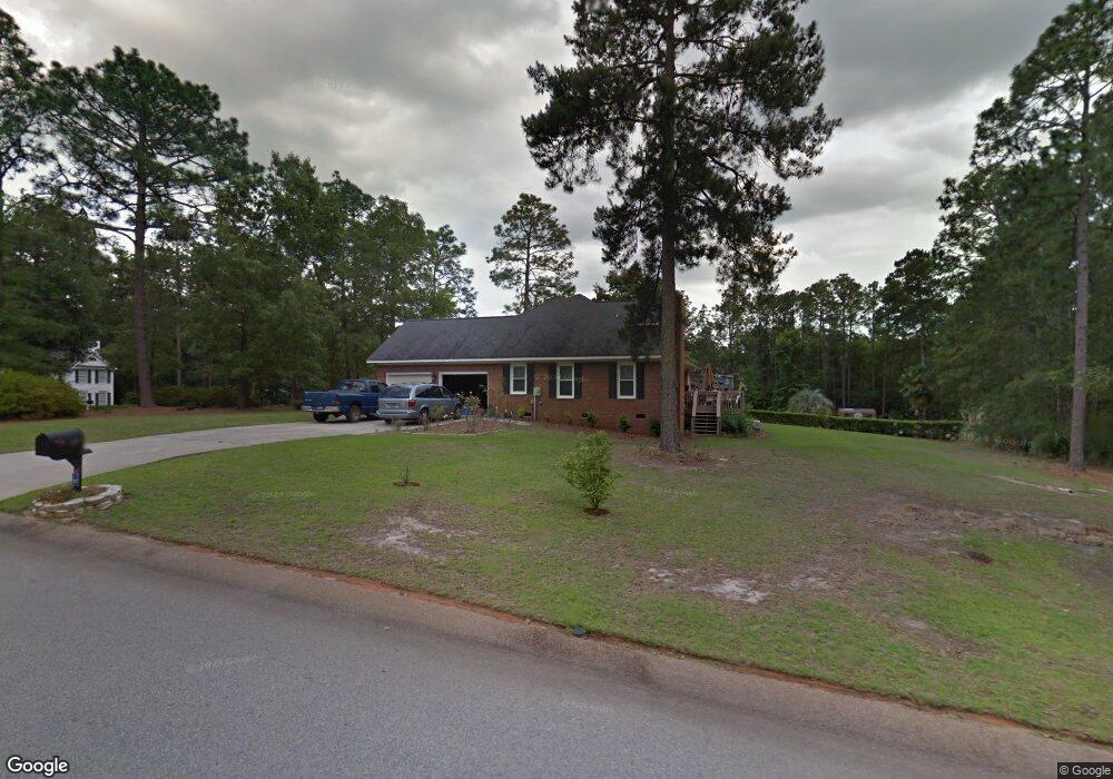
This home is located at 196 Rolling Rock Rd, Aiken, SC 29803 and is currently estimated at $442,101, approximately $170 per square foot. 196 Rolling Rock Rd is a home located in Aiken County with nearby schools including Millbrook Elementary School, M.B. Kennedy Middle School, and South Aiken High School.
Ownership History
Date
Name
Owned For
Owner Type
Purchase Details
Closed on
Sep 1, 2006
Sold by
Reel Blazer Michael Phillip and Reel Blazer Katherine
Bought by
Layton Mark H and Layton Rose M
Current Estimated Value
Home Financials for this Owner
Home Financials are based on the most recent Mortgage that was taken out on this home.
Original Mortgage
$231,200
Outstanding Balance
$136,686
Interest Rate
6.67%
Mortgage Type
Purchase Money Mortgage
Estimated Equity
$305,415
Create a Home Valuation Report for This Property
The Home Valuation Report is an in-depth analysis detailing your home's value as well as a comparison with similar homes in the area
Home Values in the Area
Average Home Value in this Area
Purchase History
| Date | Buyer | Sale Price | Title Company |
|---|---|---|---|
| Layton Mark H | $289,000 | None Available |
Source: Public Records
Mortgage History
| Date | Status | Borrower | Loan Amount |
|---|---|---|---|
| Open | Layton Mark H | $231,200 |
Source: Public Records
Tax History Compared to Growth
Tax History
| Year | Tax Paid | Tax Assessment Tax Assessment Total Assessment is a certain percentage of the fair market value that is determined by local assessors to be the total taxable value of land and additions on the property. | Land | Improvement |
|---|---|---|---|---|
| 2025 | $1,545 | $10,650 | -- | -- |
| 2023 | $1,547 | $10,650 | $1,310 | $233,580 |
| 2022 | $1,518 | $10,650 | $0 | $0 |
| 2021 | $1,520 | $10,650 | $0 | $0 |
| 2020 | $1,462 | $10,140 | $0 | $0 |
| 2019 | $1,462 | $10,140 | $0 | $0 |
| 2018 | $1,470 | $10,140 | $1,310 | $8,830 |
| 2017 | $1,419 | $0 | $0 | $0 |
| 2016 | $1,420 | $0 | $0 | $0 |
| 2015 | $1,452 | $0 | $0 | $0 |
| 2014 | $1,454 | $0 | $0 | $0 |
| 2013 | -- | $0 | $0 | $0 |
Source: Public Records
Map
Nearby Homes
- 220 Bainbridge Dr
- 189 Cheltenham Dr
- 215 Bainbridge Dr
- 75 Emerald Ridge
- 7520 Hanford Dr
- 8213 Snelling Dr
- 8220 Snelling Dr
- 8205 Snelling Dr
- 218 Atherstone St
- 8199 Snelling Dr
- 209 Atherstone St
- 8206 Snelling Dr
- 8193 Snelling Dr
- 8192 Snelling Dr
- 7255 Hanford Dr
- 8163 Snelling Dr
- 19 Shrewsbury Ln
- 05-M Snelling Dr
- 19-M Snelling Dr
- 8783 Snelling Dr
- 190 Rolling Rock Rd
- 216 Cheltenham Dr
- 225 Cheltenham Dr
- 221 Cheltenham Dr
- 189 Rolling Rock Rd
- 231 Cheltenham Dr
- 104 Oxmoor Cir
- 217 Cheltenham Dr
- 210 Cheltenham Dr
- 188 Rolling Rock Rd
- 235 Cheltenham Dr
- 186 Rolling Rock Rd
- 184 Rolling Rock Rd
- 177 Rolling Rock Rd
- 213 Cheltenham Dr
- 112 Oxmoor Cir
- 241 Cheltenham Dr
- 202 Cheltenham Dr
- 240 Cheltenham Dr
- 176 Rolling Rock Rd