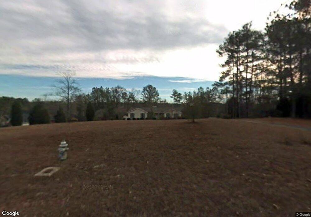
196 Selfridge Rd McDonough, GA 30252
Estimated Value: $284,946 - $307,000
3
Beds
2
Baths
1,627
Sq Ft
$181/Sq Ft
Est. Value
About This Home
This home is located at 196 Selfridge Rd, McDonough, GA 30252 and is currently estimated at $294,987, approximately $181 per square foot. 196 Selfridge Rd is a home located in Henry County with nearby schools including East Lake Elementary School, Union Grove Middle School, and Union Grove High School.
Ownership History
Date
Name
Owned For
Owner Type
Purchase Details
Closed on
Feb 24, 2021
Sold by
Parks Joseph Milan
Bought by
Settle Alec C and Settle Cheryl A
Current Estimated Value
Purchase Details
Closed on
Dec 1, 2020
Sold by
Parks Cindy
Bought by
Parks Matthew Glen and Parks Joseph Milan
Purchase Details
Closed on
Oct 10, 2017
Sold by
Parker Liv Trust
Bought by
Parker Special Needs Family Tr
Purchase Details
Closed on
May 19, 2011
Sold by
Parker Cg and Parker Shirley U
Bought by
Parker Living Trust
Create a Home Valuation Report for This Property
The Home Valuation Report is an in-depth analysis detailing your home's value as well as a comparison with similar homes in the area
Home Values in the Area
Average Home Value in this Area
Purchase History
| Date | Buyer | Sale Price | Title Company |
|---|---|---|---|
| Settle Alec C | $192,000 | -- | |
| Parks Matthew Glen | -- | -- | |
| Parker Special Needs Family Tr | -- | -- | |
| Parker Living Trust | -- | -- |
Source: Public Records
Tax History Compared to Growth
Tax History
| Year | Tax Paid | Tax Assessment Tax Assessment Total Assessment is a certain percentage of the fair market value that is determined by local assessors to be the total taxable value of land and additions on the property. | Land | Improvement |
|---|---|---|---|---|
| 2025 | $1,203 | $124,892 | $22,840 | $102,052 |
| 2024 | $1,203 | $120,640 | $22,960 | $97,680 |
| 2023 | $1,399 | $121,760 | $22,080 | $99,680 |
| 2022 | $917 | $76,800 | $16,666 | $60,134 |
| 2021 | $2,900 | $74,560 | $17,520 | $57,040 |
| 2020 | $572 | $71,840 | $16,480 | $55,360 |
| 2019 | $571 | $66,880 | $15,640 | $51,240 |
| 2018 | $570 | $59,840 | $14,440 | $45,400 |
| 2016 | $569 | $51,000 | $12,200 | $38,800 |
| 2015 | -- | $48,880 | $13,880 | $35,000 |
| 2014 | -- | $44,760 | $13,880 | $30,880 |
Source: Public Records
Map
Nearby Homes
- 0 Highway 155 N Unit 10380875
- 1104 Driftwood Ct
- 825 Rapid Ct
- 316 Moab Ct
- 283 Osier Dr
- Henry II Plan at Grandview at Millers Mill
- Isabella V Plan at Grandview at Millers Mill
- Meridian II Plan at Grandview at Millers Mill
- Rosemary II Plan at Grandview at Millers Mill
- Clarity Plan at Grandview at Millers Mill
- Stonefield Plan at Grandview at Millers Mill
- Rainier Plan at Grandview at Millers Mill
- 621 Sidney Ct
- 617 Sidney Ct
- 187 Buffalo Trace
- 613 Sidney Ct
- 609 Sidney Ct
- 605 Sidney Ct
- 80 Knight Dr
- 1205 Mill Creek Ln
- 210 Selfridge Rd
- 238 Selfridge Rd
- 0 Cotton Indian Creek Rd Unit 7043081
- 0 Cotton Indian Creek Rd Unit 7107156
- 0 Cotton Indian Creek Rd Unit Lot 1.9 ACs 8160218
- 0 Cotton Indian Creek Rd Unit 8726461
- 155 Selfridge Rd
- 148 Selfridge Rd
- 270 Selfridge Rd
- 135 Selfridge Rd
- 747 Trickle Ln
- 746 Trickle Ln
- 103 Selfridge Rd
- 743 Trickle Ln
- 35 Cotton Indian Creek Rd
- 292 Selfridge Rd
- 744 Trickle Ln
- 199 Selfridge Rd
- 140 Cotton Indian Creek Rd