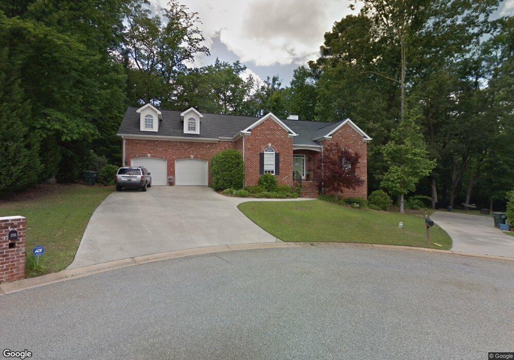
196 Sugarloaf Cir Macon, GA 31204
Estimated Value: $332,000 - $344,000
4
Beds
2
Baths
2,549
Sq Ft
$133/Sq Ft
Est. Value
About This Home
This home is located at 196 Sugarloaf Cir, Macon, GA 31204 and is currently estimated at $337,973, approximately $132 per square foot. 196 Sugarloaf Cir is a home located in Bibb County with nearby schools including Rosa Taylor Elementary School, Miller Fine Arts Magnet Middle School, and Central High School.
Ownership History
Date
Name
Owned For
Owner Type
Purchase Details
Closed on
Aug 21, 2007
Sold by
Michael Jordan M and Michael Mary Lynn
Bought by
Mixon Elizabeth R
Current Estimated Value
Home Financials for this Owner
Home Financials are based on the most recent Mortgage that was taken out on this home.
Original Mortgage
$150,800
Outstanding Balance
$94,991
Interest Rate
6.65%
Mortgage Type
Purchase Money Mortgage
Estimated Equity
$242,982
Purchase Details
Closed on
Nov 9, 2001
Create a Home Valuation Report for This Property
The Home Valuation Report is an in-depth analysis detailing your home's value as well as a comparison with similar homes in the area
Home Values in the Area
Average Home Value in this Area
Purchase History
| Date | Buyer | Sale Price | Title Company |
|---|---|---|---|
| Mixon Elizabeth R | $188,500 | None Available | |
| -- | $27,500 | -- |
Source: Public Records
Mortgage History
| Date | Status | Borrower | Loan Amount |
|---|---|---|---|
| Open | Mixon Elizabeth R | $150,800 |
Source: Public Records
Tax History Compared to Growth
Tax History
| Year | Tax Paid | Tax Assessment Tax Assessment Total Assessment is a certain percentage of the fair market value that is determined by local assessors to be the total taxable value of land and additions on the property. | Land | Improvement |
|---|---|---|---|---|
| 2025 | $3,015 | $129,679 | $12,000 | $117,679 |
| 2024 | $3,116 | $129,679 | $12,000 | $117,679 |
| 2023 | $2,254 | $113,752 | $12,000 | $101,752 |
| 2022 | $3,479 | $107,502 | $11,040 | $96,462 |
| 2021 | $3,373 | $95,770 | $9,936 | $85,834 |
| 2020 | $3,288 | $91,683 | $9,936 | $81,747 |
| 2019 | $3,315 | $91,683 | $9,936 | $81,747 |
| 2018 | $4,914 | $85,961 | $9,936 | $76,025 |
| 2017 | $2,560 | $75,334 | $9,936 | $65,398 |
| 2016 | $2,364 | $75,334 | $9,936 | $65,398 |
| 2015 | $3,347 | $75,334 | $9,936 | $65,398 |
| 2014 | $3,997 | $77,051 | $11,040 | $66,011 |
Source: Public Records
Map
Nearby Homes
- 3341 Stinsonville Rd
- 3175 Stinsonville Rd
- 3687 Overlook Ave
- 3687 Overlook Dr
- 509 Sugarloaf Dr
- 759 Mosby Ct
- 2939 General Lee Rd
- 2956 Malvern Hill Dr
- 2925 Malvern Hill Dr
- 3408 Ridge Ave
- 3790 Overlook Ave
- 3341 Ridge Ave
- 3280 Ingleside Ave
- 3823 Overlook Ave
- 803 Captain Kell Dr
- 3440 Vineville Ave
- 3432 Vineville Ave
- 3105 Ingleside Ave
- 2783 S Hillandale Cir
- 128 Prentice Place
- 235 Sugarloaf Cir
- 194 Sugarloaf Cir
- 230 Sugarloaf Cir
- 190 Sugarloaf Cir
- 233 Sugarloaf Cir
- 229 Sugarloaf Cir
- 186 Sugarloaf Cir
- 228 Sugarloaf Cir
- 224 Sugarloaf Cir
- 171 Sugarloaf Cir
- 225 Sugarloaf Cir
- 165 Sugarloaf Cir
- 565 Bel Meade Place
- 220 Sugarloaf Cir
- 221 Sugarloaf Cir
- 562 Bel Meade Place
- 161 Sugarloaf Cir
- 571 Bel Meade Place
- 568 Bel Meade Place
- 174 Sugarloaf Cir