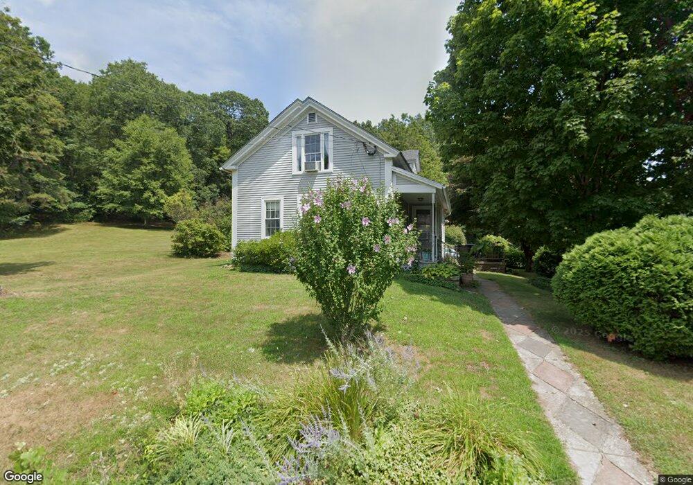
196 Upper Rd Deerfield, MA 01342
Estimated Value: $340,000 - $397,000
4
Beds
1
Bath
1,220
Sq Ft
$300/Sq Ft
Est. Value
About This Home
This home is located at 196 Upper Rd, Deerfield, MA 01342 and is currently estimated at $366,478, approximately $300 per square foot. 196 Upper Rd is a home located in Franklin County with nearby schools including Deerfield Elementary School and Frontier Regional School.
Ownership History
Date
Name
Owned For
Owner Type
Purchase Details
Closed on
Sep 24, 2024
Sold by
Butynski Jay R and Butynski Emma J
Bought by
Butynski Ann M
Current Estimated Value
Purchase Details
Closed on
Aug 23, 2018
Sold by
Drumgool Jane N Est and Hermes
Bought by
Butynski Ann M and Butynski Jay R
Home Financials for this Owner
Home Financials are based on the most recent Mortgage that was taken out on this home.
Original Mortgage
$162,000
Interest Rate
4.5%
Mortgage Type
New Conventional
Purchase Details
Closed on
Jul 15, 1981
Bought by
Drumgool Jane N
Create a Home Valuation Report for This Property
The Home Valuation Report is an in-depth analysis detailing your home's value as well as a comparison with similar homes in the area
Home Values in the Area
Average Home Value in this Area
Purchase History
| Date | Buyer | Sale Price | Title Company |
|---|---|---|---|
| Butynski Ann M | -- | None Available | |
| Butynski Ann M | -- | None Available | |
| Butynski Ann M | $210,000 | -- | |
| Drumgool Jane N | $32,300 | -- | |
| Butynski Ann M | $210,000 | -- |
Source: Public Records
Mortgage History
| Date | Status | Borrower | Loan Amount |
|---|---|---|---|
| Previous Owner | Butynski Ann M | $162,000 |
Source: Public Records
Tax History
| Year | Tax Paid | Tax Assessment Tax Assessment Total Assessment is a certain percentage of the fair market value that is determined by local assessors to be the total taxable value of land and additions on the property. | Land | Improvement |
|---|---|---|---|---|
| 2025 | $4,011 | $302,700 | $139,900 | $162,800 |
| 2024 | $3,823 | $276,000 | $127,100 | $148,900 |
| 2023 | $3,543 | $236,700 | $100,600 | $136,100 |
| 2022 | $3,377 | $222,600 | $100,600 | $122,000 |
| 2021 | $0 | $205,300 | $100,600 | $104,700 |
| 2020 | $3,129 | $199,400 | $100,600 | $98,800 |
| 2019 | $3,120 | $196,100 | $99,000 | $97,100 |
| 2018 | $3,064 | $192,100 | $95,000 | $97,100 |
| 2017 | $2,928 | $190,100 | $95,000 | $95,100 |
| 2016 | $2,823 | $185,100 | $91,000 | $94,100 |
| 2015 | $2,780 | $186,100 | $91,000 | $95,100 |
Source: Public Records
Map
Nearby Homes
Your Personal Tour Guide
Ask me questions while you tour the home.