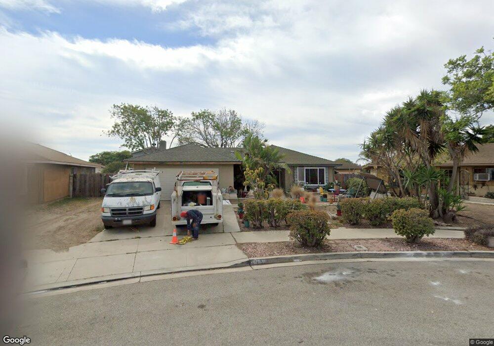
1960 Macarthur Place Oxnard, CA 93033
Lemonwood Eastmont NeighborhoodEstimated Value: $667,947 - $759,000
3
Beds
2
Baths
1,407
Sq Ft
$511/Sq Ft
Est. Value
About This Home
This home is located at 1960 Macarthur Place, Oxnard, CA 93033 and is currently estimated at $718,987, approximately $511 per square foot. 1960 Macarthur Place is a home located in Ventura County with nearby schools including Lemonwood Elementary School, R.J. Frank Academy of Marine Science & Engineering, and Santa Clara High School.
Ownership History
Date
Name
Owned For
Owner Type
Purchase Details
Closed on
Oct 23, 2025
Sold by
Garcia Robert Ruben and Garcia Maria Elena
Bought by
Robert And Maria Garcia Family Trust and Garcia
Current Estimated Value
Purchase Details
Closed on
Apr 2, 2010
Sold by
Garcia Robert Ruben and Garcia Maria Elena
Bought by
Garcia Robert Ruben and Garcia Maria Elena
Home Financials for this Owner
Home Financials are based on the most recent Mortgage that was taken out on this home.
Original Mortgage
$150,000
Interest Rate
5.01%
Mortgage Type
New Conventional
Create a Home Valuation Report for This Property
The Home Valuation Report is an in-depth analysis detailing your home's value as well as a comparison with similar homes in the area
Home Values in the Area
Average Home Value in this Area
Purchase History
| Date | Buyer | Sale Price | Title Company |
|---|---|---|---|
| Robert And Maria Garcia Family Trust | -- | None Listed On Document | |
| Garcia Robert Ruben | -- | Chicago Title Company |
Source: Public Records
Mortgage History
| Date | Status | Borrower | Loan Amount |
|---|---|---|---|
| Previous Owner | Garcia Robert Ruben | $150,000 |
Source: Public Records
Tax History
| Year | Tax Paid | Tax Assessment Tax Assessment Total Assessment is a certain percentage of the fair market value that is determined by local assessors to be the total taxable value of land and additions on the property. | Land | Improvement |
|---|---|---|---|---|
| 2025 | $2,024 | $163,215 | $40,784 | $122,431 |
| 2024 | $2,024 | $160,015 | $39,984 | $120,031 |
| 2023 | $1,951 | $156,878 | $39,200 | $117,678 |
| 2022 | $1,894 | $153,802 | $38,431 | $115,371 |
| 2021 | $1,879 | $150,787 | $37,678 | $113,109 |
| 2020 | $1,913 | $149,243 | $37,293 | $111,950 |
| 2019 | $1,860 | $146,317 | $36,562 | $109,755 |
| 2018 | $1,834 | $143,449 | $35,846 | $107,603 |
| 2017 | $1,743 | $140,638 | $35,144 | $105,494 |
| 2016 | $1,683 | $137,881 | $34,455 | $103,426 |
| 2015 | $1,701 | $135,812 | $33,939 | $101,873 |
| 2014 | $1,683 | $133,153 | $33,275 | $99,878 |
Source: Public Records
Map
Nearby Homes
- 1928 San Benito St
- 3426 Olds Rd
- 1036 Cheyenne Way
- 3700 Olds Rd Unit 86
- 1407 Peach Ave Unit 14
- 2136 Thrush Ave Unit 2136
- 2117 Cardinal Ave Unit 2117h
- 2178 Thrush Ave Unit J
- 2177 Robin Ave Unit 2177A
- 1645 Lime Ave Unit 91
- 2140 Robin Ave Unit 2140A
- 4200 Browning Dr
- 2021 E Bard Rd
- 2151 E Wooley Rd
- 2400 E Pleasant Valley Rd Unit 108
- 4340 Highland Ave
- 4108 Ranchita Ln
- 4614 Concord Way
- 3631 La Costa Place
- 360 Ibsen Place Unit 129
- 1964 Macarthur Place
- 1956 Macarthur Place
- 1951 Napoleon Ave
- 1945 Napoleon Ave
- 1955 Napoleon Ave
- 1968 Macarthur Place
- 1941 Napoleon Ave
- 1961 Napoleon Ave
- 1961 Macarthur Place
- 2411 Dupont St
- 2434 Beaufort Dr
- 2440 Beaufort Dr
- 2430 Beaufort Dr
- 1936 Macarthur Place
- 2450 Beaufort Dr
- 2420 Beaufort Dr
- 2401 Dupont St
- 1950 Napoleon Ave
- 1944 Napoleon Ave
- 1949 Macarthur Place
Your Personal Tour Guide
Ask me questions while you tour the home.