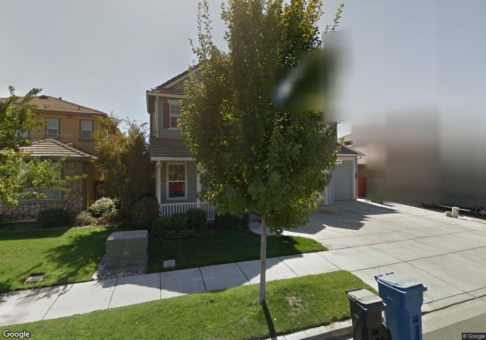
1960 Trail Way Turlock, CA 95382
Estimated Value: $717,285 - $728,000
5
Beds
3
Baths
3,484
Sq Ft
$207/Sq Ft
Est. Value
About This Home
This home is located at 1960 Trail Way, Turlock, CA 95382 and is currently estimated at $722,321, approximately $207 per square foot. 1960 Trail Way is a home located in Stanislaus County with nearby schools including Sandra Tovar Medeiros Elementary School, Turlock Junior High School, and Marvin A. Dutcher Middle School.
Ownership History
Date
Name
Owned For
Owner Type
Purchase Details
Closed on
Apr 24, 2009
Sold by
Marquette Steven C
Bought by
Montalbo Luis and Montalbo Valerie
Current Estimated Value
Home Financials for this Owner
Home Financials are based on the most recent Mortgage that was taken out on this home.
Original Mortgage
$319,113
Outstanding Balance
$202,272
Interest Rate
4.99%
Mortgage Type
FHA
Estimated Equity
$520,049
Purchase Details
Closed on
Oct 27, 2003
Sold by
Ntr Partners Llc
Bought by
Marquette Steven C
Home Financials for this Owner
Home Financials are based on the most recent Mortgage that was taken out on this home.
Original Mortgage
$295,269
Interest Rate
6.29%
Mortgage Type
Stand Alone First
Create a Home Valuation Report for This Property
The Home Valuation Report is an in-depth analysis detailing your home's value as well as a comparison with similar homes in the area
Purchase History
| Date | Buyer | Sale Price | Title Company |
|---|---|---|---|
| Montalbo Luis | $325,000 | Stewart Title Of California | |
| Marquette Steven C | $394,000 | Chicago Title |
Source: Public Records
Mortgage History
| Date | Status | Borrower | Loan Amount |
|---|---|---|---|
| Open | Montalbo Luis | $319,113 | |
| Previous Owner | Marquette Steven C | $295,269 | |
| Closed | Marquette Steven C | $59,053 |
Source: Public Records
Tax History
| Year | Tax Paid | Tax Assessment Tax Assessment Total Assessment is a certain percentage of the fair market value that is determined by local assessors to be the total taxable value of land and additions on the property. | Land | Improvement |
|---|---|---|---|---|
| 2025 | $5,409 | $422,151 | $83,697 | $338,454 |
| 2024 | $5,664 | $410,304 | $82,056 | $328,248 |
| 2023 | $5,726 | $402,260 | $80,448 | $321,812 |
| 2022 | $5,648 | $394,373 | $78,871 | $315,502 |
| 2021 | $5,402 | $386,641 | $77,325 | $309,316 |
| 2020 | $5,343 | $382,678 | $76,533 | $306,145 |
| 2019 | $5,202 | $375,176 | $75,033 | $300,143 |
| 2018 | $5,194 | $367,820 | $73,562 | $294,258 |
| 2017 | $5,038 | $360,609 | $72,120 | $288,489 |
| 2016 | $4,767 | $353,539 | $70,706 | $282,833 |
| 2015 | $4,701 | $348,229 | $69,644 | $278,585 |
| 2014 | $4,639 | $341,408 | $68,280 | $273,128 |
Source: Public Records
Map
Nearby Homes
- 2333 Old Rose Ln
- 1463 Estrella Way
- 4213 Montara Dr
- 1232 Paseo Belleza
- 1360 Shady Ln Unit 923
- 1360 Shady Ln Unit 1022
- 2500 W Barnhart Rd
- 2841 Blue Oak Ct
- 4184 Horizon Ct
- 2783 Explorer Way
- 1444 Waterthrush Way
- 3383 Summerdale Ave
- 3350 Spring Garden Dr
- 3503 Telluride Ln
- 1481 Bluethroat Dr
- 3352 Spring Crest Dr
- 2042 Spring Blossom Ln
- 0 W Barnhart Rd Unit 224133814
- 4666 Treasure Ct
- 4185 Pathway Ln
- 1970 Trail Way
- 1963 Greenfield Dr
- 1973 Greenfield Dr
- 1953 Greenfield Dr
- 1940 Trail Way
- 1980 Trail Way
- 1961 Trail Way
- 1951 Trail Way
- 1971 Trail Way
- 1943 Greenfield Dr
- 1930 Trail Way
- 1941 Trail Way
- 1981 Trail Way
- 1933 Greenfield Dr
- 1931 Trail Way
- 1920 Trail Way
- 1962 Caprice Dr
- 2300 Trail Way
- 1972 Caprice Dr
- 1952 Caprice Dr
Your Personal Tour Guide
Ask me questions while you tour the home.