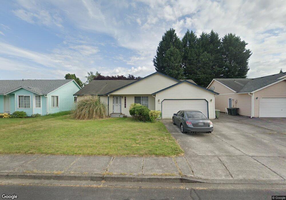
1960 Whitetail Ln Woodland, WA 98674
Estimated Value: $436,160 - $545,000
3
Beds
2
Baths
1,860
Sq Ft
$265/Sq Ft
Est. Value
About This Home
This home is located at 1960 Whitetail Ln, Woodland, WA 98674 and is currently estimated at $493,790, approximately $265 per square foot. 1960 Whitetail Ln is a home located in Cowlitz County with nearby schools including Woodland High School.
Ownership History
Date
Name
Owned For
Owner Type
Purchase Details
Closed on
Oct 18, 2021
Sold by
Tooley Richard A
Bought by
Demello Chynelle Kuuleialoha
Current Estimated Value
Home Financials for this Owner
Home Financials are based on the most recent Mortgage that was taken out on this home.
Original Mortgage
$266,000
Outstanding Balance
$242,567
Interest Rate
2.8%
Mortgage Type
New Conventional
Estimated Equity
$251,223
Create a Home Valuation Report for This Property
The Home Valuation Report is an in-depth analysis detailing your home's value as well as a comparison with similar homes in the area
Home Values in the Area
Average Home Value in this Area
Purchase History
| Date | Buyer | Sale Price | Title Company |
|---|---|---|---|
| Demello Chynelle Kuuleialoha | $397,000 | Fidelity Natl Ttl Vancouver |
Source: Public Records
Mortgage History
| Date | Status | Borrower | Loan Amount |
|---|---|---|---|
| Open | Demello Chynelle Kuuleialoha | $266,000 |
Source: Public Records
Tax History Compared to Growth
Tax History
| Year | Tax Paid | Tax Assessment Tax Assessment Total Assessment is a certain percentage of the fair market value that is determined by local assessors to be the total taxable value of land and additions on the property. | Land | Improvement |
|---|---|---|---|---|
| 2024 | $3,644 | $370,300 | $53,460 | $316,840 |
| 2023 | $3,431 | $361,600 | $53,460 | $308,140 |
| 2022 | $3,152 | $345,180 | $53,460 | $291,720 |
| 2021 | $3,344 | $298,550 | $48,600 | $249,950 |
| 2020 | $2,968 | $293,970 | $48,600 | $245,370 |
| 2019 | $2,550 | $256,539 | $48,600 | $207,939 |
| 2018 | $2,643 | $254,480 | $48,600 | $205,880 |
| 2017 | $2,221 | $227,200 | $48,600 | $178,600 |
| 2016 | $2,045 | $197,590 | $45,000 | $152,590 |
| 2015 | $1,860 | $178,740 | $45,000 | $133,740 |
| 2013 | -- | $155,440 | $36,810 | $118,630 |
Source: Public Records
Map
Nearby Homes
- 284 Gun Club Rd
- 336 York St
- 369 Gun Club Rd Unit 48
- 369 Gun Club Rd Unit 101
- 369 Gun Club Rd Unit 70
- 369 Gun Club Rd Unit 53
- 369 Gun Club Rd Unit 117
- 369 Gun Club Rd Unit 114
- 1833 Hawthorne Ct
- 1786 Clatsop St
- 2216 Statesman Dr Unit Lot 46
- 2210 Statesman Dr Unit 44
- 1986 Meadowood Loop
- 3060 Spruce Ave
- 3040 Spruce Ave
- 1850 Heartwood Dr
- 2185 Dahlia St
- 2229 Ash St Unit Lot 83
- 2233 Ash St Unit Lot 84
- 1776 Clover Ln
- 1970 Whitetail Ln
- 1950 Whitetail Ln
- 1875 Rhododendron Dr
- 1865 Rhododendron Dr
- 1980 Whitetail Ln
- 1940 Whitetail Ln
- 1975 Whitetail Ln
- 1915 Rhododendron Dr
- 1965 Whitetail Ln
- 1845 Rhododendron Dr
- 1985 Whitetail Ln
- 1955 Whitetail Ln
- 1990 Whitetail Ln
- 1930 Whitetail Ln
- 1935 Rhododendron Dr
- 1825 Rhododendron Dr
- 1960 Blacktail Ln
- 1995 Whitetail Ln
- 1970 Blacktail Ln
- 1950 Blacktail Ln