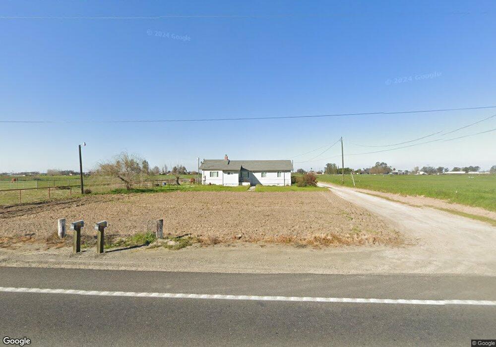
19600 State Highway 140 Stevinson, CA 95374
Estimated Value: $355,000 - $654,000
3
Beds
1
Bath
1,680
Sq Ft
$300/Sq Ft
Est. Value
About This Home
This home is located at 19600 State Highway 140, Stevinson, CA 95374 and is currently estimated at $503,355, approximately $299 per square foot. 19600 State Highway 140 is a home located in Merced County with nearby schools including Hilmar High School.
Ownership History
Date
Name
Owned For
Owner Type
Purchase Details
Closed on
Jan 29, 2025
Sold by
Bettencourt Manny A
Bought by
Manuel A Bettencourt Living Trust and Bettencourt
Current Estimated Value
Purchase Details
Closed on
Feb 27, 2007
Sold by
Bettencourt Manny A and Larson Carol Louise
Bought by
Bettencourt Manny A
Home Financials for this Owner
Home Financials are based on the most recent Mortgage that was taken out on this home.
Original Mortgage
$300,000
Interest Rate
4.87%
Mortgage Type
Unknown
Purchase Details
Closed on
Jul 18, 2001
Sold by
Cormier Joseph Felton and Cormier Barbara
Bought by
Bettencourt Manny A and Larson Carol Louise
Home Financials for this Owner
Home Financials are based on the most recent Mortgage that was taken out on this home.
Original Mortgage
$136,000
Interest Rate
6.5%
Create a Home Valuation Report for This Property
The Home Valuation Report is an in-depth analysis detailing your home's value as well as a comparison with similar homes in the area
Purchase History
| Date | Buyer | Sale Price | Title Company |
|---|---|---|---|
| Manuel A Bettencourt Living Trust | -- | None Listed On Document | |
| Bettencourt Manny A | $166,000 | Transcounty Title Company | |
| Bettencourt Manny A | $165,000 | Fidelity National Title Co |
Source: Public Records
Mortgage History
| Date | Status | Borrower | Loan Amount |
|---|---|---|---|
| Previous Owner | Bettencourt Manny A | $300,000 | |
| Previous Owner | Bettencourt Manny A | $136,000 |
Source: Public Records
Tax History
| Year | Tax Paid | Tax Assessment Tax Assessment Total Assessment is a certain percentage of the fair market value that is determined by local assessors to be the total taxable value of land and additions on the property. | Land | Improvement |
|---|---|---|---|---|
| 2025 | $4,675 | $430,358 | $286,163 | $144,195 |
| 2024 | $4,675 | $421,920 | $280,552 | $141,368 |
| 2023 | $4,548 | $413,648 | $275,051 | $138,597 |
| 2022 | $4,468 | $405,538 | $269,658 | $135,880 |
| 2021 | $4,392 | $397,587 | $264,371 | $133,216 |
| 2020 | $4,374 | $393,512 | $261,661 | $131,851 |
| 2019 | $4,336 | $385,797 | $256,531 | $129,266 |
| 2018 | $3,984 | $378,233 | $251,501 | $126,732 |
| 2017 | $3,899 | $370,818 | $246,570 | $124,248 |
| 2016 | $3,822 | $363,548 | $241,736 | $121,812 |
| 2015 | $3,279 | $310,000 | $150,000 | $160,000 |
| 2014 | $2,594 | $245,000 | $130,000 | $115,000 |
Source: Public Records
Map
Nearby Homes
- 19737 California 140
- 2776 Center St
- 2886 Center St
- 0 Third Ave
- 1 2848 4th St
- 0 2848 4th St
- 19331 First Ave
- 21160 Second Ave
- 17385 Bell Dr
- 20170 River Rd
- 5460 Kilroy Rd
- 15544 Atwater Jordan Rd
- 15490 Atwater Jordan Rd
- 0 Cemetery Rd
- 14509 Bell Dr
- 14359 Sunset Dr
- 14923 Westside Blvd
- 14176 Sunset Dr
- 14118 Bell Dr
- 19893 Lucas Ct
- 19605 State Highway 140
- 19697 State Highway 140
- 19697 State Highway 140
- 19639 State Highway 140
- 19639 State Highway 140
- 19380 State Highway 140
- 19380 State Highway 140
- 1980 Nelander Rd
- 19316 State Highway 140
- 2050 Nelander Rd
- 19861 State Highway 140
- 1526 Lander Ave
- 2140 Nelander Rd
- 0 California 140
- 0 Hwy 140 Unit 13045804
- 0 Hwy 140 Unit 18019459
- 0 Hwy 140 Unit 132219009
- 0 Hwy 140 Unit 132219007
- 0 Hwy 140 Unit 11040950
- 1966 Lander Ave
Your Personal Tour Guide
Ask me questions while you tour the home.