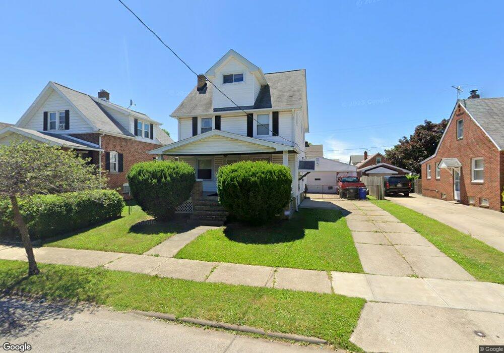
19604 Kewanee Ave Cleveland, OH 44119
North Collinwood NeighborhoodEstimated Value: $108,000 - $146,000
3
Beds
1
Bath
1,300
Sq Ft
$97/Sq Ft
Est. Value
About This Home
This home is located at 19604 Kewanee Ave, Cleveland, OH 44119 and is currently estimated at $126,503, approximately $97 per square foot. 19604 Kewanee Ave is a home located in Cuyahoga County with nearby schools including Bolton, Anton Grdina School, and Adlai Stevenson School.
Ownership History
Date
Name
Owned For
Owner Type
Purchase Details
Closed on
Jan 26, 2007
Sold by
Easton Tina M
Bought by
Easton Jon C
Current Estimated Value
Purchase Details
Closed on
Apr 11, 1990
Sold by
John E Sanders
Bought by
Easton Jon C
Purchase Details
Closed on
Mar 23, 1982
Sold by
Sanders John E
Bought by
John E Sanders
Purchase Details
Closed on
Mar 14, 1977
Sold by
Skora Ralph H
Bought by
Sanders John E
Purchase Details
Closed on
Sep 17, 1975
Sold by
Skora Ralph H and Skora Joyce M
Bought by
Skora Ralph H
Purchase Details
Closed on
Jan 1, 1975
Bought by
Skora Ralph H and Skora Joyce M
Create a Home Valuation Report for This Property
The Home Valuation Report is an in-depth analysis detailing your home's value as well as a comparison with similar homes in the area
Home Values in the Area
Average Home Value in this Area
Purchase History
| Date | Buyer | Sale Price | Title Company |
|---|---|---|---|
| Easton Jon C | $20,000 | None Available | |
| Easton Jon C | $55,900 | -- | |
| John E Sanders | -- | -- | |
| Sanders John E | $28,900 | -- | |
| Skora Ralph H | -- | -- | |
| Skora Ralph H | -- | -- |
Source: Public Records
Tax History Compared to Growth
Tax History
| Year | Tax Paid | Tax Assessment Tax Assessment Total Assessment is a certain percentage of the fair market value that is determined by local assessors to be the total taxable value of land and additions on the property. | Land | Improvement |
|---|---|---|---|---|
| 2024 | $2,635 | $40,180 | $6,195 | $33,985 |
| 2023 | $1,471 | $19,390 | $4,550 | $14,840 |
| 2022 | $1,462 | $19,390 | $4,550 | $14,840 |
| 2021 | $1,448 | $19,390 | $4,550 | $14,840 |
| 2020 | $1,469 | $17,010 | $3,990 | $13,020 |
| 2019 | $1,358 | $48,600 | $11,400 | $37,200 |
| 2018 | $1,354 | $17,010 | $3,990 | $13,020 |
| 2017 | $1,623 | $19,680 | $2,910 | $16,770 |
| 2016 | $1,610 | $19,680 | $2,910 | $16,770 |
| 2015 | $1,443 | $19,680 | $2,910 | $16,770 |
| 2014 | $1,443 | $17,570 | $2,590 | $14,980 |
Source: Public Records
Map
Nearby Homes
- 19409 Cherokee Ave
- 19511 Muskoka Ave
- 19716 Mohawk Ave
- 18707 Shawnee Ave
- 19702 Pawnee Ave
- 18606 Cherokee Ave
- 19901 Pawnee Ave
- 18806 Mohawk Ave
- 19326 Tyronne Ave
- 18715 Mohawk Ave
- 20430 Miller Ave
- 18404 Neff Rd
- 560 E 200th St
- 18111 Marcella Rd
- 901 E 210th St
- 21070 N Vine Ave
- 19450 Naumann Ave
- 983 E 179th St
- 950 E 216th St
- 18225 Landseer Rd
- 19512 Kewanee Ave
- 19606 Kewanee Ave
- 19610 Kewanee Ave
- 19508 Kewanee Ave
- 19523 Shawnee Ave
- 19519 Shawnee Ave
- 19603 Shawnee Ave
- 19517 Shawnee Ave
- 19607 Shawnee Ave
- 19517 Kewanee Ave
- 19502 Kewanee Ave
- 19614 Kewanee Ave
- 19513 Kewanee Ave
- 19605 Kewanee Ave
- 19507 Shawnee Ave
- 19509 Kewanee Ave
- 19613 Shawnee Ave
- 19505 Kewanee Ave
- 19420 Kewanee Ave
- 19615 Kewanee Ave