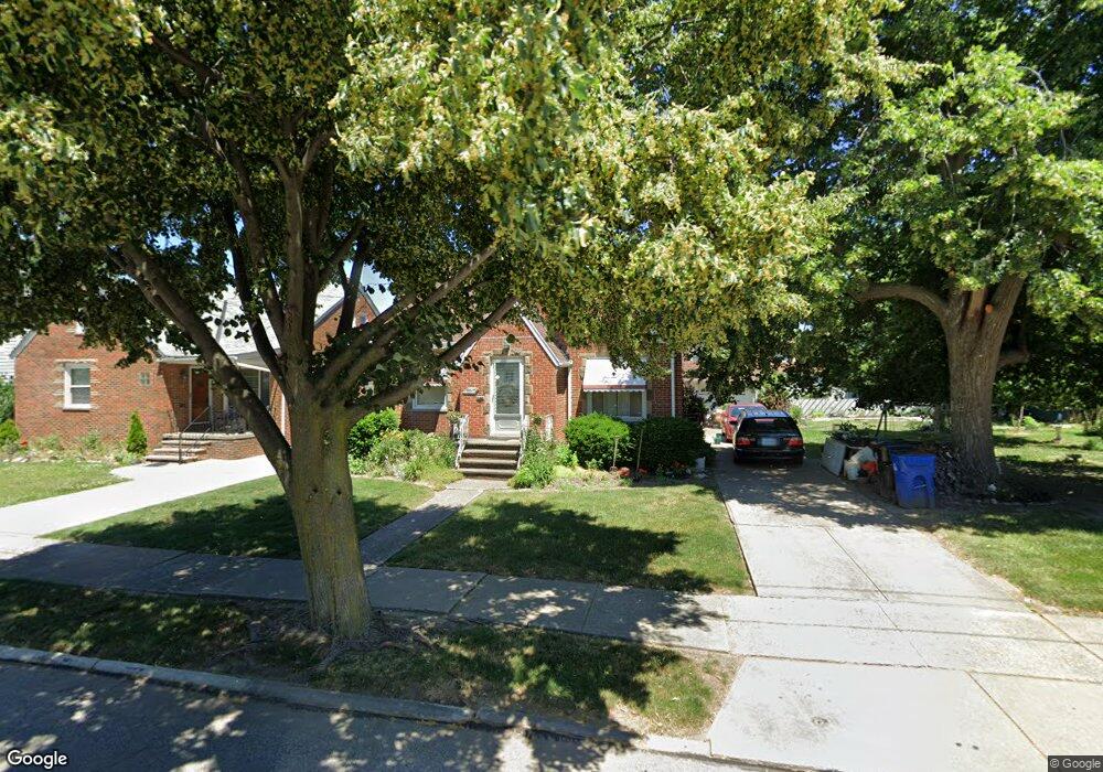
19605 Kewanee Ave Cleveland, OH 44119
North Collinwood NeighborhoodEstimated Value: $131,470 - $161,000
4
Beds
1
Bath
1,477
Sq Ft
$99/Sq Ft
Est. Value
About This Home
This home is located at 19605 Kewanee Ave, Cleveland, OH 44119 and is currently estimated at $146,118, approximately $98 per square foot. 19605 Kewanee Ave is a home located in Cuyahoga County with nearby schools including Bolton, Anton Grdina School, and Adlai Stevenson School.
Ownership History
Date
Name
Owned For
Owner Type
Purchase Details
Closed on
Jan 28, 2015
Sold by
Westmeyer Richard H and Westmeyer Alys L
Bought by
Westmeyer Linda C
Current Estimated Value
Purchase Details
Closed on
Aug 27, 2007
Sold by
Rotter Josephine
Bought by
Westmeyer Richard H and Westmeyer Alys L
Purchase Details
Closed on
Mar 28, 1980
Sold by
Rotter Stanley and Rotter Josephine
Bought by
Rotter Stanley C
Purchase Details
Closed on
Jan 1, 1975
Bought by
Rotter Stanley and Rotter Josephine
Create a Home Valuation Report for This Property
The Home Valuation Report is an in-depth analysis detailing your home's value as well as a comparison with similar homes in the area
Home Values in the Area
Average Home Value in this Area
Purchase History
| Date | Buyer | Sale Price | Title Company |
|---|---|---|---|
| Westmeyer Linda C | -- | Attorney | |
| Westmeyer Richard H | $115,000 | Realty Title Agency | |
| Rotter Stanley C | -- | -- | |
| Rotter Stanley | -- | -- |
Source: Public Records
Tax History Compared to Growth
Tax History
| Year | Tax Paid | Tax Assessment Tax Assessment Total Assessment is a certain percentage of the fair market value that is determined by local assessors to be the total taxable value of land and additions on the property. | Land | Improvement |
|---|---|---|---|---|
| 2024 | $3,052 | $45,640 | $6,195 | $39,445 |
| 2023 | $1,753 | $22,610 | $4,550 | $18,060 |
| 2022 | $1,743 | $22,610 | $4,550 | $18,060 |
| 2021 | $1,727 | $22,610 | $4,550 | $18,060 |
| 2020 | $1,753 | $19,850 | $3,990 | $15,860 |
| 2019 | $1,624 | $56,700 | $11,400 | $45,300 |
| 2018 | $1,619 | $19,850 | $3,990 | $15,860 |
| 2017 | $1,690 | $19,990 | $2,910 | $17,080 |
| 2016 | $1,677 | $19,990 | $2,910 | $17,080 |
| 2015 | $747 | $19,990 | $2,910 | $17,080 |
| 2014 | $747 | $17,850 | $2,590 | $15,260 |
Source: Public Records
Map
Nearby Homes
- 19409 Cherokee Ave
- 19511 Muskoka Ave
- 19716 Mohawk Ave
- 19702 Pawnee Ave
- 18707 Shawnee Ave
- 19901 Pawnee Ave
- 18606 Cherokee Ave
- 19326 Tyronne Ave
- 18806 Mohawk Ave
- 20430 Miller Ave
- 18715 Mohawk Ave
- 560 E 200th St
- 18404 Neff Rd
- 21070 N Vine Ave
- 901 E 210th St
- 18111 Marcella Rd
- 19450 Naumann Ave
- 950 E 216th St
- 918 E 216th St
- 983 E 179th St
- 19517 Kewanee Ave
- 19513 Kewanee Ave
- 19615 Kewanee Ave
- 19608 Chickasaw Ave
- 19612 Chickasaw Ave
- 19606 Chickasaw Ave
- 19509 Kewanee Ave
- 19620 Chickasaw Ave
- 19602 Chickasaw Ave
- 19606 Kewanee Ave
- 19610 Kewanee Ave
- 19604 Kewanee Ave
- 19614 Kewanee Ave
- 19512 Kewanee Ave
- 19504 Chickasaw Ave
- 19505 Kewanee Ave
- 19703 Kewanee Ave
- 19508 Kewanee Ave
- 19500 Chickasaw Ave
- 19419 Kewanee Ave