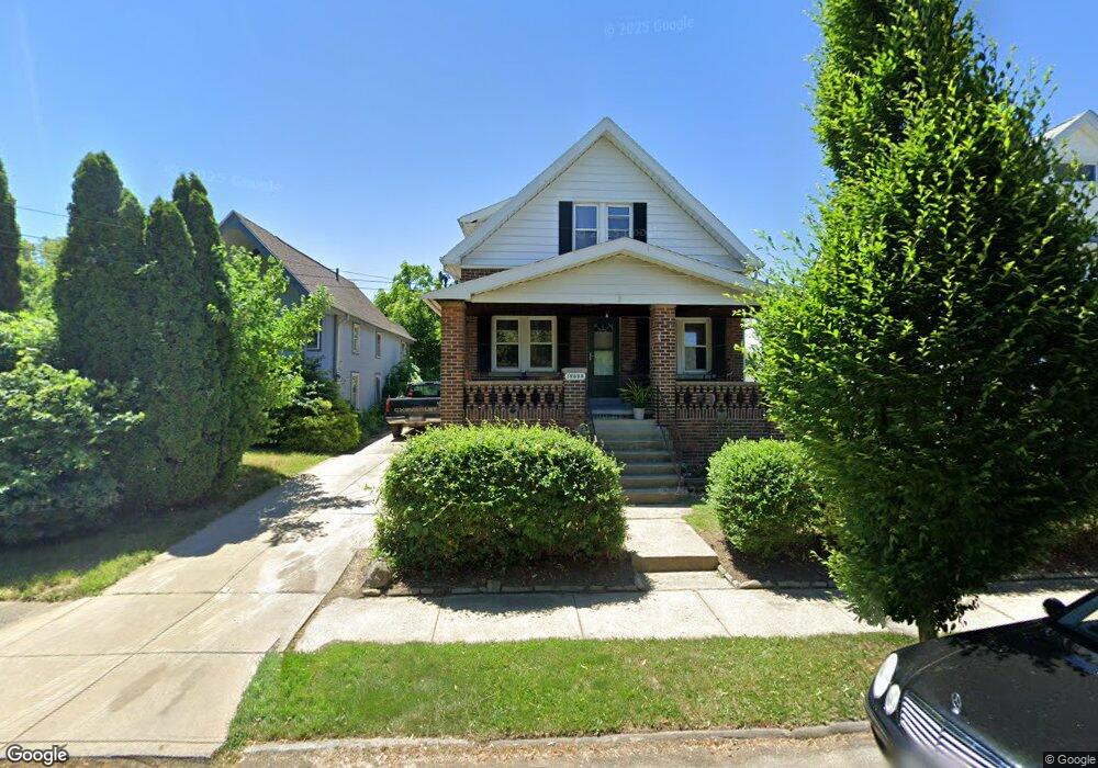
19606 Kewanee Ave Cleveland, OH 44119
North Collinwood NeighborhoodEstimated Value: $121,010 - $148,000
2
Beds
1
Bath
1,470
Sq Ft
$90/Sq Ft
Est. Value
About This Home
This home is located at 19606 Kewanee Ave, Cleveland, OH 44119 and is currently estimated at $132,003, approximately $89 per square foot. 19606 Kewanee Ave is a home located in Cuyahoga County with nearby schools including Bolton, Anton Grdina School, and Adlai Stevenson School.
Ownership History
Date
Name
Owned For
Owner Type
Purchase Details
Closed on
May 17, 2007
Sold by
Fannie Mae
Bought by
Meador Venerina
Current Estimated Value
Purchase Details
Closed on
Aug 2, 2006
Sold by
Gregory Jonathan
Bought by
Federal National Mortgage Association
Purchase Details
Closed on
Mar 4, 2003
Sold by
Robertson David C
Bought by
Gregory Jonathan
Home Financials for this Owner
Home Financials are based on the most recent Mortgage that was taken out on this home.
Original Mortgage
$92,550
Interest Rate
6.07%
Mortgage Type
New Conventional
Purchase Details
Closed on
Sep 30, 1999
Sold by
Robertson David C and Robertson Mandy A
Bought by
Robertson David C and Robertson Nancy A
Home Financials for this Owner
Home Financials are based on the most recent Mortgage that was taken out on this home.
Original Mortgage
$63,200
Interest Rate
8.21%
Purchase Details
Closed on
Sep 1, 1999
Sold by
Broccone Marc A and Broccone Cheryl L
Bought by
Robertson David C
Home Financials for this Owner
Home Financials are based on the most recent Mortgage that was taken out on this home.
Original Mortgage
$63,200
Interest Rate
8.21%
Purchase Details
Closed on
Dec 27, 1990
Sold by
Gracie William
Bought by
Broccone Marc A
Purchase Details
Closed on
Jul 31, 1989
Sold by
Beatty Linda L
Bought by
Gracie William
Purchase Details
Closed on
May 12, 1988
Bought by
Beatty Linda L
Purchase Details
Closed on
Nov 20, 1986
Sold by
Cotton Arthur L 111
Bought by
Citicorp Homeowners Inc
Purchase Details
Closed on
Dec 17, 1984
Sold by
Logarusic Ante
Bought by
Cotton Arthur L 111
Purchase Details
Closed on
Oct 28, 1977
Sold by
Bolden Thelma
Bought by
Logarusic Ante
Purchase Details
Closed on
Jul 28, 1976
Sold by
Smith Loraine
Bought by
Bolden Thelma
Purchase Details
Closed on
Jan 1, 1975
Bought by
Smith Loraine
Create a Home Valuation Report for This Property
The Home Valuation Report is an in-depth analysis detailing your home's value as well as a comparison with similar homes in the area
Home Values in the Area
Average Home Value in this Area
Purchase History
| Date | Buyer | Sale Price | Title Company |
|---|---|---|---|
| Meador Venerina | $27,000 | Phoenix Title Agency | |
| Federal National Mortgage Association | $61,334 | Attorney | |
| Gregory Jonathan | $92,600 | -- | |
| Robertson David C | -- | -- | |
| Robertson David C | $65,800 | Conway Land Title Company | |
| Broccone Marc A | $43,900 | -- | |
| Gracie William | -- | -- | |
| Gracie William | -- | -- | |
| Beatty Linda L | $43,000 | -- | |
| Citicorp Homeowners Inc | -- | -- | |
| Cotton Arthur L 111 | $49,500 | -- | |
| Logarusic Ante | $31,000 | -- | |
| Bolden Thelma | $17,500 | -- | |
| Smith Loraine | -- | -- |
Source: Public Records
Mortgage History
| Date | Status | Borrower | Loan Amount |
|---|---|---|---|
| Previous Owner | Gregory Jonathan | $92,550 | |
| Previous Owner | Robertson David C | $63,200 |
Source: Public Records
Tax History Compared to Growth
Tax History
| Year | Tax Paid | Tax Assessment Tax Assessment Total Assessment is a certain percentage of the fair market value that is determined by local assessors to be the total taxable value of land and additions on the property. | Land | Improvement |
|---|---|---|---|---|
| 2024 | $2,921 | $43,680 | $6,195 | $37,485 |
| 2023 | $1,964 | $25,340 | $4,550 | $20,790 |
| 2022 | $1,953 | $25,340 | $4,550 | $20,790 |
| 2021 | $1,935 | $25,340 | $4,550 | $20,790 |
| 2020 | $1,964 | $22,230 | $3,990 | $18,240 |
| 2019 | $1,819 | $63,500 | $11,400 | $52,100 |
| 2018 | $1,813 | $22,230 | $3,990 | $18,240 |
| 2017 | $1,264 | $14,950 | $2,910 | $12,040 |
| 2016 | $1,254 | $14,950 | $2,910 | $12,040 |
| 2015 | $1,254 | $14,950 | $2,910 | $12,040 |
| 2014 | $1,124 | $13,340 | $2,590 | $10,750 |
Source: Public Records
Map
Nearby Homes
- 19409 Cherokee Ave
- 19511 Muskoka Ave
- 19716 Mohawk Ave
- 19702 Pawnee Ave
- 18707 Shawnee Ave
- 19901 Pawnee Ave
- 18606 Cherokee Ave
- 19326 Tyronne Ave
- 20430 Miller Ave
- 18806 Mohawk Ave
- 18715 Mohawk Ave
- 18404 Neff Rd
- 560 E 200th St
- 901 E 210th St
- 21070 N Vine Ave
- 18111 Marcella Rd
- 19450 Naumann Ave
- 950 E 216th St
- 918 E 216th St
- 983 E 179th St
- 19610 Kewanee Ave
- 19604 Kewanee Ave
- 19614 Kewanee Ave
- 19512 Kewanee Ave
- 19603 Shawnee Ave
- 19607 Shawnee Ave
- 19523 Shawnee Ave
- 19519 Shawnee Ave
- 19613 Shawnee Ave
- 19605 Kewanee Ave
- 19508 Kewanee Ave
- 19517 Kewanee Ave
- 19517 Shawnee Ave
- 19513 Kewanee Ave
- 19615 Kewanee Ave
- 19509 Kewanee Ave
- 19702 Kewanee Ave
- 19502 Kewanee Ave
- 19507 Shawnee Ave
- 19701 Shawnee Ave