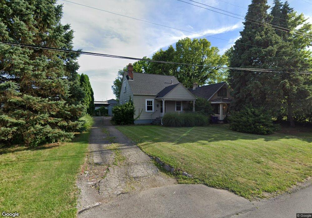
1961 Bryden Rd Columbus, OH 43205
Franklin Park NeighborhoodEstimated Value: $143,000 - $158,540
3
Beds
1
Bath
1,154
Sq Ft
$131/Sq Ft
Est. Value
About This Home
This home is located at 1961 Bryden Rd, Columbus, OH 43205 and is currently estimated at $151,385, approximately $131 per square foot. 1961 Bryden Rd is a home located in Franklin County with nearby schools including Ohio Avenue Elementary School, Champion Middle School, and East High School.
Ownership History
Date
Name
Owned For
Owner Type
Purchase Details
Closed on
Aug 3, 2012
Sold by
Saez George W
Bought by
F K Sheridan Llc
Current Estimated Value
Purchase Details
Closed on
Jul 2, 1991
Bought by
Saez George W
Purchase Details
Closed on
Feb 4, 1991
Bought by
Columbus Housing
Purchase Details
Closed on
Jul 12, 1990
Bought by
Tyree Dora B
Create a Home Valuation Report for This Property
The Home Valuation Report is an in-depth analysis detailing your home's value as well as a comparison with similar homes in the area
Home Values in the Area
Average Home Value in this Area
Purchase History
We collect this data history from publicly available records. To have your information removed, we recommend requesting removal directly through your county’s website.
| Date | Buyer | Sale Price | Title Company |
|---|---|---|---|
| F K Sheridan Llc | $10,500 | -- | |
| Saez George W | $36,000 | -- | |
| Columbus Housing | $24,000 | -- | |
| Tyree Dora B | -- | -- |
Source: Public Records
Tax History
| Year | Tax Paid | Tax Assessment Tax Assessment Total Assessment is a certain percentage of the fair market value that is determined by local assessors to be the total taxable value of land and additions on the property. | Land | Improvement |
|---|---|---|---|---|
| 2025 | $1,856 | $40,500 | $16,660 | $23,840 |
| 2024 | $1,856 | $40,500 | $16,660 | $23,840 |
| 2023 | $1,833 | $40,495 | $16,660 | $23,835 |
| 2022 | $824 | $15,510 | $1,300 | $14,210 |
| 2021 | $826 | $15,510 | $1,300 | $14,210 |
| 2020 | $827 | $15,510 | $1,300 | $14,210 |
| 2019 | $806 | $12,960 | $1,090 | $11,870 |
| 2018 | $402 | $12,960 | $1,090 | $11,870 |
| 2017 | $806 | $12,960 | $1,090 | $11,870 |
| 2016 | $461 | $6,790 | $1,820 | $4,970 |
| 2015 | $210 | $6,790 | $1,820 | $4,970 |
| 2014 | $421 | $6,790 | $1,820 | $4,970 |
| 2013 | $232 | $7,140 | $1,925 | $5,215 |
Source: Public Records
Map
Nearby Homes
- 379 Westland Ave
- 1847 Oak St
- 1786-1788 E Rich St
- 1815 Franklin Park S
- 378-380 Stoddart Ave
- 1770-1772 Oak St
- 572 Bulen Ave
- 1703 Bryden Rd
- 1707 E Main St Unit 1705
- 423 Stoddart Ave
- 1667-1671 Bryden Rd
- 1710 Oak St
- 403 Morrison Ave
- 409-411 Morrison Ave
- 415-417 Morrison Ave
- 1812-1814 Cole St
- 336 S Columbia Ave
- 544 Seymour Ave
- 1635 Franklin Ave
- 377 Berkeley Rd
- 0 Bryden Rd
- 1955 Bryden Rd
- 1954 E Walnut St
- 352 S Nelson Rd
- 1999 Bryden Rd
- 419 Holtzman Ave
- 0 S Nelson Rd
- 470 S Nelson Rd
- 309 S Nelson Rd Unit 361
- 404 Rhoads Ave Unit 406
- 410 Rhoads Ave Unit 412
- 1899 Bryden Rd
- 414-416 Rhoads Ave
- 414 Rhoads Ave Unit 416
- 392 Rhoads Ave
- 420 Rhoads Ave Unit 422
- 420-422 Rhoads Ave
- 1884-1888 E Rich St
- 1884 E Rich St
- 1884 E Rich St Unit B
Your Personal Tour Guide
Ask me questions while you tour the home.