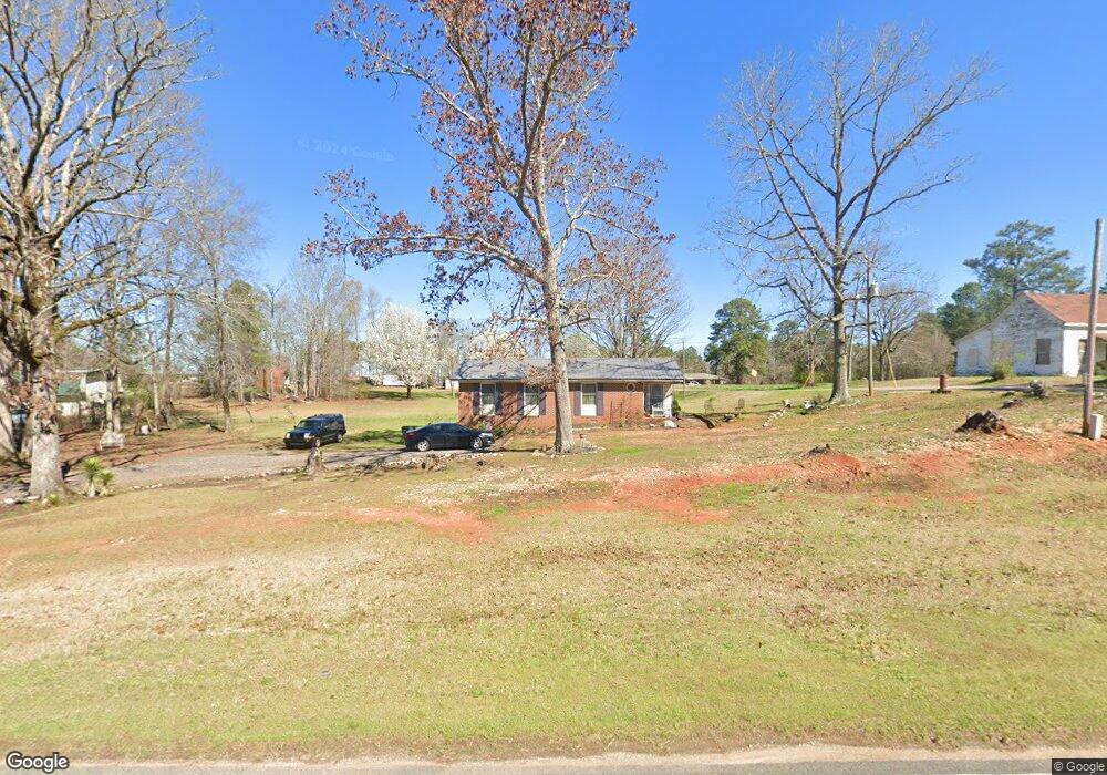
1961 Maxim Rd Lincolnton, GA 30817
Estimated Value: $160,000 - $271,000
3
Beds
1
Bath
1,380
Sq Ft
$156/Sq Ft
Est. Value
About This Home
This home is located at 1961 Maxim Rd, Lincolnton, GA 30817 and is currently estimated at $215,073, approximately $155 per square foot. 1961 Maxim Rd is a home located in Lincoln County with nearby schools including Lincoln County Elementary School, Lincoln County Middle School, and Lincoln County High School.
Ownership History
Date
Name
Owned For
Owner Type
Purchase Details
Closed on
Jul 21, 2003
Sold by
Leverett Rosa B
Bought by
Leverett Sherrie
Current Estimated Value
Purchase Details
Closed on
Nov 24, 1997
Sold by
Leverett Rosa
Bought by
Leverett Rosa B and Leverett Sherrie
Purchase Details
Closed on
Mar 16, 1977
Sold by
Secretary Of Urban Housing
Bought by
Leverett James M and Leverett Rosa B
Purchase Details
Closed on
Nov 8, 1974
Bought by
Secretary Of Urban Housing
Create a Home Valuation Report for This Property
The Home Valuation Report is an in-depth analysis detailing your home's value as well as a comparison with similar homes in the area
Home Values in the Area
Average Home Value in this Area
Purchase History
| Date | Buyer | Sale Price | Title Company |
|---|---|---|---|
| Leverett Sherrie | -- | -- | |
| Leverett Rosa B | -- | -- | |
| Leverett James M | -- | -- | |
| Secretary Of Urban Housing | -- | -- |
Source: Public Records
Tax History Compared to Growth
Tax History
| Year | Tax Paid | Tax Assessment Tax Assessment Total Assessment is a certain percentage of the fair market value that is determined by local assessors to be the total taxable value of land and additions on the property. | Land | Improvement |
|---|---|---|---|---|
| 2025 | $1,193 | $39,620 | $1,200 | $38,420 |
| 2024 | $1,135 | $36,460 | $1,200 | $35,260 |
| 2023 | $841 | $31,972 | $1,200 | $30,772 |
| 2022 | $941 | $30,692 | $1,200 | $29,492 |
| 2021 | $940 | $27,960 | $1,200 | $26,760 |
| 2020 | $805 | $20,080 | $1,200 | $18,880 |
| 2019 | $807 | $20,080 | $1,200 | $18,880 |
| 2018 | $631 | $20,080 | $1,200 | $18,880 |
| 2017 | $641 | $20,384 | $1,200 | $19,184 |
| 2016 | $756 | $20,384 | $1,200 | $19,184 |
| 2015 | -- | $20,384 | $1,200 | $19,184 |
| 2014 | -- | $20,384 | $1,200 | $19,184 |
| 2013 | -- | $20,384 | $1,200 | $19,184 |
Source: Public Records
Map
Nearby Homes
- 1016 Hidden Lake Ct
- 1051 Lake Dr
- 1085 Lake Dr
- 1080 Serenity Pointe Dr
- 1-3 Long Cove Dr
- 6-3 Long Cove Dr
- 8-3 Long Cove Dr
- 5-3 Long Cove Dr
- 4-3 Long Cove Dr
- 3-3 Long Cove Dr
- 2-3 Long Cove Dr
- 1179 Lakeside Dr
- 7-3 Long Cove
- 9-3 Long Cove
- 1129 Lakeside Dr
- 1164 Sally Ann Ct
- 1036 Longleaf Way
- 1063 Fleming Lk Ct
- 1063 Fleming Lake Ct
- 00 Chamberlain S Ferry Rd
- 1975 Maxim Rd
- 1040 Annie Kate Elam Dr
- 1954 Maxim Rd
- 1964 Maxim Rd
- 0 Maxim Rd Unit 22641418
- 0 Maxim Rd Unit 22641416
- 0 Maxim Rd Unit 250985
- 0 Maxim Rd Unit 266638
- 7.35 AC Maxim Rd
- 0 Maxim Rd Unit 432425
- 0 Maxim Rd Unit 504576
- 10942 42 Maxim Rd Unit 109.42 Ac
- 109.42Ac Maxim Rd
- 108.79Ac Maxim Rd
- 134.42Ac Maxim Rd
- 1911A Maxim Rd
- 1049 Annie Kate Elam Dr
- 1999 Maxim Rd
- 1994 Maxim Rd
- 1906 Maxim Rd