Estimated Value: $585,000 - $938,000
3
Beds
2
Baths
2,544
Sq Ft
$287/Sq Ft
Est. Value
About This Home
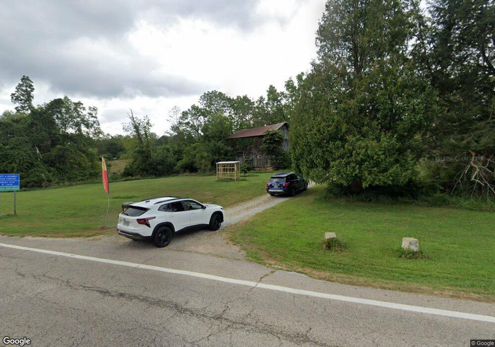
This home is located at 19615 State Route 664 S, Logan, OH 43138 and is currently estimated at $730,862, approximately $287 per square foot. 19615 State Route 664 S is a home with nearby schools including Hocking Hills Elementary School.
Ownership History
Date
Name
Owned For
Owner Type
Purchase Details
Closed on
Feb 25, 2021
Sold by
Campbell Amy S
Bought by
Lehman Berry Margaret A and Berry Ryan
Current Estimated Value
Home Financials for this Owner
Home Financials are based on the most recent Mortgage that was taken out on this home.
Original Mortgage
$351,220
Outstanding Balance
$314,844
Interest Rate
2.7%
Mortgage Type
FHA
Estimated Equity
$416,018
Purchase Details
Closed on
Nov 7, 2013
Sold by
Campbell Amy S
Bought by
Campbell William M and Campbell Susan J
Create a Home Valuation Report for This Property
The Home Valuation Report is an in-depth analysis detailing your home's value as well as a comparison with similar homes in the area
Home Values in the Area
Average Home Value in this Area
Purchase History
| Date | Buyer | Sale Price | Title Company |
|---|---|---|---|
| Lehman Berry Margaret A | $357,700 | None Available | |
| Campbell William M | $175,000 | None Available |
Source: Public Records
Mortgage History
| Date | Status | Borrower | Loan Amount |
|---|---|---|---|
| Open | Lehman Berry Margaret A | $351,220 |
Source: Public Records
Tax History Compared to Growth
Tax History
| Year | Tax Paid | Tax Assessment Tax Assessment Total Assessment is a certain percentage of the fair market value that is determined by local assessors to be the total taxable value of land and additions on the property. | Land | Improvement |
|---|---|---|---|---|
| 2024 | $3,790 | $98,350 | $22,540 | $75,810 |
| 2023 | $3,790 | $98,350 | $22,540 | $75,810 |
| 2022 | $3,797 | $98,350 | $22,540 | $75,810 |
| 2021 | $3,029 | $73,360 | $12,880 | $60,480 |
| 2020 | $3,031 | $73,360 | $12,880 | $60,480 |
| 2019 | $3,031 | $73,360 | $12,880 | $60,480 |
| 2018 | $2,603 | $64,070 | $9,730 | $54,340 |
| 2017 | $2,556 | $64,080 | $9,740 | $54,340 |
| 2016 | $2,539 | $64,080 | $9,740 | $54,340 |
| 2015 | $2,416 | $58,760 | $9,260 | $49,500 |
| 2014 | $2,416 | $58,760 | $9,260 | $49,500 |
| 2013 | $162 | $3,920 | $3,920 | $0 |
Source: Public Records
Map
Nearby Homes
- 0 Culp Rd Unit Lot D
- 0 Culp Rd Unit Lot E 225035133
- 0 Culp Rd Unit Lot C 225022147
- 19351 Unger Rd
- 19531 Kalklosch Rd
- 19401 Linden Rd
- 0 Strong Rd
- 25873 Big Pine Rd
- 26975 Chapel Ridge Rd
- 26110 Big Pine Rd
- 18596 Harble Griffith Rd
- 18732 Griffith Rd
- 18682 Griffith Rd
- 18734 Griffith Rd
- 0 Unger Rd Unit Lot H 225036416
- 29838 Strawn Rd
- 27662 Ohio 56
- 0 Cook Rd
- 0 Hawthorne Way Unit 225040022
- 28577 Hawthorne Way
- 19565 State Route 664 S
- 19693 State Route 664 S
- 19555 State Route 664 S
- 19711 State Route 664 S
- 19555 Ohio 664
- 19506 State Route 664 S
- 19773 State Route 664 S
- 19440 State Route 664 S
- 19432 State Route 664 S
- 19432 State Route 664 S
- 19392 Ohio 664
- 20621 Cotterman Rd
- 20549 Cotterman Rd
- 19382 State Route 664 S
- 20841 Cotterman Rd
- 20000 Culp Rd
- 19209 Kalklosch Rd
- 20036 Culp Rd
- 0 Culp Rd Unit Lot D 225022148
- 0 Culp Rd Unit Lot E 225013045