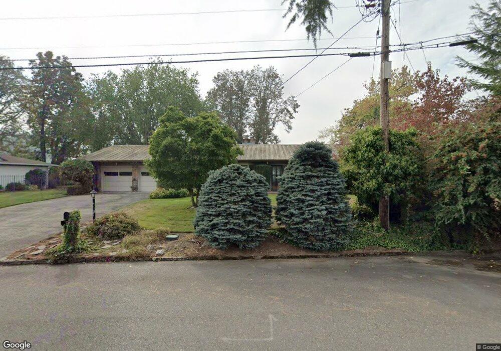
19619 SE Cottonwood St Milwaukie, OR 97267
Estimated Value: $693,000 - $976,000
3
Beds
2
Baths
2,174
Sq Ft
$368/Sq Ft
Est. Value
About This Home
This home is located at 19619 SE Cottonwood St, Milwaukie, OR 97267 and is currently estimated at $800,121, approximately $368 per square foot. 19619 SE Cottonwood St is a home located in Clackamas County with nearby schools including Jennings Lodge Elementary School, Candy Lane Elementary School, and Gardiner Middle School.
Ownership History
Date
Name
Owned For
Owner Type
Purchase Details
Closed on
Jun 3, 1999
Sold by
Weeks Thomas E and Weeks Linda M
Bought by
Otos William C and Otos Maurine B
Current Estimated Value
Home Financials for this Owner
Home Financials are based on the most recent Mortgage that was taken out on this home.
Original Mortgage
$200,000
Outstanding Balance
$50,821
Interest Rate
6.84%
Estimated Equity
$749,300
Purchase Details
Closed on
Mar 25, 1998
Sold by
Shelley Georgia M
Bought by
Weeks Thomas E and Weeks Linda M
Create a Home Valuation Report for This Property
The Home Valuation Report is an in-depth analysis detailing your home's value as well as a comparison with similar homes in the area
Home Values in the Area
Average Home Value in this Area
Purchase History
| Date | Buyer | Sale Price | Title Company |
|---|---|---|---|
| Otos William C | $295,000 | First American Title Co | |
| Weeks Thomas E | $275,000 | First American Title Ins Co |
Source: Public Records
Mortgage History
| Date | Status | Borrower | Loan Amount |
|---|---|---|---|
| Open | Otos William C | $200,000 |
Source: Public Records
Tax History Compared to Growth
Tax History
| Year | Tax Paid | Tax Assessment Tax Assessment Total Assessment is a certain percentage of the fair market value that is determined by local assessors to be the total taxable value of land and additions on the property. | Land | Improvement |
|---|---|---|---|---|
| 2025 | $10,012 | $573,471 | -- | -- |
| 2024 | $9,033 | $556,768 | -- | -- |
| 2023 | $9,033 | $540,552 | $0 | $0 |
| 2022 | $8,283 | $524,808 | $0 | $0 |
| 2021 | $7,936 | $509,523 | $0 | $0 |
| 2020 | $7,592 | $494,683 | $0 | $0 |
| 2019 | $7,467 | $480,275 | $0 | $0 |
| 2018 | $7,157 | $466,286 | $0 | $0 |
| 2017 | $6,831 | $452,705 | $0 | $0 |
| 2016 | $6,626 | $439,519 | $0 | $0 |
| 2015 | $6,276 | $426,717 | $0 | $0 |
| 2014 | $6,164 | $415,089 | $0 | $0 |
Source: Public Records
Map
Nearby Homes
- 19697 SE Cottonwood St
- 19503 SE Kay St
- 19643 SE Jay St
- 19575 River Rd Unit 53
- 19319 SE River Rd
- 18515 SE River Rd
- 4622 Mapleton Dr
- 6403 Tompkins Ct
- 2488 Tulane St
- 6345 Caufield St
- 19605 River Rd Unit 122
- 19155 Nixon Ave
- 2700 Underhill Ln Unit 1
- 1954 Buck St
- 20930 Fawn Ct Unit 26
- 2818 Treetop Ln
- 2802 Tree Top Ln
- 441 W Gloucester St
- 700 Barton Ave Unit 1
- 5910 W A St
- 19609 SE Cottonwood St
- 19641 SE Cottonwood St
- 19589 SE Cottonwood St
- 19594 SE Cottonwood St
- 19622 SE Cottonwood St
- 19583 SE Cottonwood St
- 19675 SE Cottonwood St
- 19555 SE Cottonwood St
- 19562 SE Cottonwood St
- 19674 SE Cottonwood St
- 4271 SE Manewal Ln
- 4500 SE Manewal Ln Unit LOT1
- 4500 SE Manewal Ln
- 4521 SE Meldrum Ave
- 4491 SE Meldrum Ave
- 4514 SE Meldrum Ave
- 19694 SE Cottonwood St
- 4277 SE Manewal Ln
- 0 SE Manewal Ln