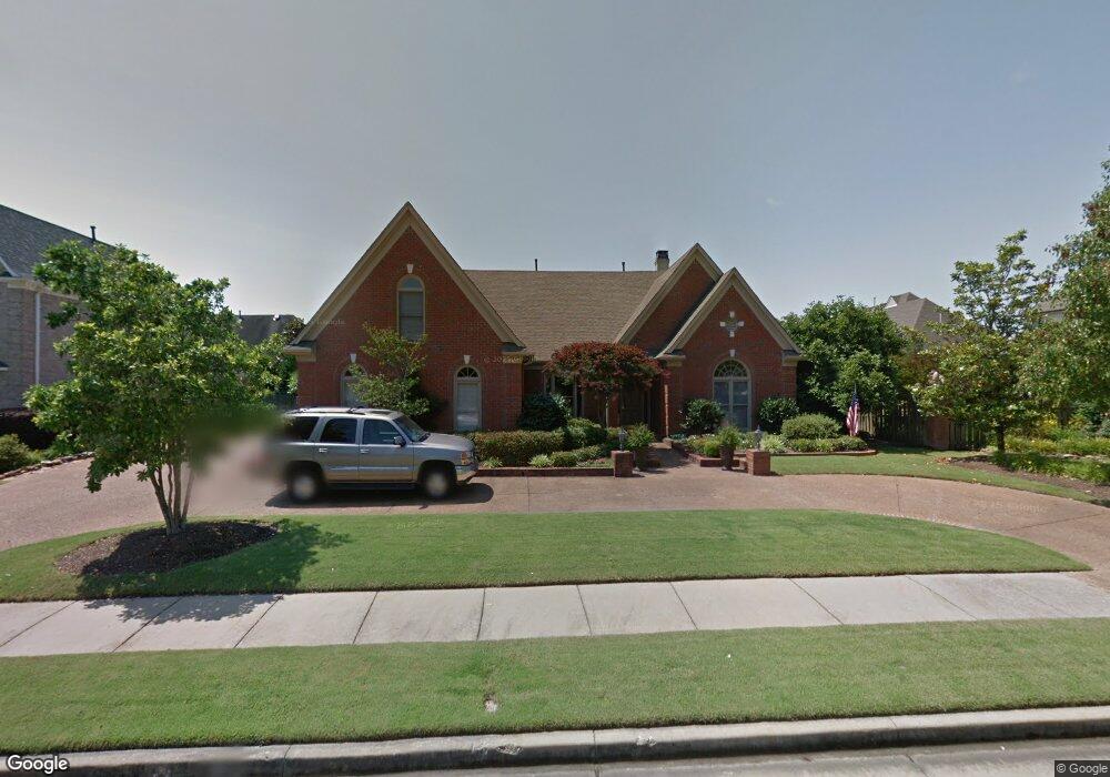
1963 Lonhill Dr Collierville, TN 38017
Estimated Value: $638,000 - $661,087
4
Beds
4
Baths
3,848
Sq Ft
$169/Sq Ft
Est. Value
About This Home
This home is located at 1963 Lonhill Dr, Collierville, TN 38017 and is currently estimated at $651,022, approximately $169 per square foot. 1963 Lonhill Dr is a home located in Shelby County with nearby schools including Bailey Station Elementary School, West Collierville Middle School, and Collierville High School.
Ownership History
Date
Name
Owned For
Owner Type
Purchase Details
Closed on
Sep 5, 2023
Sold by
Crist Steven B and Crist Terry M
Bought by
Steven B Crist And Terry M Crist Living Trust and Crist
Current Estimated Value
Purchase Details
Closed on
Jul 11, 2023
Sold by
Finney William L and Finney Jane S
Bought by
Jane Scott Finney And William Lee Finney Livi and Finney
Purchase Details
Closed on
Feb 28, 1997
Sold by
The Shrewsbury Company
Bought by
Finney William L and Finney Jane S
Home Financials for this Owner
Home Financials are based on the most recent Mortgage that was taken out on this home.
Original Mortgage
$237,856
Interest Rate
7.9%
Create a Home Valuation Report for This Property
The Home Valuation Report is an in-depth analysis detailing your home's value as well as a comparison with similar homes in the area
Home Values in the Area
Average Home Value in this Area
Purchase History
| Date | Buyer | Sale Price | Title Company |
|---|---|---|---|
| Steven B Crist And Terry M Crist Living Trust | -- | None Listed On Document | |
| Jane Scott Finney And William Lee Finney Livi | -- | None Listed On Document | |
| Finney William L | $297,321 | -- |
Source: Public Records
Mortgage History
| Date | Status | Borrower | Loan Amount |
|---|---|---|---|
| Previous Owner | Finney William L | $237,856 |
Source: Public Records
Tax History Compared to Growth
Tax History
| Year | Tax Paid | Tax Assessment Tax Assessment Total Assessment is a certain percentage of the fair market value that is determined by local assessors to be the total taxable value of land and additions on the property. | Land | Improvement |
|---|---|---|---|---|
| 2025 | $4,554 | $166,750 | $21,250 | $145,500 |
| 2024 | $4,554 | $134,325 | $21,250 | $113,075 |
| 2023 | $7,025 | $134,325 | $21,250 | $113,075 |
| 2022 | $6,864 | $134,325 | $21,250 | $113,075 |
| 2021 | $6,945 | $134,325 | $21,250 | $113,075 |
| 2020 | $6,840 | $116,325 | $21,250 | $95,075 |
| 2019 | $4,711 | $116,325 | $21,250 | $95,075 |
| 2018 | $4,711 | $116,325 | $21,250 | $95,075 |
| 2017 | $4,781 | $116,325 | $21,250 | $95,075 |
| 2016 | $4,413 | $100,975 | $0 | $0 |
| 2014 | $4,413 | $100,975 | $0 | $0 |
Source: Public Records
Map
Nearby Homes
- 1941 Lonhill Dr
- 1955 Coors Creek Dr
- 10094 Bushrod Cove
- 1893 Hartwell Manor W
- 10018 Bushrod Cove
- 1931 Katz Place
- 9940 Houston Oaks Dr
- 1911 Swynford Ln
- 1923 Swynford Ln
- 1842 Swynford Ln
- 2195 Houston Pass
- 9907 S Houston Oak Dr
- 1715 Powell Run Cove
- 9890 S Houston Way
- 9884 S Houston Oak Dr
- 10223 Poston Oak Cove
- 2167 Neshoba Nook Cir
- 10290 Shrewsbury Run W
- 2069 Standing Rock Ave
- 2087 Standing Rock Ave
- 1953 Lonhill Dr
- 1848 Greystoke Ln
- 1836 Greystoke Ln
- 1810 Dixon Place
- 1813 Dixon Place
- 1966 Lonhill Dr
- 1958 Lonhill Dr
- 1976 Lonhill Dr
- 1828 Greystoke Ln
- 1946 Lonhill Dr
- 1814 Dixon Place
- 1931 Lonhill Dr
- 1993 Lonhill Cove
- 1962 Coors Creek Dr
- 1816 Greystoke Ln
- 1965 Almadale Farms Pkwy
- 1992 Lonhill Cove
- 1955 Almadale Farms Pkwy
- 1818 Dixon Place
- 1923 Lonhill Dr