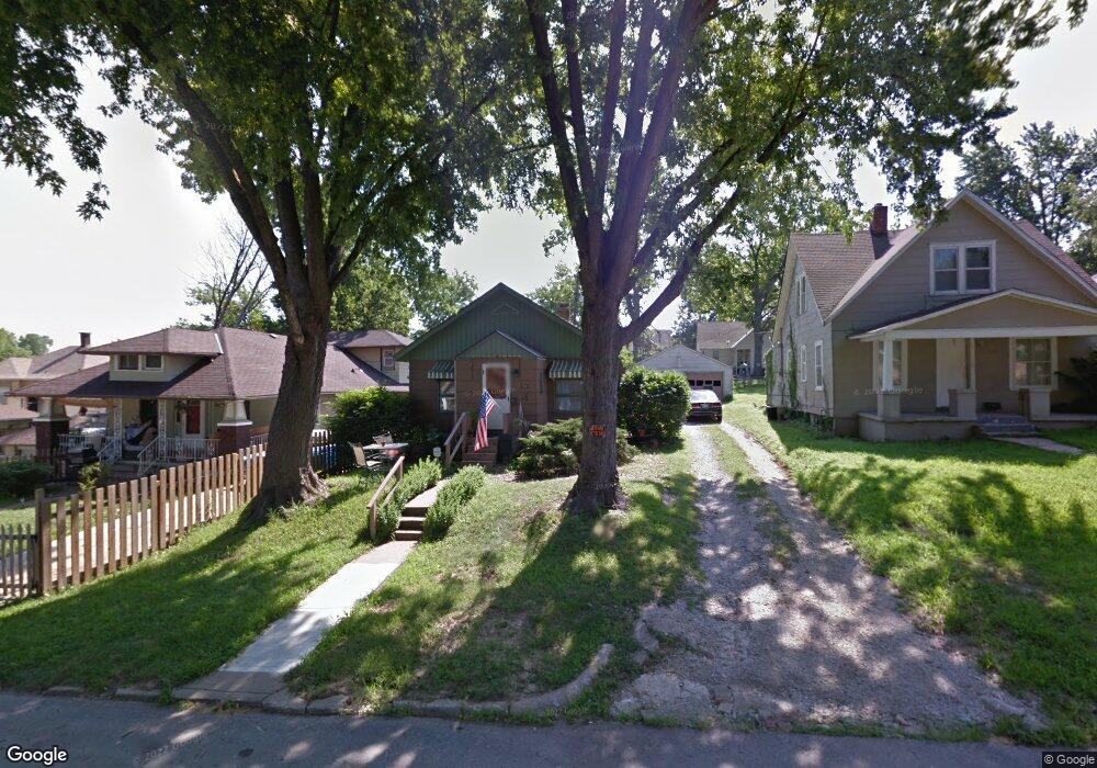
1963 N 31st St Kansas City, KS 66104
Northwest Kansas City NeighborhoodEstimated Value: $123,820 - $163,000
2
Beds
1
Bath
1,029
Sq Ft
$137/Sq Ft
Est. Value
About This Home
This home is located at 1963 N 31st St, Kansas City, KS 66104 and is currently estimated at $140,705, approximately $136 per square foot. 1963 N 31st St is a home located in Wyandotte County with nearby schools including Chelsea Elementary School, Carl B. Bruce Middle School, and Wyandotte High School.
Ownership History
Date
Name
Owned For
Owner Type
Purchase Details
Closed on
Mar 4, 2024
Sold by
Davidson Cheryl S
Bought by
Stamps Choncey Allen
Current Estimated Value
Purchase Details
Closed on
Feb 24, 2024
Sold by
Davidson Cheryl S
Bought by
Stamps Choncey Allen
Purchase Details
Closed on
Mar 20, 2017
Sold by
Davidson James R
Bought by
Davidson Cheryl S
Purchase Details
Closed on
Mar 31, 2010
Sold by
Davidson James R and Marie Davidson C
Bought by
Davidson James R
Purchase Details
Closed on
Mar 30, 2010
Sold by
Smith Spencer Lee and Smith Jerri L
Bought by
Davidson James R
Create a Home Valuation Report for This Property
The Home Valuation Report is an in-depth analysis detailing your home's value as well as a comparison with similar homes in the area
Home Values in the Area
Average Home Value in this Area
Purchase History
| Date | Buyer | Sale Price | Title Company |
|---|---|---|---|
| Stamps Choncey Allen | -- | None Listed On Document | |
| Stamps Choncey Allen | -- | None Listed On Document | |
| Davidson Cheryl S | -- | None Available | |
| Davidson James R | -- | Nations Title Agency Ks Inc | |
| Davidson James R | -- | Nations Title Agency Ks Inc |
Source: Public Records
Tax History Compared to Growth
Tax History
| Year | Tax Paid | Tax Assessment Tax Assessment Total Assessment is a certain percentage of the fair market value that is determined by local assessors to be the total taxable value of land and additions on the property. | Land | Improvement |
|---|---|---|---|---|
| 2024 | $940 | $6,946 | $1,858 | $5,088 |
| 2023 | $983 | $6,566 | $1,542 | $5,024 |
| 2022 | $835 | $5,600 | $1,206 | $4,394 |
| 2021 | $853 | $5,368 | $361 | $5,007 |
| 2020 | $703 | $4,473 | $294 | $4,179 |
| 2019 | $639 | $4,090 | $294 | $3,796 |
| 2018 | $610 | $3,933 | $399 | $3,534 |
| 2017 | $517 | $3,346 | $399 | $2,947 |
| 2016 | $364 | $2,415 | $399 | $2,016 |
| 2015 | $369 | $2,415 | $399 | $2,016 |
| 2014 | $790 | $2,322 | $429 | $1,893 |
Source: Public Records
Map
Nearby Homes
- 1943 Tennyson St
- 1969 N 30th St
- 1962 N 28th St
- 2031 N 32nd St
- 2024 N 32nd St
- 2010 N 27th St
- 2701 Parallel Ave
- 1870 N 27th St
- 2020 Brickel Blvd
- 1631 N 32nd St
- 2401 Haskell Ave
- 3618 Wood Ave
- 3701 Walker Ave
- 1972 Garfield Ave
- 2124 Lafayette Ave
- 1864 Glendale Ave
- 3723 Freeman Ave
- 1522 N 38th St
- 3414 Georgia Ave
- 3602 Rowland Ave
- 1961 N 31st St
- 1957 N 31st St
- 1957 N 31 St
- 1953 N 31st St
- 3015 Parallel Pkwy
- 1960 N 30th St
- 3017 Parallel Pkwy
- 1958 N 30th St
- 1962 N 30th St
- 3011 Parallel Pkwy
- 1954 N 30th St
- 1949 N 31st St
- 3007 Parallel Ave
- 3007 Parallel Pkwy
- 1952 N 30th St
- 1962 N 31st St
- 1960 N 31st St
- 1966 N 31st St
- 1968 N 31st St
- 1958 N 31st St