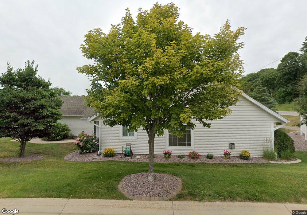
1964 Topaz Point Ln SW Rochester, MN 55902
Estimated Value: $347,000 - $372,000
2
Beds
2
Baths
1,783
Sq Ft
$201/Sq Ft
Est. Value
About This Home
This home is located at 1964 Topaz Point Ln SW, Rochester, MN 55902 and is currently estimated at $359,092, approximately $201 per square foot. 1964 Topaz Point Ln SW is a home located in Olmsted County with nearby schools including Bamber Valley Elementary School, John Adams Middle School, and Mayo Senior High School.
Ownership History
Date
Name
Owned For
Owner Type
Purchase Details
Closed on
Feb 12, 2025
Sold by
Blair Jan R
Bought by
Ronald D Schaap Revocable Living Trust and Diane L Schaap Revocable Living Trust
Current Estimated Value
Purchase Details
Closed on
Jun 12, 2024
Sold by
Blair Jan R
Bought by
Blair Jan R and Blair Scott L
Purchase Details
Closed on
Oct 14, 2013
Sold by
Sankstone Thomas I
Bought by
Blair Lewis N and Blair Jan R
Home Financials for this Owner
Home Financials are based on the most recent Mortgage that was taken out on this home.
Original Mortgage
$30,000
Interest Rate
4.38%
Mortgage Type
Credit Line Revolving
Purchase Details
Closed on
Feb 8, 2013
Sold by
Calof Stanley J and Revocable Trust Of Gloria M Ka
Bought by
Sankstone Thomas I
Create a Home Valuation Report for This Property
The Home Valuation Report is an in-depth analysis detailing your home's value as well as a comparison with similar homes in the area
Home Values in the Area
Average Home Value in this Area
Purchase History
| Date | Buyer | Sale Price | Title Company |
|---|---|---|---|
| Ronald D Schaap Revocable Living Trust | $357,500 | Legal & Title Services | |
| Blair Jan R | -- | None Listed On Document | |
| Blair Lewis N | $215,000 | None Available | |
| Sankstone Thomas I | $192,000 | None Available |
Source: Public Records
Mortgage History
| Date | Status | Borrower | Loan Amount |
|---|---|---|---|
| Previous Owner | Blair Lewis N | $426,000 | |
| Previous Owner | Blair Lewis N | $30,000 |
Source: Public Records
Tax History Compared to Growth
Tax History
| Year | Tax Paid | Tax Assessment Tax Assessment Total Assessment is a certain percentage of the fair market value that is determined by local assessors to be the total taxable value of land and additions on the property. | Land | Improvement |
|---|---|---|---|---|
| 2024 | $4,970 | $364,400 | $50,000 | $314,400 |
| 2023 | $4,504 | $361,600 | $50,000 | $311,600 |
| 2022 | $4,292 | $344,300 | $50,000 | $294,300 |
| 2021 | $4,048 | $319,300 | $50,000 | $269,300 |
| 2020 | $3,908 | $302,400 | $40,000 | $262,400 |
| 2019 | $3,816 | $282,300 | $40,000 | $242,300 |
| 2018 | $3,369 | $277,400 | $40,000 | $237,400 |
| 2017 | $3,232 | $255,800 | $26,800 | $229,000 |
| 2016 | $3,162 | $218,900 | $25,000 | $193,900 |
| 2015 | $2,998 | $209,500 | $24,800 | $184,700 |
| 2014 | $2,888 | $211,900 | $24,800 | $187,100 |
| 2012 | -- | $209,200 | $24,797 | $184,403 |
Source: Public Records
Map
Nearby Homes
- 1941 Waterford Place SW
- 1814 Mayowood Rd SW
- 1810 Mayowood Rd SW
- 3177 Glenwood Rd SW
- 3125 Glenwood Rd SW
- 2961 Glenwood Rd SW
- 2229 Ponderosa Dr SW
- 1747 Mayowood Rd SW
- 1568 Salem Ct SW
- 1911 Greenfield Ln SW Unit E
- 2114 Ponderosa Dr SW
- 2236 Ponderosa Dr SW
- 2449 Salem Heights Ln SW
- 1704 Lakeview Dr SW
- 3018 Mayowood Common Cir SW
- 2331 Ponderosa Dr SW
- 2018 Edgewood Ct SW
- 1726 Mayowood Rd SW
- 1429 20th St SW
- 1710 Mayowood Ct SW
- 1960 Topaz Point Ln SW
- 1970 Topaz Point Ln SW
- 1970 Topaz Pointe Ln SW
- 1954 Topaz Point Ln SW
- 1974 Topaz Pointe Ln SW
- 1974 Topaz Point Ln SW
- 1951 Tiffany Cove Ln SW
- 1950 Topaz Pointe Ln SW
- 1950 Topaz Point Ln SW
- 1955 Tiffany Cove Ln SW
- 1947 Tiffany Cove Ln SW
- 1944 Topaz Pointe Ln SW
- 1944 Topaz Point Ln SW
- 1940 Topaz Point Ln SW
- 1977 Topaz Pointe Ln SW
- 1977 Topaz Point Ln SW
- 1943 Tiffany Cove Ln SW
- 1920 Topaz Pointe Ln SW
- 1961 Tiffany Cove Ln SW
- 1971 Topaz Point Ln SW