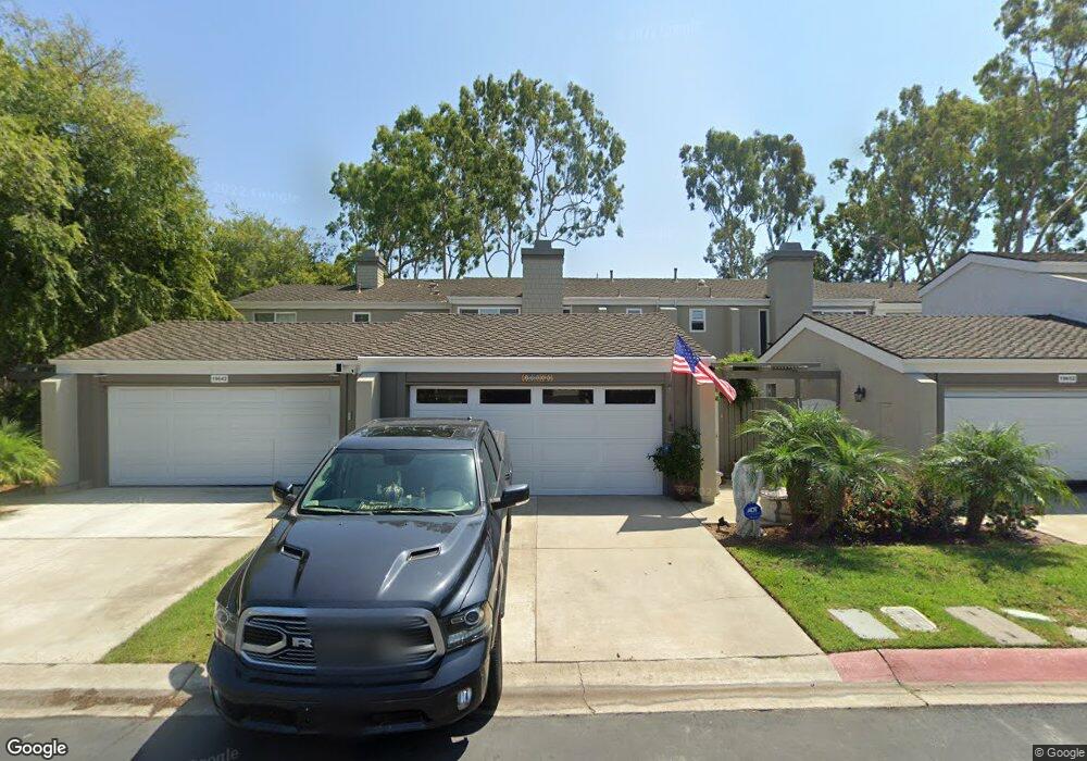
19646 Seawind Cir Huntington Beach, CA 92648
Downtown Huntington Beach NeighborhoodEstimated Value: $1,326,000 - $1,569,000
3
Beds
3
Baths
1,728
Sq Ft
$812/Sq Ft
Est. Value
About This Home
This home is located at 19646 Seawind Cir, Huntington Beach, CA 92648 and is currently estimated at $1,402,330, approximately $811 per square foot. 19646 Seawind Cir is a home located in Orange County with nearby schools including Agnes L. Smith Elementary, Ethel Dwyer Middle, and Huntington Beach High School.
Ownership History
Date
Name
Owned For
Owner Type
Purchase Details
Closed on
Nov 10, 2000
Sold by
Chmielinski John and Chmielinski Judith M
Bought by
Leysen Robert George and Karahalios Mary Jean
Current Estimated Value
Home Financials for this Owner
Home Financials are based on the most recent Mortgage that was taken out on this home.
Original Mortgage
$313,500
Outstanding Balance
$113,786
Interest Rate
7.67%
Estimated Equity
$1,288,544
Create a Home Valuation Report for This Property
The Home Valuation Report is an in-depth analysis detailing your home's value as well as a comparison with similar homes in the area
Home Values in the Area
Average Home Value in this Area
Purchase History
| Date | Buyer | Sale Price | Title Company |
|---|---|---|---|
| Leysen Robert George | $330,000 | Gateway Title Company |
Source: Public Records
Mortgage History
| Date | Status | Borrower | Loan Amount |
|---|---|---|---|
| Open | Leysen Robert George | $313,500 |
Source: Public Records
Tax History Compared to Growth
Tax History
| Year | Tax Paid | Tax Assessment Tax Assessment Total Assessment is a certain percentage of the fair market value that is determined by local assessors to be the total taxable value of land and additions on the property. | Land | Improvement |
|---|---|---|---|---|
| 2025 | $6,745 | $594,873 | $446,940 | $147,933 |
| 2024 | $6,745 | $583,209 | $438,176 | $145,033 |
| 2023 | $6,592 | $571,774 | $429,584 | $142,190 |
| 2022 | $6,418 | $560,563 | $421,161 | $139,402 |
| 2021 | $6,298 | $549,572 | $412,903 | $136,669 |
| 2020 | $6,256 | $543,937 | $408,669 | $135,268 |
| 2019 | $6,181 | $533,272 | $400,656 | $132,616 |
| 2018 | $6,022 | $517,114 | $392,800 | $124,314 |
| 2017 | $5,940 | $506,975 | $385,098 | $121,877 |
| 2016 | $5,678 | $497,035 | $377,547 | $119,488 |
| 2015 | $5,622 | $489,570 | $371,876 | $117,694 |
| 2014 | $5,504 | $479,980 | $364,591 | $115,389 |
Source: Public Records
Map
Nearby Homes
- 19731 Estate Cir
- 19748 Shorecliff Ln
- 19702 Quiet Bay Ln
- 19662 Stern Ln
- 19811 Deep Harbor Dr
- 19741 Quiet Bay Ln
- 6776 Findley Cir
- 620 22nd St
- 627 19th St
- 1824 Park St
- 521 18th St
- 19321 Manor Point Cir
- 1915 Pine St
- 1828 Pine St
- 505 17th St
- 411 22nd St
- 118 Adams Ave
- 419 18th St
- 6781 Lawn Haven Dr
- 1821 Lake St
- 19652 Seawind Cir
- 19656 Seawind Cir
- 19662 Seawind Cir
- 7132 Little Harbor Dr
- 7136 Little Harbor Dr
- 19672 Seawind Cir
- 7142 Little Harbor Dr
- 7105 Surfside Dr
- 7101 Surfside Dr
- 7095 Surfside Dr
- 7091 Surfside Dr
- 19676 Seawind Cir
- 7085 Surfside Dr
- 19681 Seacliff Ln
- 19685 Seacliff Ln
- 19682 Seawind Cir
- 7081 Surfside Dr
- 19671 Seacliff Ln
- 19691 Seacliff Ln
- 19651 Seawind Cir