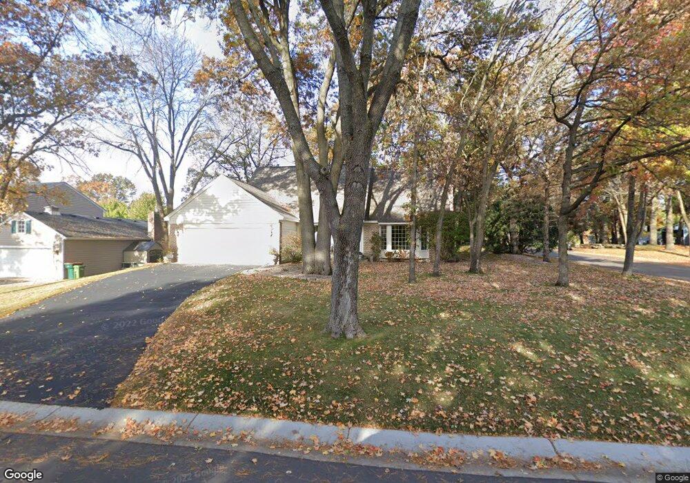
1965 128th Ave NW Coon Rapids, MN 55448
Estimated Value: $434,000 - $505,000
4
Beds
3
Baths
2,486
Sq Ft
$183/Sq Ft
Est. Value
About This Home
This home is located at 1965 128th Ave NW, Coon Rapids, MN 55448 and is currently estimated at $453,981, approximately $182 per square foot. 1965 128th Ave NW is a home located in Anoka County with nearby schools including Lucile Bruner Elementary School, Morris Bye Elementary School, and Laughlin Junior/Senior High School.
Ownership History
Date
Name
Owned For
Owner Type
Purchase Details
Closed on
Jul 23, 1999
Sold by
Koskinen John and Koskinen Collette
Bought by
Brodersen Richard A and Brodersen Linda J
Current Estimated Value
Purchase Details
Closed on
Sep 23, 1998
Sold by
Seidelmann Daniel J and Seidelmann Carolyn B
Bought by
Koskinen John D and Koskinen Collette
Create a Home Valuation Report for This Property
The Home Valuation Report is an in-depth analysis detailing your home's value as well as a comparison with similar homes in the area
Home Values in the Area
Average Home Value in this Area
Purchase History
| Date | Buyer | Sale Price | Title Company |
|---|---|---|---|
| Brodersen Richard A | $232,000 | -- | |
| Koskinen John D | $224,900 | -- |
Source: Public Records
Tax History Compared to Growth
Tax History
| Year | Tax Paid | Tax Assessment Tax Assessment Total Assessment is a certain percentage of the fair market value that is determined by local assessors to be the total taxable value of land and additions on the property. | Land | Improvement |
|---|---|---|---|---|
| 2025 | $4,862 | $449,600 | $90,000 | $359,600 |
| 2024 | $4,862 | $431,800 | $87,000 | $344,800 |
| 2023 | $4,512 | $428,100 | $72,000 | $356,100 |
| 2022 | $4,594 | $499,700 | $72,000 | $427,700 |
| 2021 | $4,197 | $388,000 | $56,000 | $332,000 |
| 2020 | $4,764 | $366,700 | $56,000 | $310,700 |
| 2019 | $4,610 | $396,000 | $56,000 | $340,000 |
| 2018 | $4,677 | $372,800 | $0 | $0 |
| 2017 | $4,398 | $365,900 | $0 | $0 |
| 2016 | $4,509 | $339,000 | $0 | $0 |
| 2015 | -- | $339,000 | $50,000 | $289,000 |
| 2014 | -- | $280,900 | $35,400 | $245,500 |
Source: Public Records
Map
Nearby Homes
- 12888 Nightingale St NW
- 1930 127th Cir NW
- 12759 Ibis St NW
- 12760 Raven St NW
- 1687 131st Ln NW
- 12554 Grouse St NW
- 2147 125th Ln NW
- 1776 133rd Ave NW
- 1520 129th Ave NW
- 1593 126th Ln NW
- 2068 124th Ln NW
- 12365 Jay St NW
- 1450 126th Ln NW
- 13416 Swallow St NW
- 12463 Drake St NW
- 13519 Partridge Cir NW
- 1234 128th Cir NW
- 13182 Zion St NW
- 2675 128th Ave NW
- 1727 121st Ln NW
- 1973 128th Ave NW
- 12864 Martin St NW
- 1981 128th Ave NW
- 1949 128th Ave NW
- 1962 128th Ave NW
- 1970 128th Ave NW
- 12853 Martin St NW
- 12819 Nightingale St NW
- 1954 128th Ave NW
- 1978 128th Ave NW
- 12878 Martin St NW
- 12881 Martin St NW
- 12833 Nightingale St NW
- 1986 128th Ave NW
- 1946 128th Ave NW
- 1941 128th Ave NW
- 12892 Martin St NW
- 12909 Martin St NW
- 12847 Nightingale St NW
- 2005 128th Ave NW