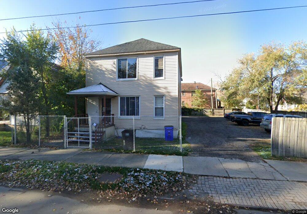
1965 Clark St Detroit, MI 48209
Southwest Detroit NeighborhoodEstimated Value: $216,000 - $289,000
8
Beds
4
Baths
3,060
Sq Ft
$78/Sq Ft
Est. Value
About This Home
This home is located at 1965 Clark St, Detroit, MI 48209 and is currently estimated at $239,859, approximately $78 per square foot. 1965 Clark St is a home located in Wayne County with nearby schools including Maybury Elementary School, Charles L. Spain Elementary-Middle School, and Edward 'Duke' Ellington Conservatory of Music and Art.
Ownership History
Date
Name
Owned For
Owner Type
Purchase Details
Closed on
May 12, 2014
Sold by
Dearborn Investments Fund Llc
Bought by
Contreras Silvia and Gutierrez Ricardo
Current Estimated Value
Purchase Details
Closed on
Mar 1, 2011
Sold by
Dearborn Investment Fund Llc
Bought by
Contreras Sylvia
Purchase Details
Closed on
Dec 3, 2009
Sold by
Garza Julio and Garza Patricia
Bought by
Credit Union One
Create a Home Valuation Report for This Property
The Home Valuation Report is an in-depth analysis detailing your home's value as well as a comparison with similar homes in the area
Home Values in the Area
Average Home Value in this Area
Purchase History
| Date | Buyer | Sale Price | Title Company |
|---|---|---|---|
| Contreras Silvia | $35,000 | None Available | |
| Contreras Sylvia | -- | None Available | |
| Credit Union One | $96,762 | None Available |
Source: Public Records
Tax History Compared to Growth
Tax History
| Year | Tax Paid | Tax Assessment Tax Assessment Total Assessment is a certain percentage of the fair market value that is determined by local assessors to be the total taxable value of land and additions on the property. | Land | Improvement |
|---|---|---|---|---|
| 2025 | $1,765 | $85,700 | $0 | $0 |
| 2024 | $1,765 | $71,600 | $0 | $0 |
| 2023 | $1,714 | $55,100 | $0 | $0 |
| 2022 | $1,834 | $44,100 | $0 | $0 |
| 2021 | $1,781 | $31,500 | $0 | $0 |
| 2020 | $1,853 | $36,200 | $0 | $0 |
| 2019 | $1,852 | $27,900 | $0 | $0 |
| 2018 | $1,625 | $21,900 | $0 | $0 |
| 2017 | $310 | $19,500 | $0 | $0 |
| 2016 | $1,781 | $39,000 | $0 | $0 |
| 2015 | $1,710 | $17,100 | $0 | $0 |
| 2013 | $1,769 | $18,902 | $0 | $0 |
| 2010 | -- | $19,115 | $394 | $18,721 |
Source: Public Records
Map
Nearby Homes
- 1028 Lansing St
- 1401 Mc Kinstry St
- 1937 Morrell St
- 1620 Morrell St
- 1408 Lansing St
- 735 Hubbard St
- 2012 Hubbard St
- 1965 Vinewood St
- 5627 Brandon St
- 1206 Lansing St
- 3644 Bagley St
- 5839 Mcmillan St
- 1502 Campbell St
- 1551 Campbell St Unit 1553 campbell
- 5854 Romeyn St
- 1253 Junction Ave
- 1547 25th St
- 3553 Bagley St
- 346 W Grand Blvd
- 1021 Hubbard St