Estimated Value: $147,000 - $183,000
3
Beds
1
Bath
1,113
Sq Ft
$153/Sq Ft
Est. Value
About This Home
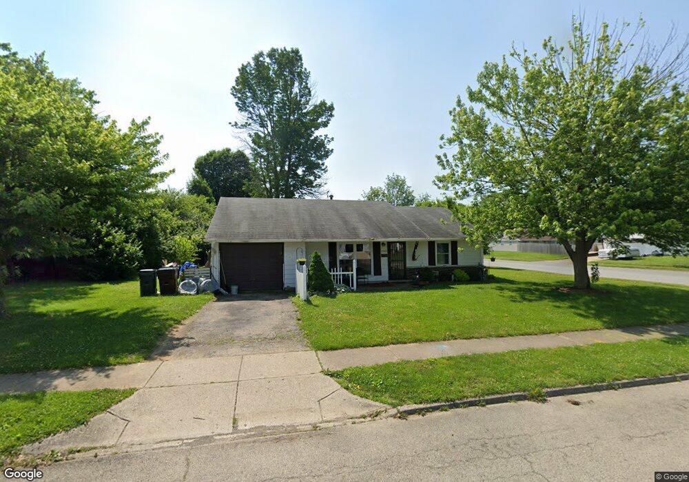
This home is located at 1965 Commonwealth Dr, Xenia, OH 45385 and is currently estimated at $170,341, approximately $153 per square foot. 1965 Commonwealth Dr is a home located in Greene County with nearby schools including Xenia High School, Summit Academy Community School for Alternative Learners - Xenia, and Legacy Christian Academy.
Ownership History
Date
Name
Owned For
Owner Type
Purchase Details
Closed on
May 28, 2020
Sold by
Caudill Henry and Caudill Pamela S
Bought by
Caudill Henry and Caudill Pamela S
Current Estimated Value
Purchase Details
Closed on
Oct 6, 2006
Sold by
Citifinancial Inc
Bought by
Caudill Henry F
Purchase Details
Closed on
Jul 27, 2006
Sold by
Gore William D
Bought by
Citifinancial Inc
Purchase Details
Closed on
Jul 17, 2006
Sold by
Gore William D
Bought by
Citifinancial Inc
Purchase Details
Closed on
Sep 4, 2002
Sold by
Logan Jennifer L
Bought by
Gore William D
Create a Home Valuation Report for This Property
The Home Valuation Report is an in-depth analysis detailing your home's value as well as a comparison with similar homes in the area
Home Values in the Area
Average Home Value in this Area
Purchase History
| Date | Buyer | Sale Price | Title Company |
|---|---|---|---|
| Caudill Henry | -- | None Available | |
| Caudill Henry F | $55,000 | Chicago Title Ins Co | |
| Citifinancial Inc | $50,000 | None Available | |
| Citifinancial Inc | $50,000 | None Available | |
| Gore William D | -- | -- |
Source: Public Records
Tax History Compared to Growth
Tax History
| Year | Tax Paid | Tax Assessment Tax Assessment Total Assessment is a certain percentage of the fair market value that is determined by local assessors to be the total taxable value of land and additions on the property. | Land | Improvement |
|---|---|---|---|---|
| 2024 | $1,890 | $44,170 | $11,920 | $32,250 |
| 2023 | $1,890 | $44,170 | $11,920 | $32,250 |
| 2022 | $1,558 | $31,060 | $7,010 | $24,050 |
| 2021 | $1,579 | $31,060 | $7,010 | $24,050 |
| 2020 | $1,513 | $31,060 | $7,010 | $24,050 |
| 2019 | $1,207 | $23,320 | $6,870 | $16,450 |
| 2018 | $1,211 | $23,320 | $6,870 | $16,450 |
| 2017 | $1,100 | $23,320 | $6,870 | $16,450 |
| 2016 | $1,101 | $20,790 | $6,870 | $13,920 |
| 2015 | $1,104 | $20,790 | $6,870 | $13,920 |
| 2014 | $1,057 | $20,790 | $6,870 | $13,920 |
Source: Public Records
Map
Nearby Homes
- 1866 Roxbury Dr
- 1255 Colorado Dr
- 1908 Whitt St
- 1107 Arkansas Dr
- 1403 Texas Dr
- 1829 Gayhart Dr
- 1769 Gayhart Dr
- 2499 Jenny Marie Dr
- 1778 Arapaho Dr
- 2540 Jenny Marie Dr
- 2421 Louisiana Dr
- 2540 Cornwall Dr
- 2345 Tennessee Dr
- 0 Berkshire Dr Unit 942854
- 2257 Maryland Dr
- 910 Wright Ave
- 1272 Bellbrook Ave
- 2144 Tandem Dr
- 1653 Seneca Dr
- 1618 Navajo Dr
- 2070 Wimbledon Dr
- 1951 Commonwealth Dr
- 2060 Wimbledon Dr
- 1972 Crase Dr
- 1937 Commonwealth Dr
- 2001 Commonwealth Dr
- 1970 Commonwealth Dr
- 1986 Commonwealth Dr
- 2000 Drummond Dr
- 2048 Wimbledon Dr
- 1973 Crase Dr
- 1923 Commonwealth Dr
- 2015 Commonwealth Dr
- 2000 Commonwealth Dr
- 1952 Crase Dr
- 2014 Drummond Dr
- 1955 Roxbury Dr
- 2034 Wimbledon St
- 2034 Wimbledon Dr
- 1916 Commonwealth Dr