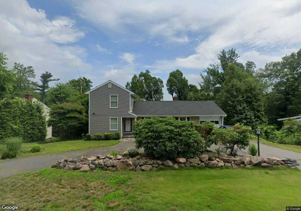
1965 Shepard Ave Hamden, CT 06518
Estimated Value: $458,227 - $553,000
3
Beds
3
Baths
1,844
Sq Ft
$263/Sq Ft
Est. Value
About This Home
This home is located at 1965 Shepard Ave, Hamden, CT 06518 and is currently estimated at $484,307, approximately $262 per square foot. 1965 Shepard Ave is a home located in New Haven County with nearby schools including Hamden Middle School, Hamden High School, and Laurel Oaks Adventist School.
Ownership History
Date
Name
Owned For
Owner Type
Purchase Details
Closed on
Jun 24, 1999
Sold by
Digiro Linda
Bought by
Foery Raymond A and Foery Jan E
Current Estimated Value
Home Financials for this Owner
Home Financials are based on the most recent Mortgage that was taken out on this home.
Original Mortgage
$124,000
Outstanding Balance
$32,172
Interest Rate
7.09%
Estimated Equity
$452,135
Purchase Details
Closed on
Oct 22, 1980
Bought by
Azurin Bernardo G and Azurin Josephine G
Create a Home Valuation Report for This Property
The Home Valuation Report is an in-depth analysis detailing your home's value as well as a comparison with similar homes in the area
Home Values in the Area
Average Home Value in this Area
Purchase History
| Date | Buyer | Sale Price | Title Company |
|---|---|---|---|
| Foery Raymond A | $155,000 | -- | |
| Azurin Bernardo G | -- | -- |
Source: Public Records
Mortgage History
| Date | Status | Borrower | Loan Amount |
|---|---|---|---|
| Open | Azurin Bernardo G | $124,000 | |
| Previous Owner | Azurin Bernardo G | $35,000 | |
| Previous Owner | Azurin Bernardo G | $75,000 |
Source: Public Records
Tax History
| Year | Tax Paid | Tax Assessment Tax Assessment Total Assessment is a certain percentage of the fair market value that is determined by local assessors to be the total taxable value of land and additions on the property. | Land | Improvement |
|---|---|---|---|---|
| 2025 | $17,207 | $331,660 | $60,550 | $271,110 |
| 2024 | $10,277 | $184,800 | $42,420 | $142,380 |
| 2023 | $6,370 | $112,980 | $42,420 | $70,560 |
| 2022 | $6,268 | $112,980 | $42,420 | $70,560 |
| 2021 | $5,925 | $112,980 | $42,420 | $70,560 |
| 2020 | $6,229 | $119,840 | $73,920 | $45,920 |
| 2019 | $5,855 | $119,840 | $73,920 | $45,920 |
| 2018 | $6,892 | $143,710 | $73,920 | $69,790 |
| 2017 | $6,504 | $143,710 | $73,920 | $69,790 |
| 2016 | $6,519 | $143,710 | $73,920 | $69,790 |
| 2015 | $6,534 | $159,880 | $82,110 | $77,770 |
| 2014 | $6,384 | $159,880 | $82,110 | $77,770 |
Source: Public Records
Map
Nearby Homes
- 68 Todd St
- 35 Todd St Unit 103
- 35 Todd St Unit 302
- 399 W Woods Rd
- 150 Chatterton Way
- 34 Lloyd St
- 26 Kelly Rd
- 270 Johnson Rd
- 151 Fans Rock Rd
- 3409 Whitney Ave Unit 1
- 292 Deerfield Dr
- 1 Pond Hollow Unit 1
- 180 River Rd
- 141 Birchwood Dr
- 4183 Whitney Ave
- 51 Greenes Ridge Rd
- 116 Bender Rd
- 1125 W Woods Rd Unit 37
- 52 Quarry Ln
- 71 Renshaw Rd
- 1975 Shepard Ave
- 1953 Shepard Ave
- 27 Barbara Ln
- 1943 Shepard Ave
- 1985 Shepard Ave
- 1950 Shepard Ave
- 45 Barbara Ln
- 45 Barbara Ln Unit Right
- 45 Barbara Ln Unit 2
- 284 Todd St
- 1940 Shepard Ave
- 1980 Shepard Ave
- 1994 Shepard Ave
- 36 Barbara Ln
- 2011 Shepard Ave
- 285 Todd St
- 1909 Shepard Ave
- 256 Todd St
- 50 Barbara Ln
- 2004 Shepard Ave
Your Personal Tour Guide
Ask me questions while you tour the home.