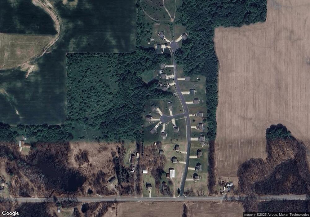
1965 Sunset View Ct NE Cedar Springs, MI 49319
Estimated Value: $429,000 - $519,000
4
Beds
3
Baths
2,619
Sq Ft
$178/Sq Ft
Est. Value
About This Home
This home is located at 1965 Sunset View Ct NE, Cedar Springs, MI 49319 and is currently estimated at $465,129, approximately $177 per square foot. 1965 Sunset View Ct NE is a home located in Kent County with nearby schools including Cedar Trails Elementary School, Red Hawk Intermediate School, and Beach Elementary School.
Ownership History
Date
Name
Owned For
Owner Type
Purchase Details
Closed on
May 3, 2012
Sold by
Westview Capital Llc
Bought by
Rypma Roylin and Rypma Shanielle R
Current Estimated Value
Home Financials for this Owner
Home Financials are based on the most recent Mortgage that was taken out on this home.
Original Mortgage
$14,178
Interest Rate
3.83%
Mortgage Type
Construction
Purchase Details
Closed on
Jun 28, 2011
Sold by
1975 Investments Llc
Bought by
Westview Capital Llc
Home Financials for this Owner
Home Financials are based on the most recent Mortgage that was taken out on this home.
Original Mortgage
$200,000
Interest Rate
4.56%
Mortgage Type
Future Advance Clause Open End Mortgage
Create a Home Valuation Report for This Property
The Home Valuation Report is an in-depth analysis detailing your home's value as well as a comparison with similar homes in the area
Home Values in the Area
Average Home Value in this Area
Purchase History
| Date | Buyer | Sale Price | Title Company |
|---|---|---|---|
| Rypma Roylin | $21,000 | Devon | |
| Westview Capital Llc | $237,500 | None Available |
Source: Public Records
Mortgage History
| Date | Status | Borrower | Loan Amount |
|---|---|---|---|
| Previous Owner | Rypma Roylin | $14,178 | |
| Previous Owner | Westview Capital Llc | $200,000 |
Source: Public Records
Tax History Compared to Growth
Tax History
| Year | Tax Paid | Tax Assessment Tax Assessment Total Assessment is a certain percentage of the fair market value that is determined by local assessors to be the total taxable value of land and additions on the property. | Land | Improvement |
|---|---|---|---|---|
| 2025 | $2,758 | $202,800 | $0 | $0 |
| 2024 | $2,758 | $191,900 | $0 | $0 |
| 2023 | $2,636 | $164,200 | $0 | $0 |
| 2022 | $2,843 | $142,900 | $0 | $0 |
| 2021 | $2,865 | $132,400 | $0 | $0 |
| 2020 | $2,518 | $131,000 | $0 | $0 |
| 2019 | $31,563 | $122,600 | $0 | $0 |
| 2018 | $2,743 | $111,600 | $0 | $0 |
| 2017 | $2,668 | $97,500 | $0 | $0 |
| 2016 | $2,567 | $96,300 | $0 | $0 |
| 2015 | -- | $96,300 | $0 | $0 |
| 2013 | -- | $87,800 | $0 | $0 |
Source: Public Records
Map
Nearby Homes
- 2053 Winston View Dr NE Unit 31
- 13475 Lime Lake Dr NE
- 944 Tibalew Dr NW
- 2070 Solon St NE
- 12501 Pine Island Dr NE
- 14035 Hanna Ave NE
- 14551 Algoma Ave NE
- V/L Par 1 Algoma Ave
- 13625 Krauskopf Rd NE
- 12524 Hoskins Ave NE
- 13625 Larkspur Ln
- 3567 Hollyfield Dr
- 13671 Starflower
- 3498 Braeburn Orchard Dr NE
- The Taylor Plan at Saddlebrook
- The Stockton Plan at Saddlebrook
- The Stafford Plan at Saddlebrook
- The Rowen Plan at Saddlebrook
- The Mayfair Plan at Saddlebrook
- The Brinley Plan at Saddlebrook
- 1965 Sunset View Ct NE
- 1953 Sunset View Ct
- 1971 Sunset View Ct
- 13409 Sunset View Dr Unit 15
- 13409 Sunset View Dr
- 1950 Sunset View Ct NE
- 1962 Sunset View Ct
- 13421 Sunset View Dr NE
- 0 Sunset View Dr
- 13394 Sunset View Dr
- 13406 Sunset View Dr
- 13433 Sunset View Dr NE
- 13433 Sunset View Dr NE
- 13382 Sunset View Dr
- 13349 Sunset View Dr NE
- 13349 Sunset View Dr NE
- 13418 Sunset View Dr
- 13370 Sunset View Dr
- 13337 Sunset View Dr
- 13358 Sunset View Dr
