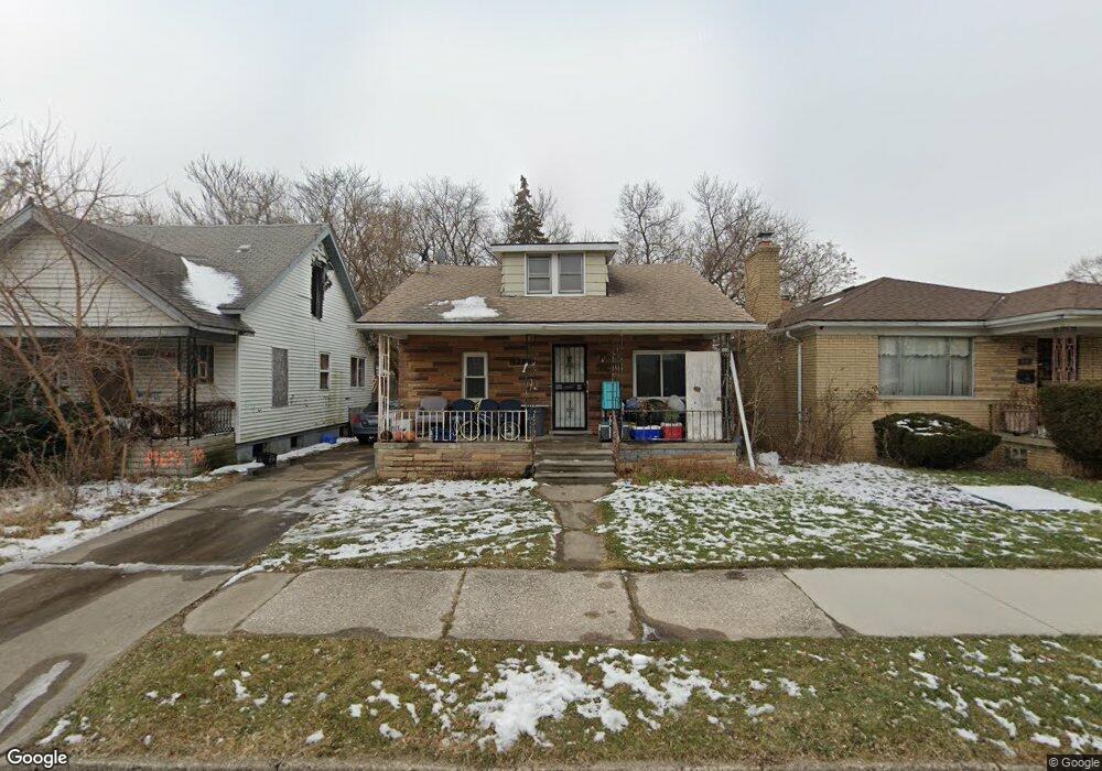
19657 Regent Dr Detroit, MI 48205
Franklin NeighborhoodEstimated Value: $68,000 - $86,000
3
Beds
1
Bath
951
Sq Ft
$81/Sq Ft
Est. Value
About This Home
This home is located at 19657 Regent Dr, Detroit, MI 48205 and is currently estimated at $77,481, approximately $81 per square foot. 19657 Regent Dr is a home located in Wayne County with nearby schools including Casimir Pulaski Elementary-Middle School, Edward 'Duke' Ellington Conservatory of Music and Art, and Charles L. Spain Elementary-Middle School.
Ownership History
Date
Name
Owned For
Owner Type
Purchase Details
Closed on
Mar 26, 2003
Sold by
Kue Samantha May and Kue Samantha M
Bought by
Kue Kao
Current Estimated Value
Home Financials for this Owner
Home Financials are based on the most recent Mortgage that was taken out on this home.
Original Mortgage
$41,000
Interest Rate
5.76%
Mortgage Type
Purchase Money Mortgage
Create a Home Valuation Report for This Property
The Home Valuation Report is an in-depth analysis detailing your home's value as well as a comparison with similar homes in the area
Home Values in the Area
Average Home Value in this Area
Purchase History
| Date | Buyer | Sale Price | Title Company |
|---|---|---|---|
| Kue Kao | -- | Multiple |
Source: Public Records
Mortgage History
| Date | Status | Borrower | Loan Amount |
|---|---|---|---|
| Closed | Kue Kao | $41,000 |
Source: Public Records
Tax History Compared to Growth
Tax History
| Year | Tax Paid | Tax Assessment Tax Assessment Total Assessment is a certain percentage of the fair market value that is determined by local assessors to be the total taxable value of land and additions on the property. | Land | Improvement |
|---|---|---|---|---|
| 2025 | $855 | $28,200 | $0 | $0 |
| 2024 | $855 | $25,200 | $0 | $0 |
| 2023 | $828 | $19,800 | $0 | $0 |
| 2022 | $898 | $13,700 | $0 | $0 |
| 2021 | $877 | $11,300 | $0 | $0 |
| 2020 | $869 | $10,200 | $0 | $0 |
| 2019 | $857 | $9,400 | $0 | $0 |
| 2018 | $744 | $8,600 | $0 | $0 |
| 2017 | $159 | $8,400 | $0 | $0 |
| 2016 | $941 | $11,700 | $0 | $0 |
| 2015 | $1,160 | $11,700 | $0 | $0 |
| 2013 | $1,124 | $16,195 | $0 | $0 |
| 2010 | -- | $23,744 | $791 | $22,953 |
Source: Public Records
Map
Nearby Homes
- 14404 Manning St
- 14153 Manning St
- 14405 Manning St
- 14110 E State Fair St
- 14124 Rossini Dr
- 14076 Rossini Dr
- 14141 Rossini Dr
- 14467 Rossini Dr
- 14504 Coram St
- 14140 Fairmount Dr
- 14024 Rossini Dr
- 14390 Lappin St
- 14531 Lappin St
- 14741 Coram St
- 14772 Tacoma St
- 14007 Fairmount Dr
- 13832 Pinewood St
- 14578 Lappin St
- 14819 Tacoma St
- 14788 Rossini Dr
- 19649 Regent Dr
- 19663 Regent Dr
- 19641 Regent Dr
- 14192 Manning St
- 19633 Regent Dr
- 14184 Manning St
- 19636 Regent Dr
- 19625 Regent Dr
- 14209 Manning St
- 14203 Manning St
- 14221 Manning St
- 14412 Manning St
- 19619 Regent Dr
- 14195 Manning St
- 14170 Manning St
- 19620 Regent Dr
- 14164 Manning St
- 14420 Manning St
- 19611 Regent Dr
- 14185 Liberal St