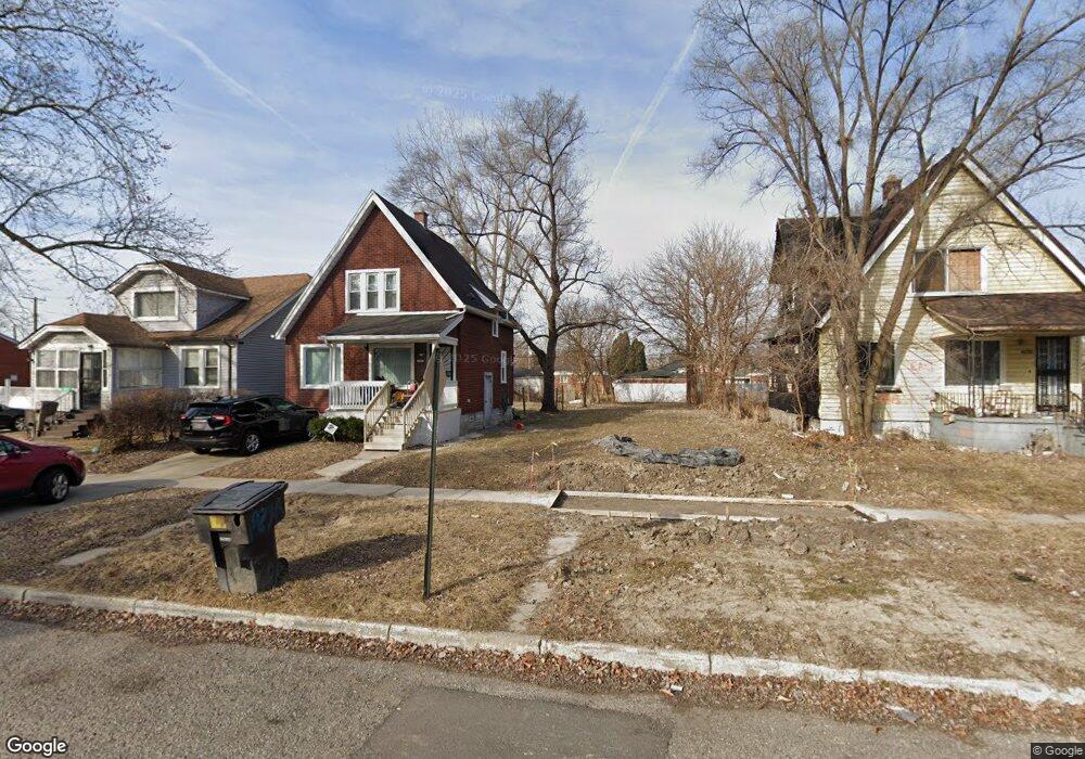
19657 Saint Aubin St Detroit, MI 48234
Nolan NeighborhoodEstimated Value: $75,000 - $82,000
4
Beds
1
Bath
1,500
Sq Ft
$52/Sq Ft
Est. Value
About This Home
This home is located at 19657 Saint Aubin St, Detroit, MI 48234 and is currently estimated at $78,500, approximately $52 per square foot. 19657 Saint Aubin St is a home located in Wayne County with nearby schools including Nolan Elementary/Middle School, Edward 'Duke' Ellington Conservatory of Music and Art, and Charles L. Spain Elementary-Middle School.
Ownership History
Date
Name
Owned For
Owner Type
Purchase Details
Closed on
Jan 13, 2016
Sold by
Wayne County Treasurer
Bought by
Detroit Land Bank Authority
Current Estimated Value
Purchase Details
Closed on
Nov 19, 2012
Sold by
Harbour Portfolio Vii Lp
Bought by
Bc Reo Fund I Llc
Purchase Details
Closed on
Apr 22, 2011
Sold by
Everbank
Bought by
Federal National Mortgage Association
Purchase Details
Closed on
Mar 17, 2011
Sold by
Pratt Rose Lee
Bought by
Everbank
Create a Home Valuation Report for This Property
The Home Valuation Report is an in-depth analysis detailing your home's value as well as a comparison with similar homes in the area
Home Values in the Area
Average Home Value in this Area
Purchase History
| Date | Buyer | Sale Price | Title Company |
|---|---|---|---|
| Detroit Land Bank Authority | -- | None Available | |
| Bc Reo Fund I Llc | -- | None Available | |
| Federal National Mortgage Association | -- | None Available | |
| Everbank | $37,410 | None Available |
Source: Public Records
Tax History Compared to Growth
Tax History
| Year | Tax Paid | Tax Assessment Tax Assessment Total Assessment is a certain percentage of the fair market value that is determined by local assessors to be the total taxable value of land and additions on the property. | Land | Improvement |
|---|---|---|---|---|
| 2025 | -- | $0 | $0 | $0 |
| 2024 | -- | $0 | $0 | $0 |
| 2023 | $0 | $0 | $0 | $0 |
| 2022 | $0 | $0 | $0 | $0 |
| 2021 | $0 | $0 | $0 | $0 |
| 2020 | $0 | $0 | $0 | $0 |
| 2019 | $1,208 | $0 | $0 | $0 |
| 2018 | $0 | $0 | $0 | $0 |
| 2017 | $1,030 | $0 | $0 | $0 |
| 2016 | $240 | $0 | $0 | $0 |
| 2015 | $1,030 | $10,300 | $0 | $0 |
| 2013 | $1,286 | $12,860 | $0 | $0 |
| 2010 | -- | $18,855 | $787 | $18,068 |
Source: Public Records
Map
Nearby Homes
- 19704 Saint Aubin St
- 19434 Saint Aubin St
- 19404 Saint Aubin St
- 19664 Fleming St
- 19623 Goddard St
- 19934 Riopelle St
- 20021 Fleming St
- 19415 Riopelle St
- 19235 Fleming St
- 19951 Mackay St
- 20048 Fleming St
- 19626 Mackay St
- 19303 Riopelle St
- 19164 Dequindre St
- 20181 Lumpkin St
- 20021 Mackay St
- 19222 Riopelle St
- 19249 Riopelle St
- 20100 Greeley St
- 19403 Anglin St
- 19663 Saint Aubin St
- 19651 Saint Aubin St
- 19645 Saint Aubin St
- 19669 Saint Aubin St
- 19675 Saint Aubin St
- 19639 Saint Aubin St
- 19658 Dequindre St
- 19652 Dequindre St
- 19629 Saint Aubin St
- 19640 Dequindre St
- 19691 Saint Aubin St
- 19678 Dequindre St
- 19630 Dequindre St
- 19660 Saint Aubin St
- 19621 Saint Aubin St
- 19650 Saint Aubin St
- 19666 Saint Aubin St
- 19691 Dequindre St
- 19640 Saint Aubin St
- 19620 Dequindre St