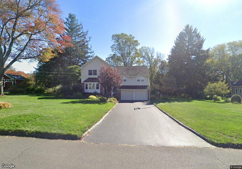
1966 Duncan Dr Scotch Plains, NJ 07076
Estimated Value: $861,000 - $1,409,000
--
Bed
--
Bath
3,526
Sq Ft
$328/Sq Ft
Est. Value
About This Home
This home is located at 1966 Duncan Dr, Scotch Plains, NJ 07076 and is currently estimated at $1,156,596, approximately $328 per square foot. 1966 Duncan Dr is a home located in Union County with nearby schools including William J. McGinn Elementary School, Terrill Middle School, and Scotch Plains-Fanwood High School.
Ownership History
Date
Name
Owned For
Owner Type
Purchase Details
Closed on
Jul 30, 2004
Sold by
Weed Jane
Bought by
Oster Steven and Oster Barbara
Current Estimated Value
Home Financials for this Owner
Home Financials are based on the most recent Mortgage that was taken out on this home.
Original Mortgage
$200,000
Outstanding Balance
$100,229
Interest Rate
6.16%
Estimated Equity
$1,056,367
Create a Home Valuation Report for This Property
The Home Valuation Report is an in-depth analysis detailing your home's value as well as a comparison with similar homes in the area
Home Values in the Area
Average Home Value in this Area
Purchase History
| Date | Buyer | Sale Price | Title Company |
|---|---|---|---|
| Oster Steven | $625,000 | -- |
Source: Public Records
Mortgage History
| Date | Status | Borrower | Loan Amount |
|---|---|---|---|
| Open | Oster Steven | $200,000 |
Source: Public Records
Tax History Compared to Growth
Tax History
| Year | Tax Paid | Tax Assessment Tax Assessment Total Assessment is a certain percentage of the fair market value that is determined by local assessors to be the total taxable value of land and additions on the property. | Land | Improvement |
|---|---|---|---|---|
| 2025 | $19,982 | $169,800 | $53,700 | $116,100 |
| 2024 | $19,393 | $169,800 | $53,700 | $116,100 |
| 2023 | $19,393 | $169,800 | $53,700 | $116,100 |
| 2022 | $19,162 | $169,800 | $53,700 | $116,100 |
| 2021 | $19,130 | $169,800 | $53,700 | $116,100 |
| 2020 | $19,038 | $169,800 | $53,700 | $116,100 |
| 2019 | $18,897 | $169,800 | $53,700 | $116,100 |
| 2018 | $18,580 | $169,800 | $53,700 | $116,100 |
| 2017 | $18,167 | $169,800 | $53,700 | $116,100 |
| 2016 | $17,817 | $169,800 | $53,700 | $116,100 |
| 2015 | $17,525 | $169,800 | $53,700 | $116,100 |
| 2014 | $16,948 | $169,800 | $53,700 | $116,100 |
Source: Public Records
Map
Nearby Homes
- 2 Brookside Ct
- 2 Dutch Ln
- 1466 Lamberts Mill Rd
- 1972 W Broad St
- 314 Highgate Ave
- 2154 W Broad St
- 119 Lamberts Mill Rd
- 57 Rambling Dr
- 1933 Mary Ellen Ln
- 2 Unami Ln
- 2116 Newark Ave
- 1840 Raritan Rd
- 1840 Lake Ave
- 525 Edgar Rd
- 524 Edgar Rd
- 614 Dorian Rd
- 1701 Raritan Rd
- 676 Vermont St
- 608 Hort St
- 1380 Terrill Rd
- 1958 Duncan Dr
- 1974 Duncan Dr
- 1957 Inverness Dr
- 1973 Inverness Dr
- 1965 Duncan Dr
- 1973 Duncan Dr
- 1950 Duncan Dr
- 1957 Duncan Dr
- 1981 Duncan Dr
- 1989 Duncan Dr
- 1949 Inverness Dr
- 1997 Duncan Dr
- 1947 Duncan Dr
- 1984 Inverness Dr
- 2002 Parkwood Dr
- 1942 Duncan Dr
- 2012 Parkwood Dr
- 1992 Parkwood Dr
- 1964 Inverness Dr
- 1958 Inverness Dr