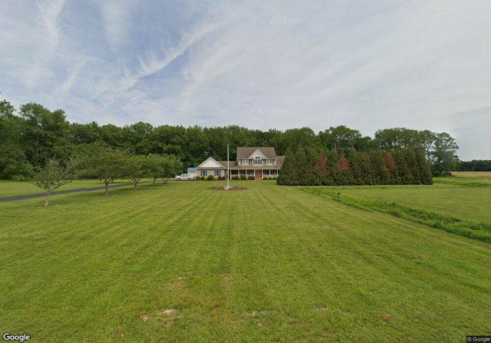
1966 Ingram Branch Rd Harrington, DE 19952
Estimated Value: $509,000 - $708,000
4
Beds
4
Baths
3,256
Sq Ft
$198/Sq Ft
Est. Value
About This Home
This home is located at 1966 Ingram Branch Rd, Harrington, DE 19952 and is currently estimated at $644,880, approximately $198 per square foot. 1966 Ingram Branch Rd is a home located in Kent County with nearby schools including Lake Forest South Elementary School, Lake Forest Central Elementary School, and W.T. Chipman Middle School.
Ownership History
Date
Name
Owned For
Owner Type
Purchase Details
Closed on
Mar 14, 2006
Sold by
Swann Marion Scott and Swann Susan Faye
Bought by
Kinnamon William Allen and Stallings Sandra K
Current Estimated Value
Home Financials for this Owner
Home Financials are based on the most recent Mortgage that was taken out on this home.
Original Mortgage
$35,000
Outstanding Balance
$19,955
Interest Rate
6.32%
Mortgage Type
Unknown
Estimated Equity
$624,925
Create a Home Valuation Report for This Property
The Home Valuation Report is an in-depth analysis detailing your home's value as well as a comparison with similar homes in the area
Home Values in the Area
Average Home Value in this Area
Purchase History
| Date | Buyer | Sale Price | Title Company |
|---|---|---|---|
| Kinnamon William Allen | -- | None Available |
Source: Public Records
Mortgage History
| Date | Status | Borrower | Loan Amount |
|---|---|---|---|
| Open | Kinnamon William Allen | $35,000 |
Source: Public Records
Tax History Compared to Growth
Tax History
| Year | Tax Paid | Tax Assessment Tax Assessment Total Assessment is a certain percentage of the fair market value that is determined by local assessors to be the total taxable value of land and additions on the property. | Land | Improvement |
|---|---|---|---|---|
| 2025 | $1,480 | $541,800 | $109,300 | $432,500 |
| 2024 | $1,480 | $541,800 | $109,300 | $432,500 |
| 2023 | $1,775 | $95,100 | $9,700 | $85,400 |
| 2022 | $1,536 | $95,100 | $9,700 | $85,400 |
| 2021 | $1,526 | $95,100 | $9,700 | $85,400 |
| 2020 | $2,009 | $95,100 | $9,700 | $85,400 |
| 2019 | $2,012 | $95,100 | $9,700 | $85,400 |
| 2018 | $1,990 | $95,100 | $9,700 | $85,400 |
| 2017 | $2,070 | $95,100 | $0 | $0 |
| 2016 | $1,897 | $95,100 | $0 | $0 |
| 2015 | -- | $95,100 | $0 | $0 |
| 2014 | $1,840 | $95,100 | $0 | $0 |
Source: Public Records
Map
Nearby Homes
- 10440 Burrsville Branch Rd
- 227 Burnite Mill Rd
- 2235 Vernon Rd
- 3398 Brownsville Rd
- 2 Road 268
- 3809 Road 112
- 12459 Kibler Rd
- Lot 12 Road 268
- Lot 11 Road 268
- Lot 7 Road 268
- Lot 6 Road 268
- Lot 5 Road 268
- Lot 3 Road 268
- Lot 2 Road 268
- Lot 1 Road 268
- Lot 10 Road 268
- 3029 Burnite Mill Rd
- 12618 Knife Box Rd
- 1111 Daylily Ln
- 1612 Cattail Commons Way
- 1914 Ingram Branch Rd
- 1986 Ingram Branch Rd
- 2020 Ingram Branch Rd
- 2066 Ingram Branch Rd
- 2122 Ingram Branch Rd
- 2196 Ingram Branch Rd
- 1707 Ingram Branch Rd
- 767 Brownsville Rd
- 1667 Ingram Branch Rd
- 2378 Ingram Branch Rd
- 293 Brownsville Rd
- 974 Brownsville Rd
- 1058 Brownsville Rd
- 1076 Brownsville Rd
- Par2610 Ingram Branch Rd
- 1394 Ingram Branch Rd
- 153 Bullock Rd
- 111 Brownsville Rd
- 315 Bullock Rd
- 1280 Ingram Branch Rd