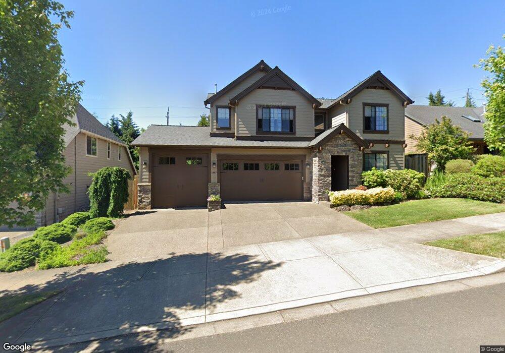
1967 Furlong Ct West Linn, OR 97068
Hidden Springs NeighborhoodEstimated Value: $940,337 - $1,026,000
4
Beds
3
Baths
2,637
Sq Ft
$370/Sq Ft
Est. Value
About This Home
This home is located at 1967 Furlong Ct, West Linn, OR 97068 and is currently estimated at $975,834, approximately $370 per square foot. 1967 Furlong Ct is a home located in Clackamas County with nearby schools including Trillium Creek Primary School, Rosemont Ridge Middle School, and West Linn High School.
Ownership History
Date
Name
Owned For
Owner Type
Purchase Details
Closed on
Jan 8, 2025
Sold by
Mason Leanne G
Bought by
Mason Family Trust and Mason
Current Estimated Value
Purchase Details
Closed on
Dec 26, 2012
Sold by
Floyd Stephen M and Floyd Julie A T
Bought by
Floyd Julie A T
Purchase Details
Closed on
Jun 5, 2012
Sold by
Pahlisch Homes Inc
Bought by
Floyd Julie A T and Floyd Stephen M
Home Financials for this Owner
Home Financials are based on the most recent Mortgage that was taken out on this home.
Original Mortgage
$309,050
Interest Rate
3.84%
Mortgage Type
New Conventional
Create a Home Valuation Report for This Property
The Home Valuation Report is an in-depth analysis detailing your home's value as well as a comparison with similar homes in the area
Home Values in the Area
Average Home Value in this Area
Purchase History
| Date | Buyer | Sale Price | Title Company |
|---|---|---|---|
| Mason Family Trust | -- | None Listed On Document | |
| Mason Family Trust | -- | None Listed On Document | |
| Floyd Julie A T | -- | None Available | |
| Floyd Julie A T | $441,500 | Fidelity Natl Title Co Of Or |
Source: Public Records
Mortgage History
| Date | Status | Borrower | Loan Amount |
|---|---|---|---|
| Previous Owner | Floyd Julie A T | $309,050 |
Source: Public Records
Tax History Compared to Growth
Tax History
| Year | Tax Paid | Tax Assessment Tax Assessment Total Assessment is a certain percentage of the fair market value that is determined by local assessors to be the total taxable value of land and additions on the property. | Land | Improvement |
|---|---|---|---|---|
| 2025 | $12,219 | $634,025 | -- | -- |
| 2024 | $11,761 | $615,559 | -- | -- |
| 2023 | $11,761 | $597,631 | $0 | $0 |
| 2022 | $11,101 | $580,225 | $0 | $0 |
| 2021 | $10,538 | $563,326 | $0 | $0 |
| 2020 | $10,532 | $546,919 | $0 | $0 |
| 2019 | $10,076 | $530,990 | $0 | $0 |
| 2018 | $9,590 | $515,524 | $0 | $0 |
| 2017 | $9,201 | $500,509 | $0 | $0 |
| 2016 | $8,798 | $485,931 | $0 | $0 |
| 2015 | $8,405 | $471,778 | $0 | $0 |
| 2014 | $7,944 | $458,037 | $0 | $0 |
Source: Public Records
Map
Nearby Homes
- 20111 Hoodview Ave
- 2024 Conestoga Ln
- 20322 Noble Ln
- 5135 Heron Dr
- 20349 Noble Ln
- 6135 Cheyenne Terrace
- 6296 Belmont Way
- 4057 Heron Dr
- 6275 Clubhouse Cir
- 22987 Bland Cir
- 6233 Meridian Cir
- 3029 Club House Ct
- 3088 Club House Ct
- 2583 Pimlico Dr
- 2038 Titan Terrace
- 2450 Bellevue Terrace
- 4050 Serango Ct
- 3296 Nomie Way
- 19874 Bennington Ct
- 4020 Ridge Ln
- 1955 Furlong Ct
- 1971 Furlong Ct
- 1951 Furlong Ct
- 1975 Furlong Ct
- 1023 Furlong Dr
- 1978 Furlong Ct
- 1966 Furlong Ct
- 1947 Furlong Dr
- 1982 Furlong Ct
- 1954 Furlong Ct
- 1991 Furlong Ct
- 1994 Furlong Ct
- 1935 Furlong Dr
- 6113 Canter Ln
- 6115 Canter Ln
- 6113 Canter Lane-Relist
- 6117 Canter Ln
- 6111 Canter Ln
- 6119 Canter Ln
- 1180 Rosemont Rd