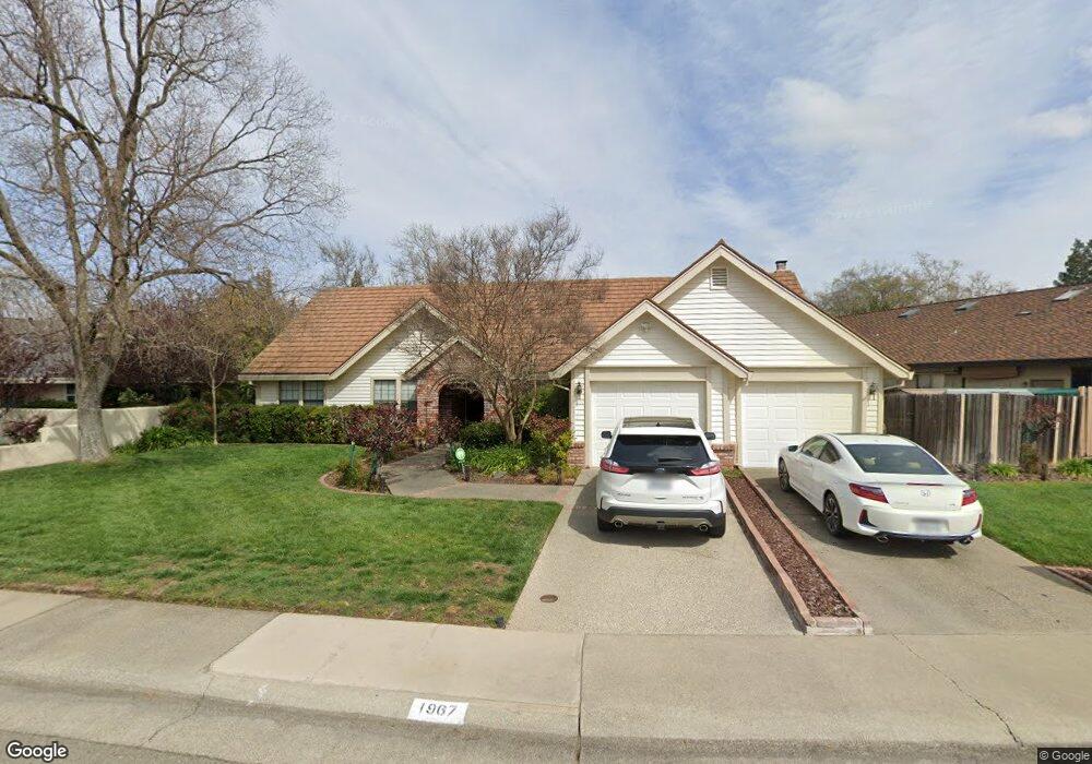
1967 Sidesaddle Way Roseville, CA 95661
Maidu NeighborhoodEstimated Value: $533,000 - $820,000
3
Beds
3
Baths
2,267
Sq Ft
$316/Sq Ft
Est. Value
About This Home
This home is located at 1967 Sidesaddle Way, Roseville, CA 95661 and is currently estimated at $716,112, approximately $315 per square foot. 1967 Sidesaddle Way is a home located in Placer County with nearby schools including Maidu Elementary School, Excelsior Elementary School, and Olympus Junior High School.
Ownership History
Date
Name
Owned For
Owner Type
Purchase Details
Closed on
Nov 20, 2012
Sold by
Plantaric Penelope Ann and Yeransian Raymond A
Bought by
Yeransian Raymond A and Plantaric Yeransian Penelope
Current Estimated Value
Purchase Details
Closed on
Jul 20, 1993
Sold by
Vivas Ernest E and Plantaric Penelope Ann
Bought by
Yeransian Raymond A and Plantaric Penelope Ann
Home Financials for this Owner
Home Financials are based on the most recent Mortgage that was taken out on this home.
Original Mortgage
$187,500
Interest Rate
7.38%
Mortgage Type
Purchase Money Mortgage
Create a Home Valuation Report for This Property
The Home Valuation Report is an in-depth analysis detailing your home's value as well as a comparison with similar homes in the area
Home Values in the Area
Average Home Value in this Area
Purchase History
| Date | Buyer | Sale Price | Title Company |
|---|---|---|---|
| Yeransian Raymond A | -- | None Available | |
| Yeransian Raymond A | $46,000 | First American Title Co |
Source: Public Records
Mortgage History
| Date | Status | Borrower | Loan Amount |
|---|---|---|---|
| Closed | Yeransian Raymond A | $187,500 |
Source: Public Records
Tax History Compared to Growth
Tax History
| Year | Tax Paid | Tax Assessment Tax Assessment Total Assessment is a certain percentage of the fair market value that is determined by local assessors to be the total taxable value of land and additions on the property. | Land | Improvement |
|---|---|---|---|---|
| 2025 | $3,845 | $384,934 | $99,302 | $285,632 |
| 2023 | $3,845 | $369,989 | $95,447 | $274,542 |
| 2022 | $3,779 | $362,735 | $93,576 | $269,159 |
| 2021 | $3,704 | $355,624 | $91,742 | $263,882 |
| 2020 | $3,695 | $351,979 | $90,802 | $261,177 |
| 2019 | $3,687 | $345,078 | $89,022 | $256,056 |
| 2018 | $3,550 | $338,313 | $87,277 | $251,036 |
| 2017 | $3,573 | $331,680 | $85,566 | $246,114 |
| 2016 | $3,488 | $325,178 | $83,889 | $241,289 |
| 2015 | $3,415 | $320,294 | $82,629 | $237,665 |
| 2014 | $3,361 | $314,021 | $81,011 | $233,010 |
Source: Public Records
Map
Nearby Homes
- 1902 Mclaren Dr
- 2106 Van Ness Dr
- 2177 Charter Ct
- 2203 Banbury Cir
- 2208 N Cirby Way
- 1508 Martinique Dr
- 1822 Cirby Way
- 1215 Meadow Ln
- 608 Glenshire Ct
- 2710 Courtside Dr
- 1902 Wildwood Way
- 1816 Wildwood Way
- 1812 Wildwood Way
- 1505 E Colonial Pkwy Unit E
- 1817 Woodacre Way
- 156 Rimma Way
- 1411 Michael Way
- 1408 Gregory Way
- 167 Rimma Way
- 2760 Prestwick Dr
- 1969 Sidesaddle Way
- 1601 Winchester Way
- 1973 Sidesaddle Way
- 1968 Sidesaddle Way
- 1966 Sidesaddle Way
- 1964 Sidesaddle Way
- 1975 Sidesaddle Way
- 401 Stirrup Ct
- 1961 Sidesaddle Way
- 1962 Sidesaddle Way
- 1602 Winchester Way
- 402 Stirrup Ct
- 1974 Sidesaddle Way
- 1929 Branding Iron Way
- 1960 Sidesaddle Way
- 1977 Sidesaddle Way
- 1927 Branding Iron Way
- 403 Stirrup Ct
- 1607 Winchester Way
- 404 Stirrup Ct