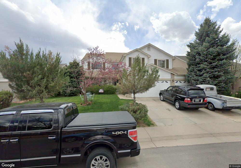
19682 E Union Dr Centennial, CO 80015
Fox Hill NeighborhoodEstimated Value: $603,000 - $681,000
4
Beds
4
Baths
2,667
Sq Ft
$236/Sq Ft
Est. Value
About This Home
This home is located at 19682 E Union Dr, Centennial, CO 80015 and is currently estimated at $629,419, approximately $236 per square foot. 19682 E Union Dr is a home located in Arapahoe County with nearby schools including Summit Elementary School, Horizon Middle School, and Smoky Hill High School.
Ownership History
Date
Name
Owned For
Owner Type
Purchase Details
Closed on
Jul 13, 2017
Sold by
Coleman Lawrence E
Bought by
Coleman Lawrence E and Coleman Glenda M
Current Estimated Value
Home Financials for this Owner
Home Financials are based on the most recent Mortgage that was taken out on this home.
Original Mortgage
$439,000
Outstanding Balance
$362,069
Interest Rate
3.89%
Mortgage Type
VA
Estimated Equity
$267,350
Purchase Details
Closed on
Nov 30, 1993
Sold by
Melody Homes
Bought by
Coleman Lawrence E and Coleman Glenda M
Home Financials for this Owner
Home Financials are based on the most recent Mortgage that was taken out on this home.
Original Mortgage
$183,500
Interest Rate
6.71%
Mortgage Type
VA
Purchase Details
Closed on
Mar 19, 1993
Bought by
Conversion Arapco
Create a Home Valuation Report for This Property
The Home Valuation Report is an in-depth analysis detailing your home's value as well as a comparison with similar homes in the area
Home Values in the Area
Average Home Value in this Area
Purchase History
| Date | Buyer | Sale Price | Title Company |
|---|---|---|---|
| Coleman Lawrence E | -- | None Available | |
| Coleman Lawrence E | -- | First Integrity Title | |
| Coleman Lawrence E | $183,747 | Land Title | |
| Conversion Arapco | -- | -- |
Source: Public Records
Mortgage History
| Date | Status | Borrower | Loan Amount |
|---|---|---|---|
| Open | Coleman Lawrence E | $439,000 | |
| Closed | Coleman Lawrence E | $183,500 |
Source: Public Records
Tax History Compared to Growth
Tax History
| Year | Tax Paid | Tax Assessment Tax Assessment Total Assessment is a certain percentage of the fair market value that is determined by local assessors to be the total taxable value of land and additions on the property. | Land | Improvement |
|---|---|---|---|---|
| 2025 | $3,890 | $43,338 | -- | -- |
| 2024 | $3,460 | $43,504 | -- | -- |
| 2023 | $3,460 | $43,504 | $0 | $0 |
| 2022 | $3,228 | $32,533 | $0 | $0 |
| 2021 | $3,241 | $32,533 | $0 | $0 |
| 2020 | $3,459 | $35,521 | $0 | $0 |
| 2019 | $3,338 | $35,521 | $0 | $0 |
| 2018 | $3,173 | $30,175 | $0 | $0 |
| 2017 | $3,121 | $30,175 | $0 | $0 |
| 2016 | $2,879 | $26,356 | $0 | $0 |
| 2015 | $2,780 | $26,356 | $0 | $0 |
| 2014 | -- | $22,431 | $0 | $0 |
| 2013 | -- | $22,720 | $0 | $0 |
Source: Public Records
Map
Nearby Homes
- 19905 E Stanford Dr
- 19872 E Stanford Ave
- 19562 E Sunset Cir
- 4483 S Himalaya Cir
- 4947 S Espana Way
- 4304 S Genoa Ct
- 4522 S Jebel Way
- 5026 S Dunkirk Way
- 5015 S Dunkirk Way
- 4343 S Ceylon Way
- 20431 E Union Cir
- 20473 E Layton Ave
- 19466 E Purdue Place
- 19815 E Belleview Place
- 20551 E Union Ave
- 19707 E Princeton Place
- 19093 E Bellewood Dr
- 4382 S Bahama Way
- 4240 S Ireland St
- 4179 S Himalaya Way
- 19672 E Union Dr
- 19692 E Union Dr
- 19662 E Union Dr
- 4698 S Flanders Way
- 19707 E Tufts Dr
- 19704 E Union Dr
- 19642 E Union Dr
- 4688 S Flanders Way
- 19727 E Tufts Dr
- 4697 S Flanders Way
- 19724 E Union Dr
- 19681 E Union Dr
- 4700 S Flanders St
- 4687 S Flanders Way
- 19747 E Tufts Dr
- 4678 S Flanders Way
- 19728 E Tufts Dr
- 19734 E Union Dr
- 4626 S Flanders St
- 4710 S Flanders St