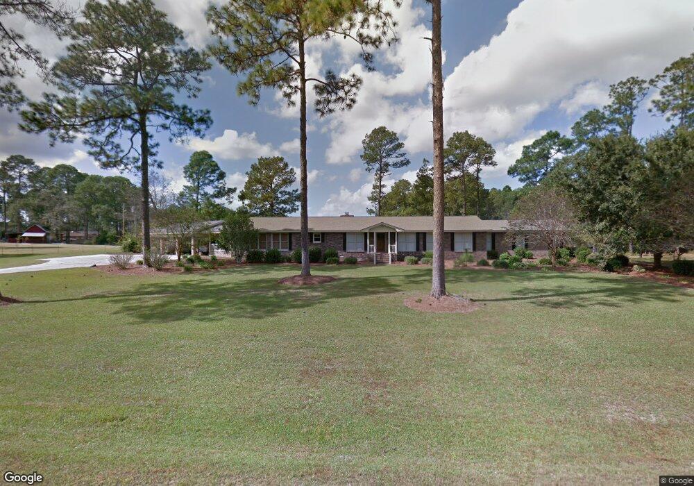
197 Harper Rd Moultrie, GA 31788
Estimated Value: $466,000 - $516,000
Studio
2
Baths
3,647
Sq Ft
$134/Sq Ft
Est. Value
About This Home
This home is located at 197 Harper Rd, Moultrie, GA 31788 and is currently estimated at $489,274, approximately $134 per square foot. 197 Harper Rd is a home located in Colquitt County with nearby schools including Sunset Elementary School, Willie J. Williams Middle School, and C.A. Gray Junior High School.
Ownership History
Date
Name
Owned For
Owner Type
Purchase Details
Closed on
Apr 6, 2021
Sold by
Demott Shannon
Bought by
Demott Shannon and Demott Stewart
Current Estimated Value
Purchase Details
Closed on
Dec 30, 2015
Sold by
Demott Stewart
Bought by
Demott Shannon
Purchase Details
Closed on
Jan 9, 2003
Sold by
Wilder Ronald W
Bought by
Demott Stewart
Purchase Details
Closed on
Aug 1, 1975
Bought by
Wilder Ronald W
Create a Home Valuation Report for This Property
The Home Valuation Report is an in-depth analysis detailing your home's value as well as a comparison with similar homes in the area
Purchase History
| Date | Buyer | Sale Price | Title Company |
|---|---|---|---|
| Demott Shannon | -- | -- | |
| Demott Shannon | -- | -- | |
| Demott Stewart | $177,500 | -- | |
| Wilder Ronald W | -- | -- |
Source: Public Records
Tax History
| Year | Tax Paid | Tax Assessment Tax Assessment Total Assessment is a certain percentage of the fair market value that is determined by local assessors to be the total taxable value of land and additions on the property. | Land | Improvement |
|---|---|---|---|---|
| 2025 | $3,109 | $158,319 | $18,870 | $139,449 |
| 2024 | $3,109 | $183,212 | $18,870 | $164,342 |
| 2023 | $3,821 | $140,254 | $18,870 | $121,384 |
| 2022 | $2,728 | $116,557 | $18,870 | $97,687 |
| 2021 | $2,707 | $113,496 | $18,870 | $94,626 |
| 2020 | $2,756 | $113,496 | $18,870 | $94,626 |
| 2019 | $2,957 | $109,560 | $18,870 | $90,690 |
| 2018 | $2,802 | $109,560 | $18,870 | $90,690 |
| 2017 | $2,788 | $104,420 | $13,730 | $90,690 |
| 2016 | $2,825 | $104,420 | $13,730 | $90,690 |
| 2015 | $2,851 | $104,420 | $13,730 | $90,690 |
| 2014 | $2,797 | $104,420 | $13,730 | $90,690 |
| 2013 | -- | $104,420 | $13,730 | $90,690 |
Source: Public Records
Map
Nearby Homes
- 424 U S Highway 319
- 104 Inner Cir
- 0 Old Timey Trail
- 410 Indian Trail
- 2754 Tallokas Rd
- 235 Riggins Rd
- 150 Friendship Trail
- 151 Upper Trail
- 7 SE Pheasant Ln
- 31 31st Ave SE
- 2720 Jacqueline Cir
- 0 Tallokas Rd Unit 11663248
- 2216 Azalea Dr
- 126 Sunset Cir
- 301 Camellia Dr
- 204 Nandina Dr
- 35 Cobblestone Blvd SE
- 36 Cobblestone Blvd SE
- 2004 4th St SE
- 44 Sloans Village Way SE
- 316 Harper Rd
- 224 Harper Rd
- 237 Harper Rd
- 152 Harper Rd
- 2501 Tallokas Rd
- 2455 Tallokas Rd
- 134 Cheyenne Way
- 250 Harper Rd
- 109 Lonesome Pine Trail
- 0000 Harper Rd
- 00 Harper Rd
- 105 Lonesome Pine Trail
- 2527 Tallokas Rd
- 117 Lonesome Pine Trail
- 125 Lonesome Pine Trail
- 2541 Tallokas Rd
- 129 Lonesome Pine Trail
- 2488 Tallokas Rd
- 133 Lonesome Pine Trail
- 178 Cheyenne Way
Your Personal Tour Guide
Ask me questions while you tour the home.