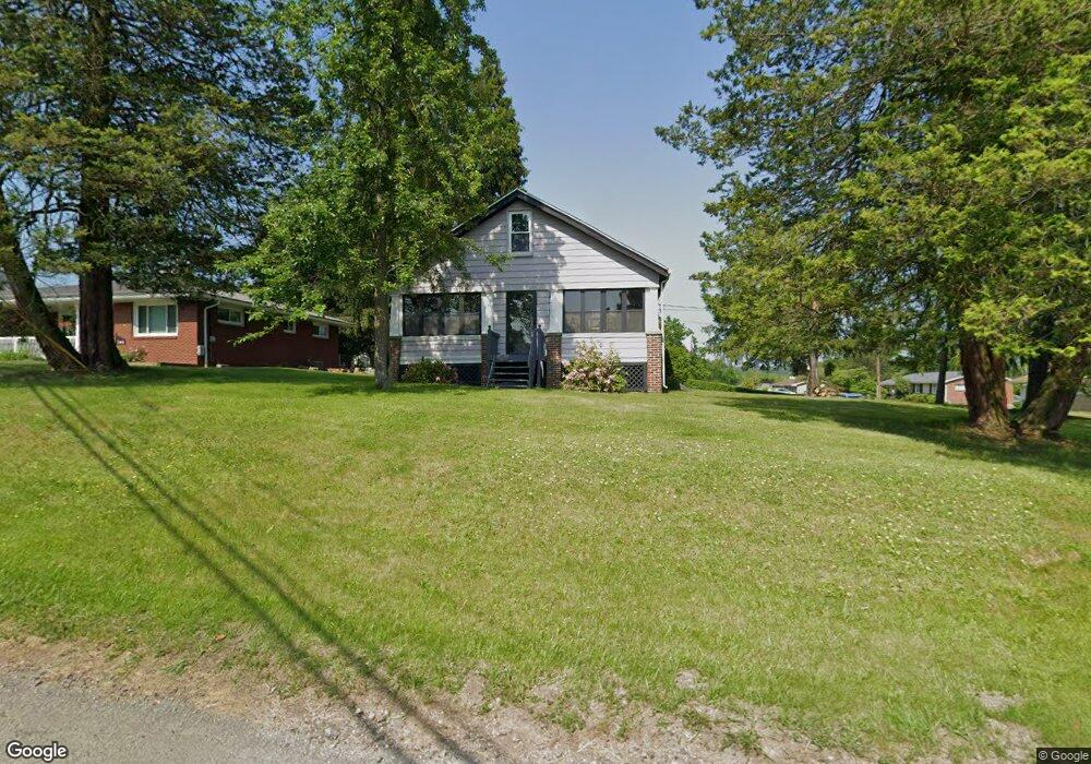
197 State Route 356 Apollo, PA 15613
Estimated Value: $99,355 - $235,000
Studio
--
Bath
--
Sq Ft
0.45
Acres
About This Home
This home is located at 197 State Route 356, Apollo, PA 15613 and is currently estimated at $178,089. 197 State Route 356 is a home located in Westmoreland County with nearby schools including Kiski Area High School.
Ownership History
Date
Name
Owned For
Owner Type
Purchase Details
Closed on
Oct 27, 2017
Sold by
Margaret E Moore
Bought by
Macevoy David and Macevoy Jean
Current Estimated Value
Home Financials for this Owner
Home Financials are based on the most recent Mortgage that was taken out on this home.
Original Mortgage
$37,000
Outstanding Balance
$31,078
Interest Rate
3.94%
Estimated Equity
$147,011
Create a Home Valuation Report for This Property
The Home Valuation Report is an in-depth analysis detailing your home's value as well as a comparison with similar homes in the area
Home Values in the Area
Average Home Value in this Area
Purchase History
| Date | Buyer | Sale Price | Title Company |
|---|---|---|---|
| Macevoy David | $200,000 | -- |
Source: Public Records
Mortgage History
| Date | Status | Borrower | Loan Amount |
|---|---|---|---|
| Open | Macevoy David | $37,000 | |
| Closed | Macevoy David | -- |
Source: Public Records
Tax History
| Year | Tax Paid | Tax Assessment Tax Assessment Total Assessment is a certain percentage of the fair market value that is determined by local assessors to be the total taxable value of land and additions on the property. | Land | Improvement |
|---|---|---|---|---|
| 2025 | $1,569 | $10,520 | $1,350 | $9,170 |
| 2024 | $1,488 | $10,520 | $1,350 | $9,170 |
| 2023 | $1,358 | $10,520 | $1,350 | $9,170 |
| 2022 | $1,316 | $10,520 | $1,350 | $9,170 |
| 2021 | $1,316 | $10,520 | $1,350 | $9,170 |
| 2020 | $1,312 | $10,520 | $1,350 | $9,170 |
| 2019 | $1,297 | $10,520 | $1,350 | $9,170 |
| 2018 | $1,276 | $10,520 | $1,350 | $9,170 |
| 2017 | $1,244 | $10,520 | $1,350 | $9,170 |
| 2016 | $1,225 | $10,520 | $1,350 | $9,170 |
| 2015 | $1,225 | $10,520 | $1,350 | $9,170 |
| 2014 | $1,218 | $10,520 | $1,350 | $9,170 |
Source: Public Records
Map
Nearby Homes
- 843 Pine Run Rd
- 184 Pine Run Church Rd
- 150 Watson Rd
- 217 Karen Dr
- 4792 State Route 66
- 905 Watt Rd
- 115 Acadia Ln
- 0 Watson Rd
- 384 Northgate Dr Unit T
- 716 Pennsylvania 356
- 380 Northgate Dr Unit E
- 380 Northgate Dr Unit D
- 127 Lily St
- 1738 Hancock Ave
- 223 Old Mill Rd
- 211 Old Mill Rd
- 501 State Route 356
- 262 Vista Dr
- 428 Meadows Dr
- 519 Dogwood Ct
- 193 State Route 356
- 1006 Shaner Acres Dr
- 1005 Shaner Acres Dr
- 191 State Route 356
- 191 St Rt 356
- 1010 Shaner Acres Dr
- 1009 Shaner Acres Dr
- 200 State Route 356
- 187 State Route 356
- 591 State Route 356
- 509 Mahen Ln
- 1014 Shaner Acres Dr
- 1013 Shaner Acres Dr
- 198 State Route 356
- 183 State Route 356
- 1018 Shaner Acres Dr
- 183 Rt 356
- 1017 Shaner Acres Dr
- 1022 Shaner Acres Dr
- 513 Mahen Ln