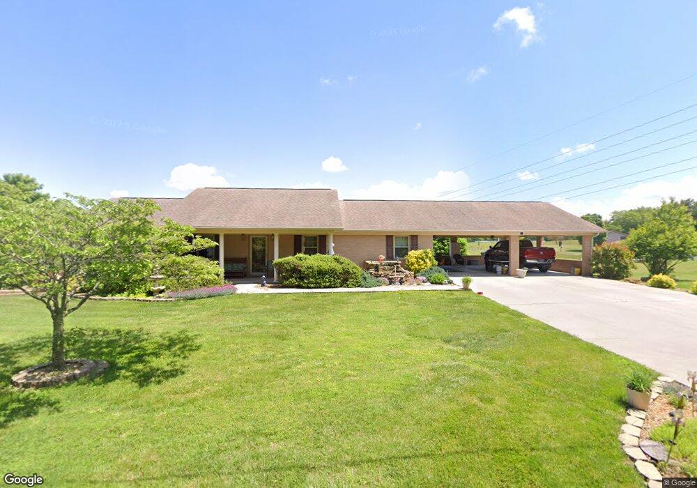
1970 Jaybird Rd Morristown, TN 37814
Estimated Value: $315,000 - $411,000
--
Bed
2
Baths
1,891
Sq Ft
$194/Sq Ft
Est. Value
About This Home
This home is located at 1970 Jaybird Rd, Morristown, TN 37814 and is currently estimated at $367,395, approximately $194 per square foot. 1970 Jaybird Rd is a home located in Hamblen County with nearby schools including Russellville Elementary School, East Ridge Middle School, and Morristown East High School.
Ownership History
Date
Name
Owned For
Owner Type
Purchase Details
Closed on
Nov 5, 2007
Sold by
Williams David P
Bought by
Wilder Richard
Current Estimated Value
Purchase Details
Closed on
Jun 7, 2005
Sold by
Knowles Clayton D
Bought by
Wilder Richard C
Home Financials for this Owner
Home Financials are based on the most recent Mortgage that was taken out on this home.
Original Mortgage
$132,800
Interest Rate
5.66%
Purchase Details
Closed on
Mar 31, 1994
Bought by
Taylor Bobby M and Taylor Sharon
Purchase Details
Closed on
Mar 5, 1986
Bought by
Burleson Jesse and Burleson Josephine
Purchase Details
Closed on
May 13, 1971
Create a Home Valuation Report for This Property
The Home Valuation Report is an in-depth analysis detailing your home's value as well as a comparison with similar homes in the area
Home Values in the Area
Average Home Value in this Area
Purchase History
| Date | Buyer | Sale Price | Title Company |
|---|---|---|---|
| Wilder Richard | -- | -- | |
| Wilder Richard C | $166,000 | -- | |
| Taylor Bobby M | $125,000 | -- | |
| Burleson Jesse | -- | -- | |
| -- | -- | -- |
Source: Public Records
Mortgage History
| Date | Status | Borrower | Loan Amount |
|---|---|---|---|
| Previous Owner | Not Available | $132,800 |
Source: Public Records
Tax History Compared to Growth
Tax History
| Year | Tax Paid | Tax Assessment Tax Assessment Total Assessment is a certain percentage of the fair market value that is determined by local assessors to be the total taxable value of land and additions on the property. | Land | Improvement |
|---|---|---|---|---|
| 2024 | $1,227 | $62,300 | $3,975 | $58,325 |
| 2023 | $1,227 | $62,300 | $0 | $0 |
| 2022 | $1,227 | $62,300 | $3,975 | $58,325 |
| 2021 | $1,227 | $62,300 | $3,975 | $58,325 |
| 2020 | $1,227 | $62,300 | $3,975 | $58,325 |
| 2019 | $1,118 | $52,500 | $3,600 | $48,900 |
| 2018 | $984 | $46,175 | $3,600 | $42,575 |
| 2017 | $984 | $46,175 | $3,600 | $42,575 |
| 2016 | $895 | $46,175 | $3,600 | $42,575 |
| 2015 | $832 | $44,975 | $3,600 | $41,375 |
| 2014 | -- | $44,975 | $3,600 | $41,375 |
| 2013 | -- | $50,725 | $0 | $0 |
Source: Public Records
Map
Nearby Homes
- 4475 Copeland Dr
- 1708 Boardwalk Cir
- 4146 Leslie Dr
- 5110 Anne Cir
- 1881 Raven Rd
- 3835 High Oak Dr
- 3800 Dan Dr
- 5085 Old Kentucky Rd
- 5556 Denton Dr
- 1134 Shannons Little Mountain Rd
- 4959 Brights Pike
- 2551 Cedar Creek Rd
- 354 Volunteer Dr
- 3646 Falcon Rd
- 4027 White Wood Cir
- 4119 Azalea Ct
- 5659 Browning Way
- 4091 White Wood Cir
- 4547 Brights Pike
- 505 Mary St
- 1992 Jaybird Rd
- 1955 Jaybird Rd
- 1952 Jaybird Rd
- 1930 Lawson Rd
- 1995 Jaybird Rd
- 5018 Stuffel Rd
- 5028 Stuffel Rd
- 2007 Jaybird Rd
- 1835 Jaybird Rd
- 5005 Stuffel Rd
- 5001 Stuffel Rd
- 1866 Jaybird Rd
- 4090 Wide View Dr
- 1840 Fairfax Cir
- 1920 Jaybird Rd
- 1825 Jaybird Rd
- 4082 Wide View Dr
- 1966 Lawson Rd
- 2032 Musick Rd
- 4095 Wide View Dr