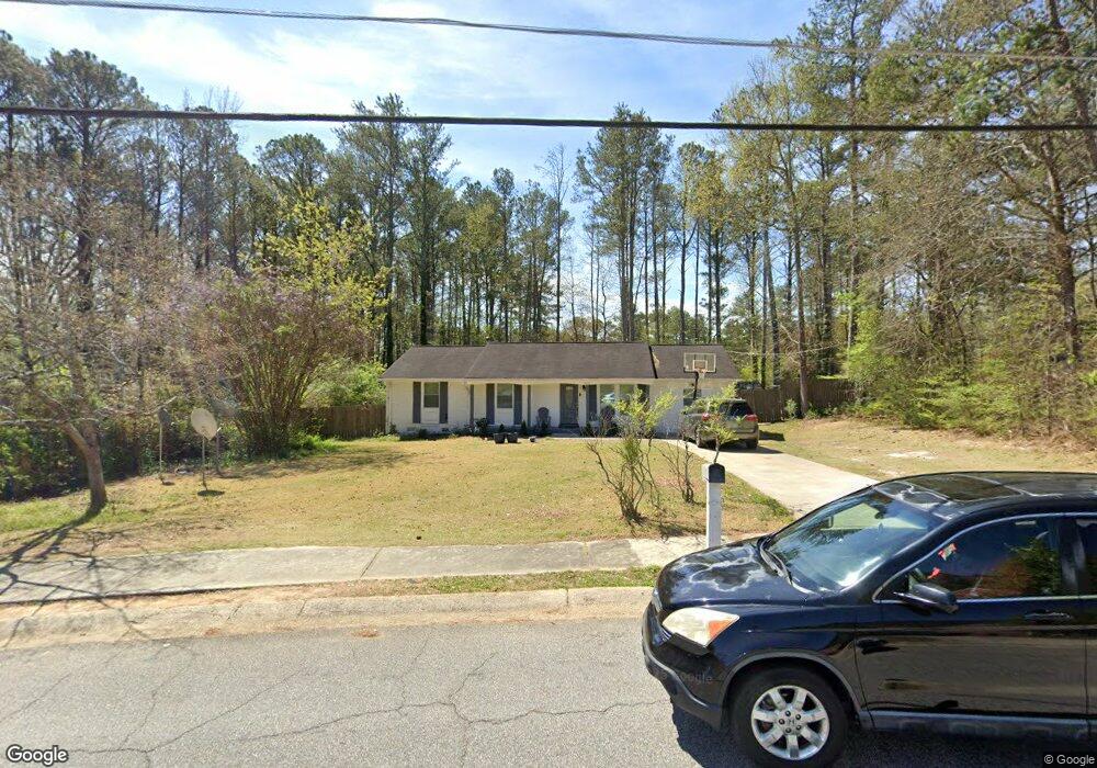
1971 Devore Dr SW Unit 34 Marietta, GA 30008
Southwestern Marietta NeighborhoodEstimated Value: $279,000 - $317,000
4
Beds
2
Baths
1,350
Sq Ft
$218/Sq Ft
Est. Value
About This Home
This home is located at 1971 Devore Dr SW Unit 34, Marietta, GA 30008 and is currently estimated at $293,936, approximately $217 per square foot. 1971 Devore Dr SW Unit 34 is a home located in Cobb County with nearby schools including Hollydale Elementary School, Smitha Middle School, and Osborne High School.
Ownership History
Date
Name
Owned For
Owner Type
Purchase Details
Closed on
Oct 11, 2001
Sold by
Karrick Joshua T and Karrick Shawn T
Bought by
Diawara Siguine
Current Estimated Value
Home Financials for this Owner
Home Financials are based on the most recent Mortgage that was taken out on this home.
Original Mortgage
$116,914
Outstanding Balance
$44,526
Interest Rate
6.67%
Mortgage Type
FHA
Estimated Equity
$249,410
Purchase Details
Closed on
Dec 15, 2000
Sold by
Taylor Clayton D
Bought by
Karrick Joshua T and Karrick Shawn T
Home Financials for this Owner
Home Financials are based on the most recent Mortgage that was taken out on this home.
Original Mortgage
$106,125
Interest Rate
7.81%
Mortgage Type
FHA
Create a Home Valuation Report for This Property
The Home Valuation Report is an in-depth analysis detailing your home's value as well as a comparison with similar homes in the area
Home Values in the Area
Average Home Value in this Area
Purchase History
| Date | Buyer | Sale Price | Title Company |
|---|---|---|---|
| Diawara Siguine | $118,800 | -- | |
| Karrick Joshua T | $107,000 | -- |
Source: Public Records
Mortgage History
| Date | Status | Borrower | Loan Amount |
|---|---|---|---|
| Open | Diawara Siguine | $116,914 | |
| Previous Owner | Karrick Joshua T | $106,125 |
Source: Public Records
Tax History Compared to Growth
Tax History
| Year | Tax Paid | Tax Assessment Tax Assessment Total Assessment is a certain percentage of the fair market value that is determined by local assessors to be the total taxable value of land and additions on the property. | Land | Improvement |
|---|---|---|---|---|
| 2025 | $2,177 | $97,680 | $30,000 | $67,680 |
| 2024 | $2,179 | $97,680 | $30,000 | $67,680 |
| 2023 | $1,432 | $88,288 | $20,000 | $68,288 |
| 2022 | $1,410 | $61,772 | $14,000 | $47,772 |
| 2021 | $1,410 | $61,772 | $14,000 | $47,772 |
| 2020 | $1,201 | $52,220 | $14,000 | $38,220 |
| 2019 | $1,201 | $52,220 | $14,000 | $38,220 |
| 2018 | $853 | $37,112 | $11,200 | $25,912 |
| 2017 | $810 | $37,112 | $11,200 | $25,912 |
| 2016 | $590 | $29,400 | $11,200 | $18,200 |
| 2015 | $606 | $29,400 | $11,200 | $18,200 |
| 2014 | $419 | $22,936 | $0 | $0 |
Source: Public Records
Map
Nearby Homes
- 0 Burfordi Dr SW Unit 7658493
- 0 Burfordi Dr SW Unit 10637361
- 2060 Powder Springs Rd SW
- 3145 Fern Valley Dr SW
- 3000 Fern Valley Dr SW
- 3055 Milford Chase Overlook SW
- 2099 Redbud Ct SW
- 1970 Powder Springs Rd SW
- 2720 Cold Springs Trail SW
- 2318 Powder Springs Rd SW
- 3106 Sasanqua Ln SW
- 2700 Flintlock Ln SW
- 1697 Rustic Dr SW
- 3112 Patriot Square SW
- 3100 Patriot Square SW
- 3047 Patriot Square SW
- 2450 Horseshoe Bend Rd SW
- 1719 Silverchase Dr SW
- 1981 Devore Dr SW
- 1963 Devore Dr SW
- 1921 Foxcroft Ct SW
- 1976 Devore Dr SW Unit II
- 2811 Valley Brook Dr SW Unit 2
- 1955 Devore Dr SW
- 1911 Foxcroft Ct SW Unit 2
- 2899 Bay Berry Ct SW
- 2795 Valley Brook Dr SW
- 2821 Valley Brook Dr SW
- 1952 Devore Dr SW
- 1992 Devore Dr SW Unit 18
- 1992 Devore Dr SW
- 1992 Devore Dr SW Unit II
- 1947 Devore Dr SW
- 2889 Bay Berry Ct SW Unit 3
- 2835 Valley Brook Dr SW Unit 2
- 1920 Foxcroft Ct SW
- 1942 Devore Dr SW
- 2002 Devore Dr SW