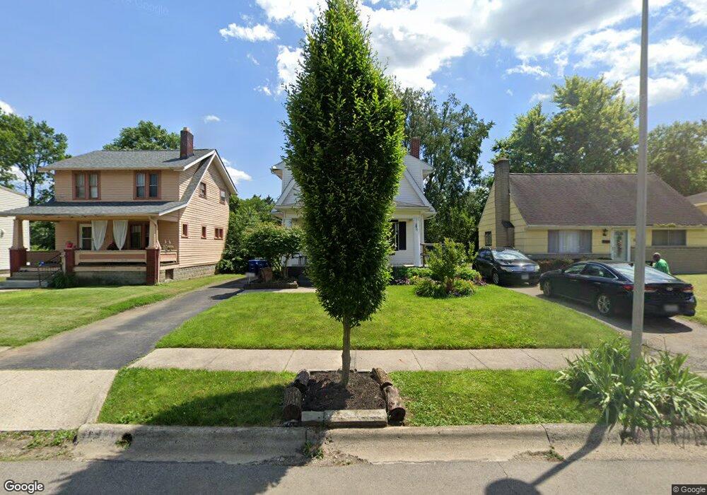
1971 Merryhill Dr Columbus, OH 43219
Eastgate NeighborhoodEstimated Value: $233,000 - $325,000
4
Beds
2
Baths
1,336
Sq Ft
$197/Sq Ft
Est. Value
About This Home
This home is located at 1971 Merryhill Dr, Columbus, OH 43219 and is currently estimated at $263,455, approximately $197 per square foot. 1971 Merryhill Dr is a home located in Franklin County with nearby schools including Eastgate Elementary School, Champion Middle School, and East High School.
Ownership History
Date
Name
Owned For
Owner Type
Purchase Details
Closed on
Jul 23, 2012
Sold by
Whitlow Michael E
Bought by
Cooper Evelyn
Current Estimated Value
Purchase Details
Closed on
Sep 12, 1997
Sold by
Relocation Collaborative Services Inc
Bought by
Tshaka Jacqueline
Home Financials for this Owner
Home Financials are based on the most recent Mortgage that was taken out on this home.
Original Mortgage
$81,800
Interest Rate
7.25%
Mortgage Type
FHA
Purchase Details
Closed on
Aug 9, 1997
Sold by
Brotherton Marvin A and Brotherton Davida L
Bought by
Relocation Collaborative Services Inc
Home Financials for this Owner
Home Financials are based on the most recent Mortgage that was taken out on this home.
Original Mortgage
$81,800
Interest Rate
7.25%
Mortgage Type
FHA
Purchase Details
Closed on
Feb 19, 1993
Create a Home Valuation Report for This Property
The Home Valuation Report is an in-depth analysis detailing your home's value as well as a comparison with similar homes in the area
Home Values in the Area
Average Home Value in this Area
Purchase History
| Date | Buyer | Sale Price | Title Company |
|---|---|---|---|
| Cooper Evelyn | -- | None Available | |
| Tshaka Jacqueline | $81,900 | Title First Agency Inc | |
| Relocation Collaborative Services Inc | -- | Title First Agency Inc | |
| -- | $74,900 | -- |
Source: Public Records
Mortgage History
| Date | Status | Borrower | Loan Amount |
|---|---|---|---|
| Previous Owner | Tshaka Jacqueline | $81,800 |
Source: Public Records
Tax History Compared to Growth
Tax History
| Year | Tax Paid | Tax Assessment Tax Assessment Total Assessment is a certain percentage of the fair market value that is determined by local assessors to be the total taxable value of land and additions on the property. | Land | Improvement |
|---|---|---|---|---|
| 2024 | $2,528 | $66,120 | $18,940 | $47,180 |
| 2023 | $2,523 | $66,115 | $18,935 | $47,180 |
| 2022 | $1,351 | $34,790 | $6,720 | $28,070 |
| 2021 | $1,353 | $34,790 | $6,720 | $28,070 |
| 2020 | $1,355 | $34,790 | $6,720 | $28,070 |
| 2019 | $1,217 | $28,810 | $5,600 | $23,210 |
| 2018 | $1,196 | $28,810 | $5,600 | $23,210 |
| 2017 | $1,256 | $28,810 | $5,600 | $23,210 |
| 2016 | $1,296 | $28,320 | $5,670 | $22,650 |
| 2015 | $1,177 | $28,320 | $5,670 | $22,650 |
| 2014 | $1,180 | $28,320 | $5,670 | $22,650 |
| 2013 | $627 | $29,820 | $5,985 | $23,835 |
Source: Public Records
Map
Nearby Homes
- 1993 Greenway Ave N
- 1872 Greenway Ave S
- 362 Woodland Ave
- 334 Woodland Ave
- 449 Woodland Ave
- 341 Woodland Ave
- 495 Eldridge Ave
- 1634-1636 Greenway Ave
- 82 Bishop Square
- 1598 Harvard Ave
- 189 N Parkview Ave
- 479 Parkwood Ave
- 1961 Dartmouth Ave
- 2136 Dartmouth Ave
- 1622 Clifton Ave
- 1458 Harvard Ave
- 220 Parkwood Ave Unit 222
- 1575 Granville St
- 779 Sunbury Rd
- 1577 Richmond Ave
- 1965 Merryhill Dr
- 1977 Merryhill Dr
- 1963 Merryhill Dr
- 1966 Stratford Way
- 1960 Stratford Way
- 1972 Stratford Way
- 1955 Merryhill Dr
- 1989 Merryhill Dr
- 1954 Stratford Way
- 1978 Stratford Way
- 1970 Merryhill Dr
- 1978 Merryhill Dr
- 1949 Merryhill Dr
- 1993 Merryhill Dr
- 1966 Merryhill Dr
- 1982 Stratford Way
- 1984 Merryhill Dr
- 1946 Stratford Way
- 1962 Merryhill Dr
- 1988 Merryhill Dr