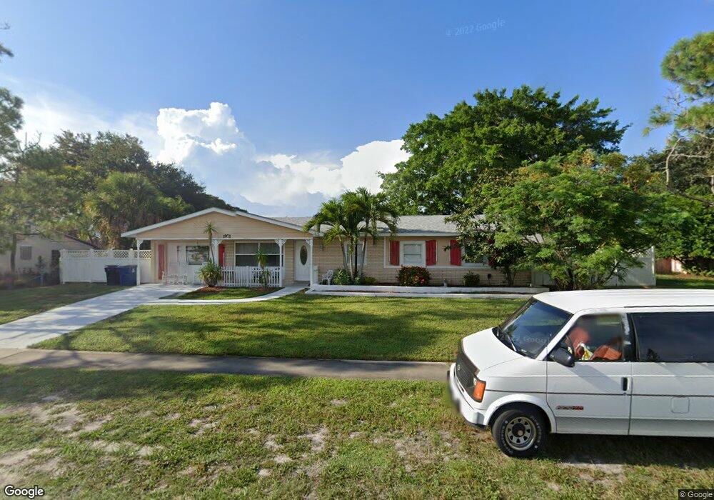
1971 Port Malabar Blvd NE Palm Bay, FL 32905
Estimated Value: $245,000 - $267,000
3
Beds
2
Baths
1,400
Sq Ft
$181/Sq Ft
Est. Value
About This Home
This home is located at 1971 Port Malabar Blvd NE, Palm Bay, FL 32905 and is currently estimated at $253,971, approximately $181 per square foot. 1971 Port Malabar Blvd NE is a home located in Brevard County with nearby schools including Palm Bay Elementary School, Stone Magnet Middle School, and Palm Bay Magnet Senior High School.
Ownership History
Date
Name
Owned For
Owner Type
Purchase Details
Closed on
Dec 14, 2006
Sold by
Walker Diane M
Bought by
Walker Diane M and Diane M Walker Revocable Trust
Current Estimated Value
Purchase Details
Closed on
Mar 14, 2005
Sold by
Powell Jonathan
Bought by
Walker Diane Marie
Home Financials for this Owner
Home Financials are based on the most recent Mortgage that was taken out on this home.
Original Mortgage
$102,750
Interest Rate
7.75%
Purchase Details
Closed on
May 4, 2004
Sold by
Sipus Gregory S
Bought by
Powell Jonathan
Create a Home Valuation Report for This Property
The Home Valuation Report is an in-depth analysis detailing your home's value as well as a comparison with similar homes in the area
Home Values in the Area
Average Home Value in this Area
Purchase History
| Date | Buyer | Sale Price | Title Company |
|---|---|---|---|
| Walker Diane M | -- | Attorney | |
| Walker Diane Marie | $137,000 | Republic Title Company | |
| Powell Jonathan | $60,000 | -- |
Source: Public Records
Mortgage History
| Date | Status | Borrower | Loan Amount |
|---|---|---|---|
| Previous Owner | Walker Diane Marie | $102,750 |
Source: Public Records
Tax History Compared to Growth
Tax History
| Year | Tax Paid | Tax Assessment Tax Assessment Total Assessment is a certain percentage of the fair market value that is determined by local assessors to be the total taxable value of land and additions on the property. | Land | Improvement |
|---|---|---|---|---|
| 2025 | $3,876 | $238,230 | -- | -- |
| 2024 | $3,737 | $244,240 | -- | -- |
| 2023 | $3,737 | $246,790 | $0 | $0 |
| 2022 | $3,329 | $217,380 | $0 | $0 |
| 2021 | $3,014 | $161,620 | $30,000 | $131,620 |
| 2020 | $2,722 | $144,250 | $18,000 | $126,250 |
| 2019 | $2,790 | $142,770 | $15,000 | $127,770 |
| 2018 | $2,474 | $117,450 | $14,000 | $103,450 |
| 2017 | $2,352 | $107,430 | $12,500 | $94,930 |
| 2016 | $2,006 | $92,670 | $9,000 | $83,670 |
| 2015 | $1,878 | $80,790 | $9,000 | $71,790 |
| 2014 | $1,742 | $73,450 | $9,000 | $64,450 |
Source: Public Records
Map
Nearby Homes
- 872 Sadnet Cir NE
- 2050 Port Malabar Blvd NE
- 750 Burman Ln NE
- 790 Cobblestone Ln NE
- 751 Burman Ln NE
- 712 Bianca Dr NE
- 958 Chace Ln NE
- 1010 Citrus Ave NE
- 1081 Sunswept Rd NE
- 831 Edwards St NE
- 880 Hampton Dr NE
- 960 Falls Trail
- 1115 Baywood Ct
- 1078 Daytona Dr NE
- 898 Hampton Dr NE
- 756 Bianca Dr NE
- 941 Vangi Ln NE
- 581 Drexel Ave NE
- 926 Pine Creek Cir NE
- 1125 Brook St NE
- 1961 Port Malabar Blvd NE
- 2614 Sabrina St NE
- 2626 Sabrina St NE
- 2638 Sabrina St NE
- 1991 Port Malabar Blvd NE Unit 43
- 1991 Port Malabar Blvd NE
- 806 Vance Cir NE
- 1970 Port Malabar Blvd NE
- 1980 Port Malabar Blvd NE
- 2627 Sabrina St NE
- 1960 Port Malabar Blvd NE
- 810 Vance Cir NE
- 2650 Sabrina St NE
- 1999 Port Malabar Blvd NE
- 2639 Sabrina St NE
- 799 Apollo Cir NE
- 1950 Port Malabar Blvd NE
- 2606 Yalta St NE
- 796 Apollo Cir NE
- 805 Vance Cir NE