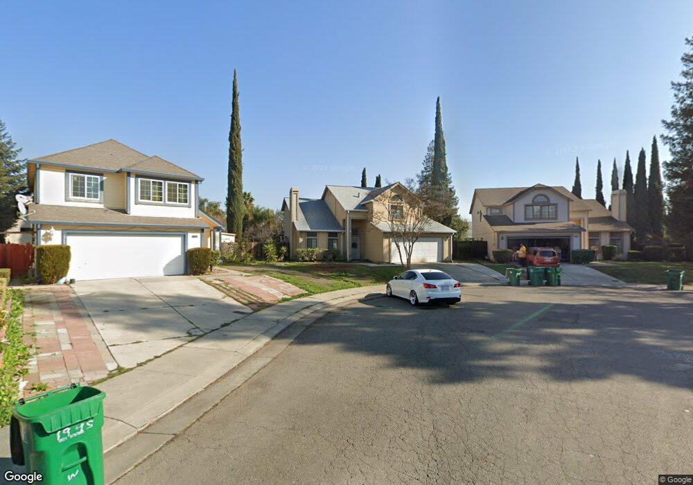
1971 Whitney St Stockton, CA 95210
Valley Oak NeighborhoodEstimated Value: $427,000 - $481,000
4
Beds
3
Baths
1,885
Sq Ft
$239/Sq Ft
Est. Value
About This Home
This home is located at 1971 Whitney St, Stockton, CA 95210 and is currently estimated at $450,783, approximately $239 per square foot. 1971 Whitney St is a home located in San Joaquin County with nearby schools including George W. Bush Elementary School, Rio Calaveras Elementary School, and Valentine Peyton Elementary School.
Ownership History
Date
Name
Owned For
Owner Type
Purchase Details
Closed on
Nov 13, 2017
Sold by
Phuon Chhary Puth
Bought by
Phuon Ky Peng and Phuon Charry
Current Estimated Value
Purchase Details
Closed on
Sep 21, 1999
Sold by
Phuon Ky Peng and Phuon Chhary Puth
Bought by
Phuon Chhry Puth and Puth Chheav
Purchase Details
Closed on
Nov 12, 1997
Sold by
Chhary Puth and Phuon Chhary
Bought by
Phuon Ky Peng and Phuon Chhary
Create a Home Valuation Report for This Property
The Home Valuation Report is an in-depth analysis detailing your home's value as well as a comparison with similar homes in the area
Home Values in the Area
Average Home Value in this Area
Purchase History
| Date | Buyer | Sale Price | Title Company |
|---|---|---|---|
| Phuon Ky Peng | -- | None Available | |
| Phuon Chhry Puth | -- | -- | |
| Phuon Ky Peng | -- | -- |
Source: Public Records
Tax History
| Year | Tax Paid | Tax Assessment Tax Assessment Total Assessment is a certain percentage of the fair market value that is determined by local assessors to be the total taxable value of land and additions on the property. | Land | Improvement |
|---|---|---|---|---|
| 2025 | $2,799 | $227,155 | $57,241 | $169,914 |
| 2024 | $2,755 | $222,702 | $56,119 | $166,583 |
| 2023 | $2,693 | $218,336 | $55,019 | $163,317 |
| 2022 | $2,674 | $214,056 | $53,941 | $160,115 |
| 2021 | $2,570 | $209,860 | $52,884 | $156,976 |
| 2020 | $2,620 | $207,709 | $52,342 | $155,367 |
| 2019 | $2,610 | $203,637 | $51,316 | $152,321 |
| 2018 | $2,561 | $199,645 | $50,310 | $149,335 |
| 2017 | $2,426 | $195,731 | $49,324 | $146,407 |
| 2016 | $2,471 | $191,893 | $48,357 | $143,536 |
| 2014 | $2,351 | $185,309 | $46,698 | $138,611 |
Source: Public Records
Map
Nearby Homes
- 6069 Shetland Ct
- 1927 Montauban Ct
- 1926 Shameran St
- 5808 Gentry Ave
- 5723 Larcom Ln
- 7019 Village Green Dr Unit 103
- 6706 Tam o Shanter Dr Unit 34
- 6706 Tam o Shanter Dr Unit 87
- 6706 Tam O'Shanter Dr Unit 72
- 6706 Tam o Shanter Dr Unit 126
- 6706 Tam o Shanter Dr Unit 75
- 6706 Tam O'Shanter Dr Unit 127
- 6706 Tam o Shanter Dr Unit 128
- 7033 Tristan Cir
- 7078 Tristan Cir
- 5457 Governor Cir
- 2449 Calvert St
- 7208 Tristan Cir
- 5813 Fred Russo Dr
- 1122 Morning Dew Place
- 1945 Whitney St
- 1995 Whitney St
- 6674 Montauban Ave
- 6631 Mount Bachelor Ct
- 1909 Whitney St
- 6667 Mount Bachelor Ct
- 6607 Mount Bachelor Ct
- 6706 Montauban Ave
- 6599 Mount Bachelor Ct
- 1994 Whitney St
- 6693 Mount Bachelor Ct
- 6545 Mount Bachelor Ct
- 1972 Whitney St
- 1946 Whitney St
- 6509 Mount Bachelor Ct
- 6741 El Capitan Cir
- 1910 Whitney St
- 6737 El Capitan Cir
- 6749 El Capitan Cir
- 1861 Whitney St
Your Personal Tour Guide
Ask me questions while you tour the home.